MyTopo
Deer Park SE Florida US Topo Map
Couldn't load pickup availability
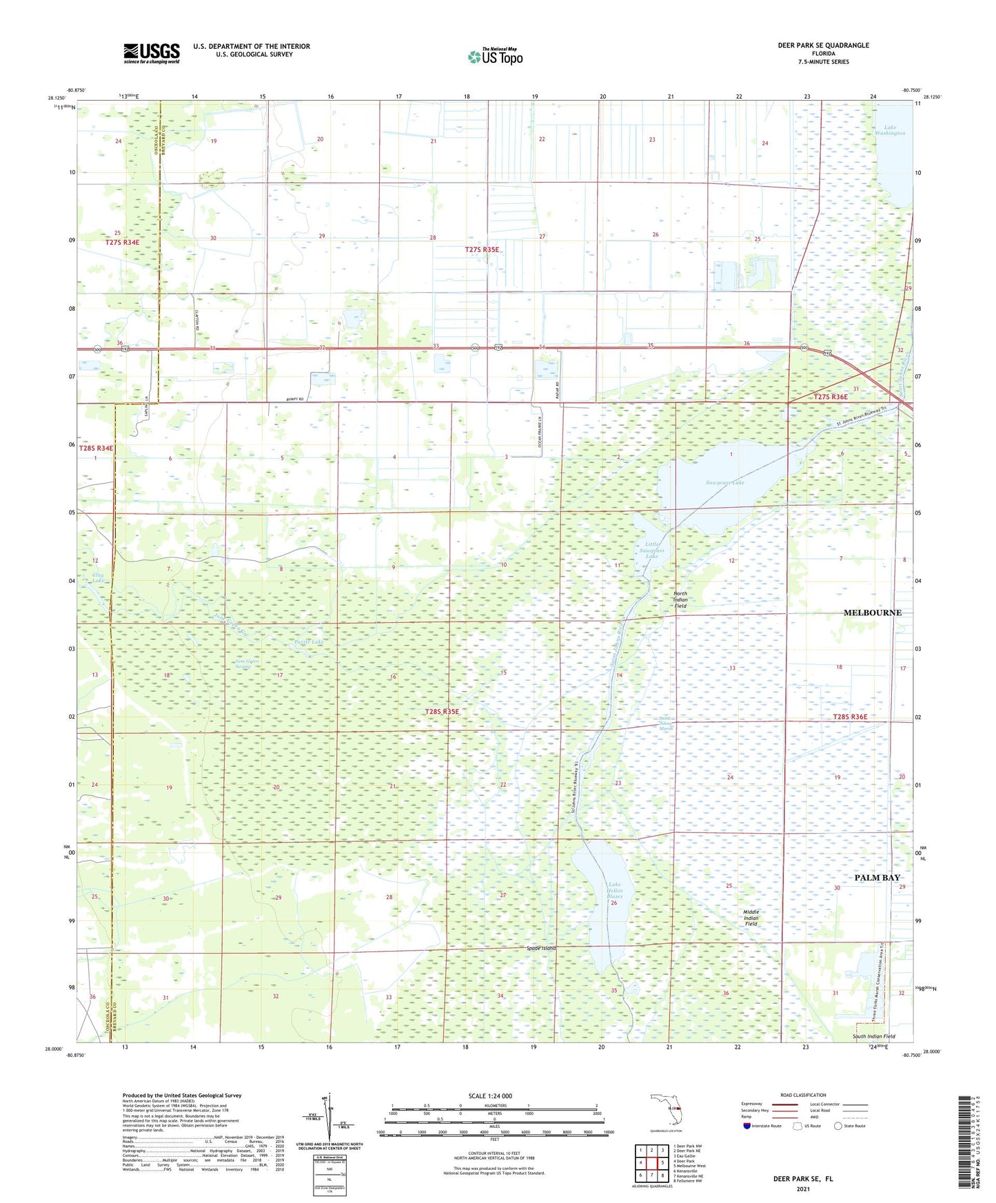
2024 topographic map quadrangle Deer Park SE in the state of Florida. Scale: 1:24000. Based on the newly updated USGS 7.5' US Topo map series, this map is in the following counties: Brevard, Osceola. The map contains contour data, water features, and other items you are used to seeing on USGS maps, but also has updated roads and other features. This is the next generation of topographic maps. Printed on high-quality waterproof paper with UV fade-resistant inks.
Quads adjacent to this one:
West: Deer Park
Northwest: Deer Park NW
North: Deer Park NE
Northeast: Eau Gallie
East: Melbourne West
Southeast: Fellsmere NW
South: Kenansville NE
Southwest: Kenansville
This map covers the same area as the classic USGS quad with code o28080a7.
Contains the following named places: Clay Lake, Jane Green Creek, Jane Green Swamp, Lake Hellen Blazes, Little Sawgrass Lake, Mayacas, Middle Indian Field, North Indian Field, Puzzle Lake, Sawgrass Lake, South Indian Field, Spade Island, West Brevard Division