MyTopo
Choctaw Beach Florida US Topo Map
Couldn't load pickup availability
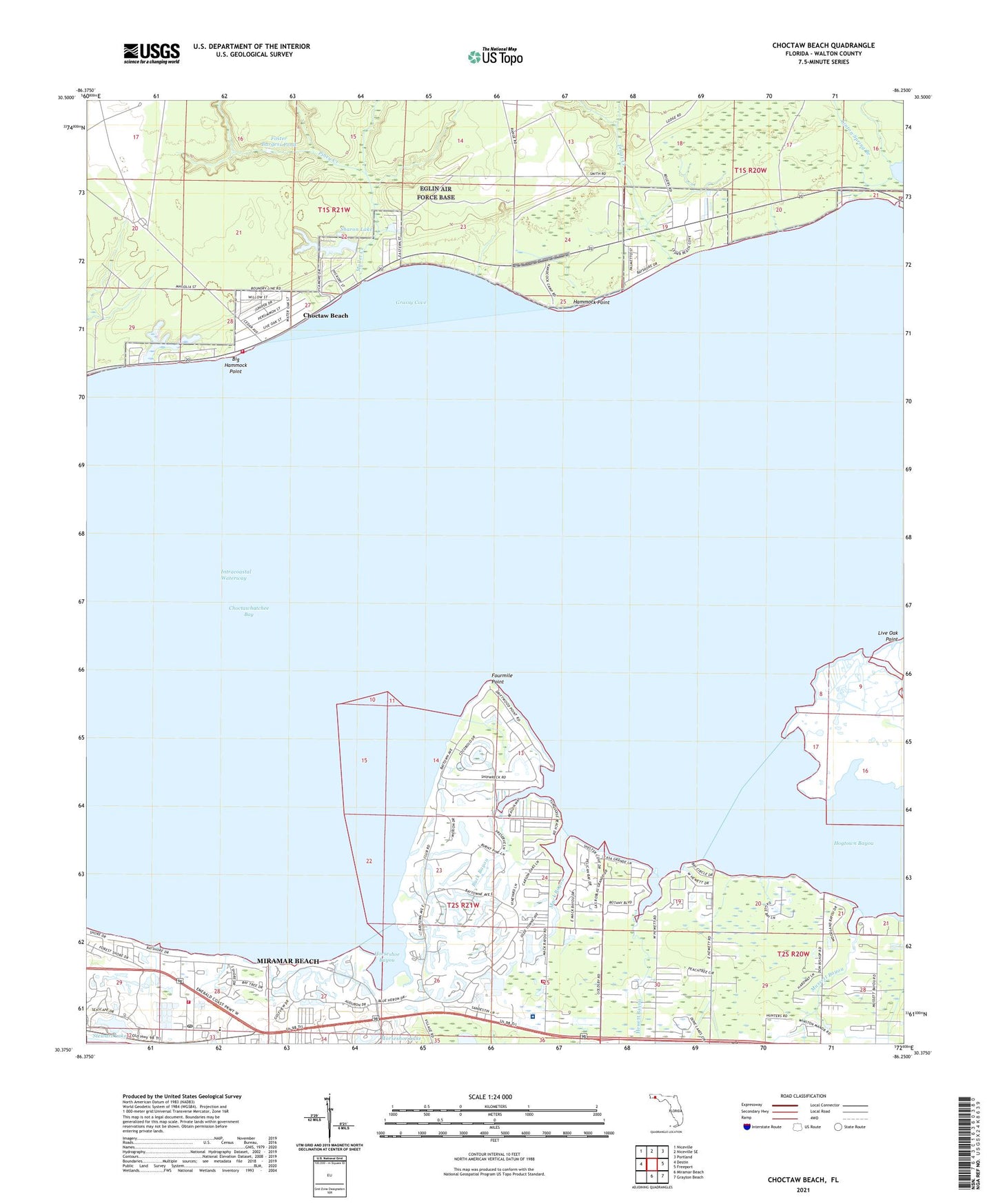
2024 topographic map quadrangle Choctaw Beach in the state of Florida. Scale: 1:24000. Based on the newly updated USGS 7.5' US Topo map series, this map is in the following counties: Walton. The map contains contour data, water features, and other items you are used to seeing on USGS maps, but also has updated roads and other features. This is the next generation of topographic maps. Printed on high-quality waterproof paper with UV fade-resistant inks.
Quads adjacent to this one:
West: Destin
Northwest: Niceville
North: Niceville SE
Northeast: Portland
East: Freeport
Southeast: Grayton Beach
South: Miramar Beach
This map covers the same area as the classic USGS quad with code o30086d3.
Contains the following named places: Baytowne Marina, Big Hammock, Big Hammock Point, Buck Bayou, Choctaw Beach, Choctawhatchee Bay, Fort Rucker Recreation Area, Foster Burgess Pond, Fourmile Point, Grassy Cove, Grosh, Hammock Point, Hewett Bayou, Hogtown Bayou, Horseshoe Bayou, Linton Spring Branch, Mack Bayou, Miramar Beach Census Designated Place, Miramar Beach Post Office, Mullet Creek, Mussett Bayou, Piney Creek, Sacred Heart Hospital on the Emerald Coast, Sandestin, Seascape, Sharon Lake, South Walton Fire District Station 4, South Walton Fire District Station 5 Miramar Beach, Stewart Lake, The Village of Baytowne Wharf, Trout Creek, Turquoise Beach, Walton County Fire Rescue Station 10 / Tri - Village Fire Department Choctaw Beach, WWAV-FM (Santa Rosa Beach), ZIP Code: 32550