MyTopo
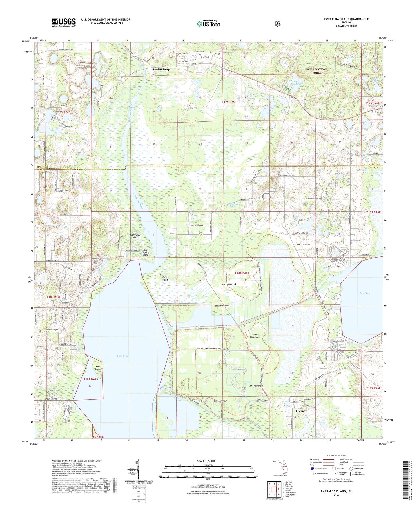
Emeralda Island Florida US Topo Map
Couldn't load pickup availability
Also explore the Emeralda Island Forest Service Topo of this same quad for updated USFS data
2024 topographic map quadrangle Emeralda Island in the state of Florida. Scale: 1:24000. Based on the newly updated USGS 7.5' US Topo map series, this map is in the following counties: Lake, Marion. The map contains contour data, water features, and other items you are used to seeing on USGS maps, but also has updated roads and other features. This is the next generation of topographic maps. Printed on high-quality waterproof paper with UV fade-resistant inks.
Quads adjacent to this one:
West: Lady Lake
Northwest: Lake Weir
North: Lake Mary
Northeast: Farles Lake
East: Umatilla
Southeast: Eustis
South: Leesburg East
Southwest: Leesburg West
This map covers the same area as the classic USGS quad with code o28081h7.
Contains the following named places: Bell Hammock, Big Bass Lake, Big Bass Lake Recreation Site, Big Hammock, Big Pine Island, Big Trees Campsites, Bird Island, Blue Heron Cove Marina, Buck Hammock, Bull Hammock, Cabbage Hammock, Eagles Nest, Emeralda, Emeralda Island, Emeralda Marsh, Eustis Muck Farms Incorporated Airport, Fishermans Wharf Mobile Home Park, Florida Baptist Retreat, Flying Exotics Airport, Fly'n R Ranch Airport, Gator Lake, Island Ponds, Island Ponds Recreation Site, Lake Yale Baptist Assembly, Linadale, Lisbon Census Designated Place, Lisbon Church of God, Little Pine Island, Marion County Fire Rescue South Forest Station 6, North Lake Chapel, Palm Island, Pipers Fish Camp Marina, Sandpiper Mobile Home Manor, South Tower, Starkes Ferry, Sunlake Estates Mobile Park, Turkey Lake, ZIP Code: 34788