MyTopo
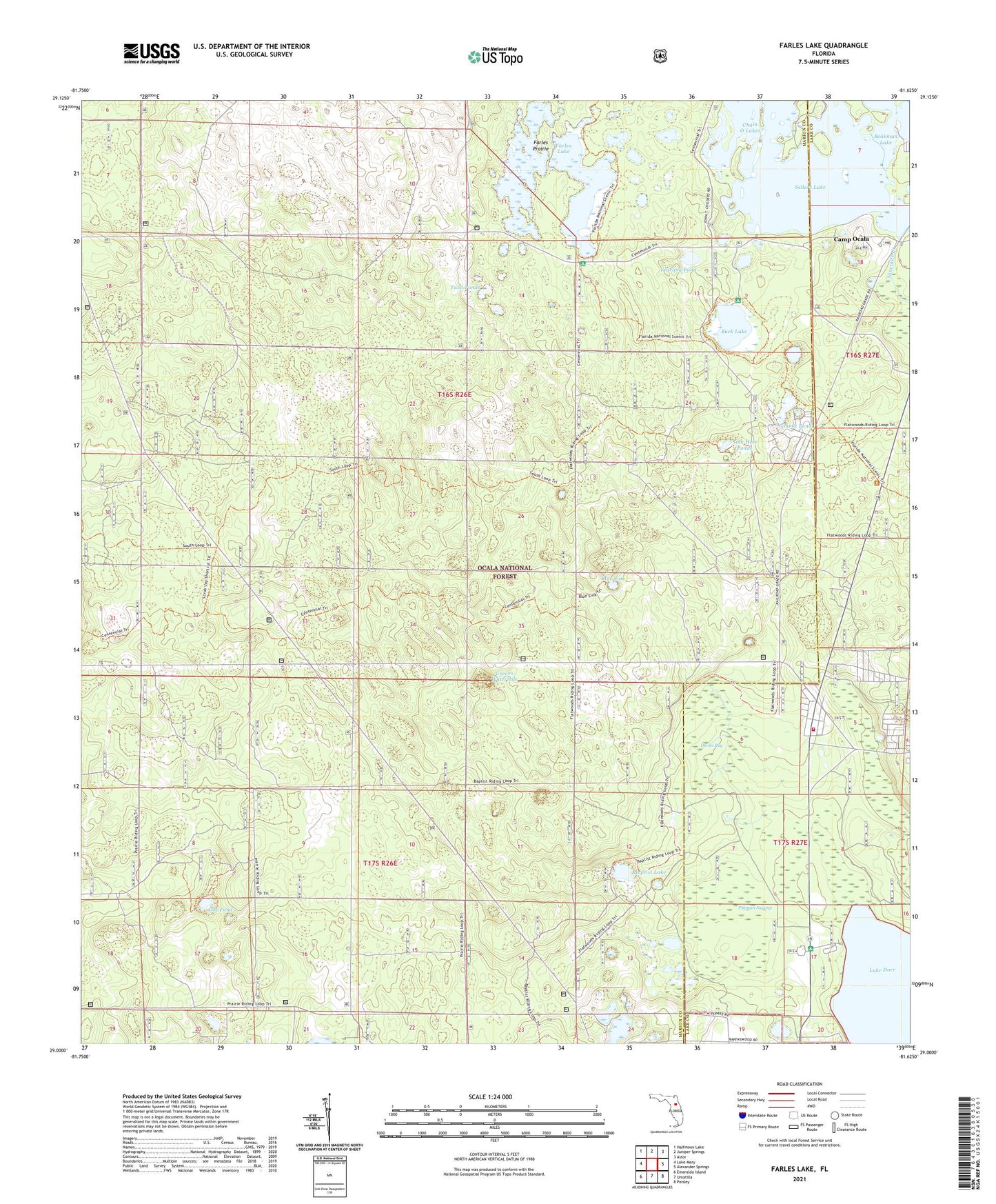
Farles Lake Florida US Topo Map
Couldn't load pickup availability
Also explore the Farles Lake Forest Service Topo of this same quad for updated USFS data
2024 topographic map quadrangle Farles Lake in the state of Florida. Scale: 1:24000. Based on the newly updated USGS 7.5' US Topo map series, this map is in the following counties: Marion, Lake. The map contains contour data, water features, and other items you are used to seeing on USGS maps, but also has updated roads and other features. This is the next generation of topographic maps. Printed on high-quality waterproof paper with UV fade-resistant inks.
Quads adjacent to this one:
West: Lake Mary
Northwest: Halfmoon Lake
North: Juniper Springs
Northeast: Astor
East: Alexander Springs
Southeast: Paisley
South: Umatilla
Southwest: Emeralda Island
This map covers the same area as the classic USGS quad with code o29081a6.
Contains the following named places: Baptist Lake, Baptist Lake Trasil, Beakman Lake, Blue Sink, Buck Lake, Buck Lake Recreation Area, Camp Ocala, Chain O Lakes, Devils Bay, Doe Pond, Farles Lake, Farles Prairie, Farles Prairie Recreation Area, Greens Waterhole, Lake County Fire Rescue Station 11, Lake Dorr Mobile Home Park, Lake Dorr Recreation Area, Pinecastle Impact Range, Pittman Swamp, Pittman Work Center, Sellers Lake, Sink Hole Ponds, Summit Pond, Twin Ponds, Yearling Pond, ZIP Code: 32702