MyTopo
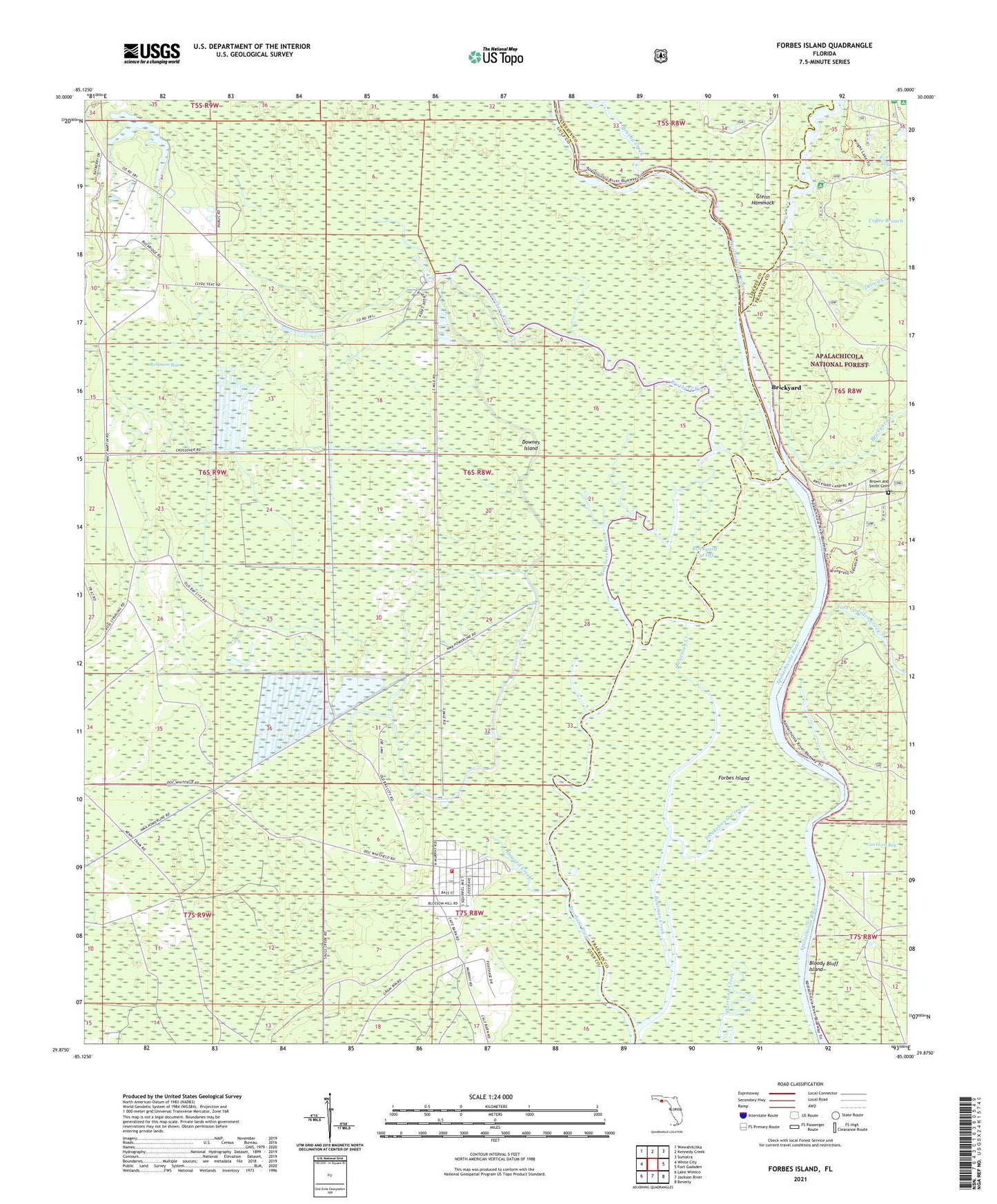
Forbes Island Florida US Topo Map
Couldn't load pickup availability
Also explore the Forbes Island Forest Service Topo of this same quad for updated USFS data
2024 topographic map quadrangle Forbes Island in the state of Florida. Scale: 1:24000. Based on the newly updated USGS 7.5' US Topo map series, this map is in the following counties: Gulf, Franklin, Liberty. The map contains contour data, water features, and other items you are used to seeing on USGS maps, but also has updated roads and other features. This is the next generation of topographic maps. Printed on high-quality waterproof paper with UV fade-resistant inks.
Quads adjacent to this one:
West: White City
Northwest: Wewahitchka
North: Kennedy Creek
Northeast: Sumatra
East: Fort Gadsden
Southeast: Beverly
South: Jackson River
Southwest: Lake Wimico
This map covers the same area as the classic USGS quad with code o29085h1.
Contains the following named places: Bearman Creek, Bloody Bluff Island, Brickyard, Brickyard Creek, Brickyard Cut Off, Brickyard Landing, Brown and Smith Cemetery, Brushy Creek, Devon Creek, Downes Island, Ekanachatte, Forbes Island, Fort Gadsden Creek, Fort Gadsden State Historic Site, Fort Gadsden State Park, Glenn Hammock, Hickory Landing, Hickory Landing Recreaton Site, Howard Creek, Howard Creek Fire Department, Kenny Camp, Lister Camp, Owl Creek, Poplar Branch, Prospect Bluff Historic Sites, Robinson Bay, Smith Creek Landing, Smokehouse Creek, Van Horn Landing, Willis Landing, Wright Landing