MyTopo
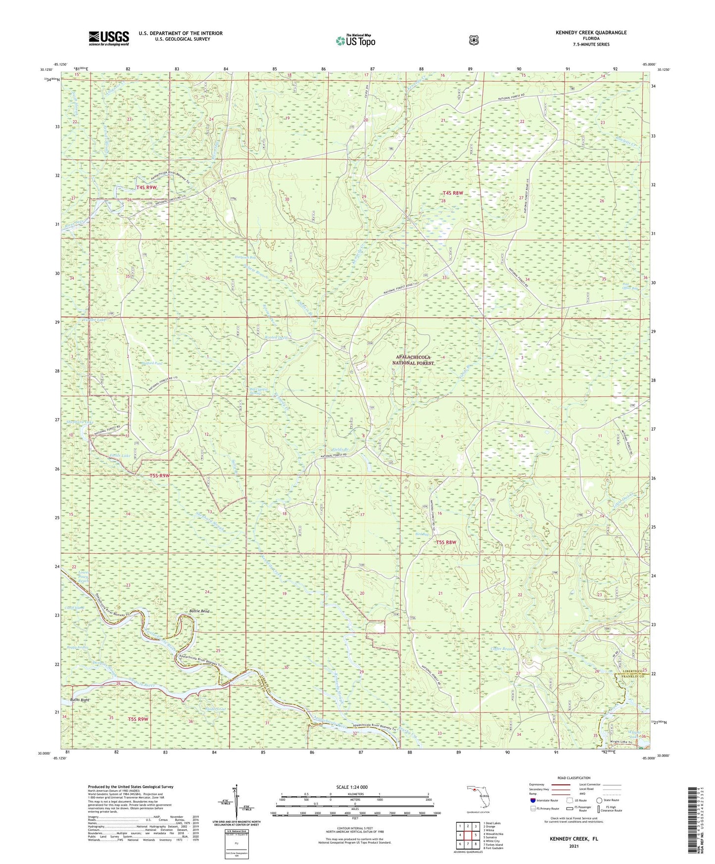
Kennedy Creek Florida US Topo Map
Couldn't load pickup availability
Also explore the Kennedy Creek Forest Service Topo of this same quad for updated USFS data
2024 topographic map quadrangle Kennedy Creek in the state of Florida. Scale: 1:24000. Based on the newly updated USGS 7.5' US Topo map series, this map is in the following counties: Liberty, Gulf, Franklin. The map contains contour data, water features, and other items you are used to seeing on USGS maps, but also has updated roads and other features. This is the next generation of topographic maps. Printed on high-quality waterproof paper with UV fade-resistant inks.
Quads adjacent to this one:
West: Wewahitchka
Northwest: Dead Lakes
North: Orange
Northeast: Wilma
East: Sumatra
Southeast: Fort Gadsden
South: Forbes Island
Southwest: White City
This map covers the same area as the classic USGS quad with code o30085a1.
Contains the following named places: Alligator Creek, Battle Bend, Big Cypress Swamp, Bird Bay, Black Creek, Bucks Bight, Chipola River, Cotton Landing, Cotton Landing Campground, Douglas Slough, Escambia, Fields Branch, Fields Lake, Graveyard Pole Lookout, Hathcock Bay, Hosford Pond, Kennedy Creek, Kennedy Creek Fish Camp, Kennedy Slough, Little Owl Creek, Lower Piney Reach, Owl Landing, Post Office Bay, Rooted Devil, Rowletts Creek, Salters Branch, Salty Branch, Shephard Lake, Shephard Slough, Solomon Lake, Spiders Gut, Swift Slough, Turner Lake, White Oak Landing, WHite Oak Landing Campground, Wright Lake, Wright Lake Recreation Site