MyTopo
Harold Florida US Topo Map
Couldn't load pickup availability
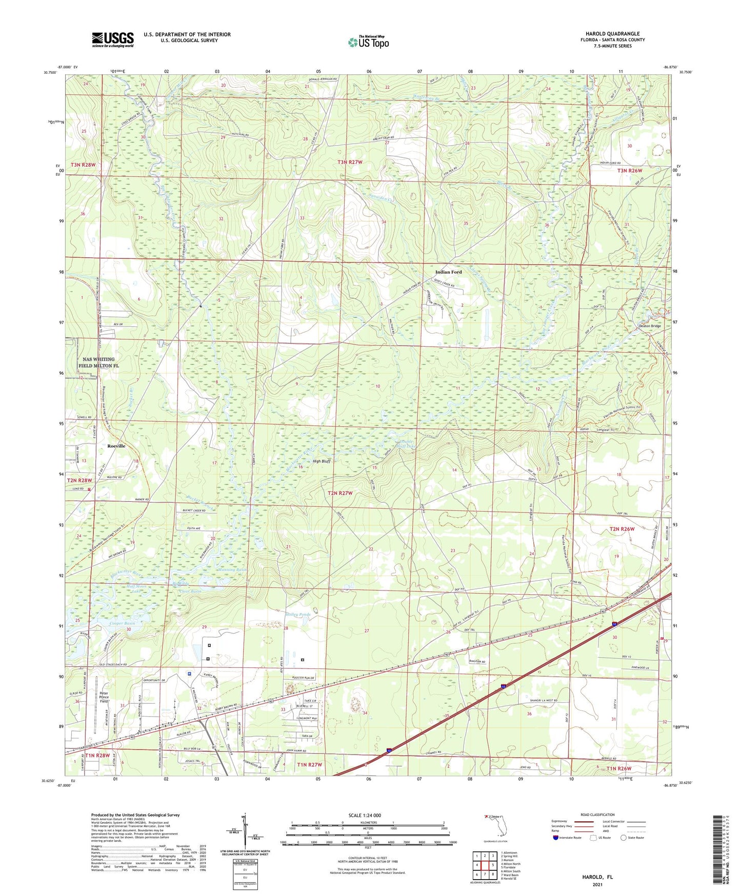
2024 topographic map quadrangle Harold in the state of Florida. Scale: 1:24000. Based on the newly updated USGS 7.5' US Topo map series, this map is in the following counties: Santa Rosa. The map contains contour data, water features, and other items you are used to seeing on USGS maps, but also has updated roads and other features. This is the next generation of topographic maps. Printed on high-quality waterproof paper with UV fade-resistant inks.
Quads adjacent to this one:
West: Milton North
Northwest: Allentown
North: Spring Hill
Northeast: Munson
East: Floridale
Southeast: Harold SE
South: Ward Basin
Southwest: Milton South
This map covers the same area as the classic USGS quad with code o30086f8.
Contains the following named places: Adams Spring Branch, Alligator Creek, Big Coldwater Creek, Big Eddy, Big Juniper Creek, Black Branch, Blackwater River Correctional Facility, Blackwater River State Park, Bucket Branch, Clear Basin, Coldwater Lookout Tower, Cooper Basin, Deaton Bridge, Double Bluff Lake, Earnest Mill Creek, Faith Chapel, Green Branch, Half Moon Lake, Harold, Harold Volunteer Fire Department 16, High Bluff, Holley Ponds, Indian Ford, Manning Basin, Mill Creek, Ninemile Creek, Peter Prince Field, Pleasant Home Baptist Church Cemetery, Pleasant Home Church, Race Track Landing, Roeville, Roeville Census Designated Place, Santa Rosa Correctional Institution, Santa Rosa Correctional Institution Annex, Santa Rosa County Detention Facility, Santa Rosa County Sheriff's Office - Main and District 4 Milton, Skyline Volunteer Fire and Rescue Department 22 Substation 2, Snowden Creek, Wasteway Branch