MyTopo
Allentown Florida US Topo Map
Couldn't load pickup availability
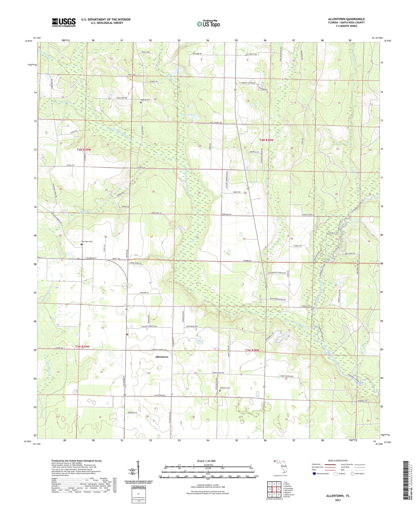
2024 topographic map quadrangle Allentown in the state of Florida. Scale: 1:24000. Based on the newly updated USGS 7.5' US Topo map series, this map is in the following counties: Santa Rosa. The map contains contour data, water features, and other items you are used to seeing on USGS maps, but also has updated roads and other features. This is the next generation of topographic maps. Printed on high-quality waterproof paper with UV fade-resistant inks.
Quads adjacent to this one:
West: Chumuckla
Northwest: Jay
North: Fidelis
Northeast: McLellan
East: Spring Hill
Southeast: Harold
South: Milton North
Southwest: Wallace
This map covers the same area as the classic USGS quad with code o30087g1.
Contains the following named places: Allentown, Allentown Census Designated Place, Allentown School, Allentown Volunteer Fire Department, Bass Brinks Creek, Blackjack Creek, Calvary Church, Central High School, Chavers Cemetery, Coldwater Church, East Fork Big Coldwater Creek, Harmony Church, Hopewell Church, Juniper Creek, Kelly Creek, Lake Wami, Manning Creek, Mare Branch, Pine View Church, Pineview United Methodist Cemetery, Pleasant Grove Church, Porter Stolport, Walling Cemetery, Walling Church, West Fork Big Coldwater Creek, Wolf Creek