MyTopo
Munson Florida US Topo Map
Couldn't load pickup availability
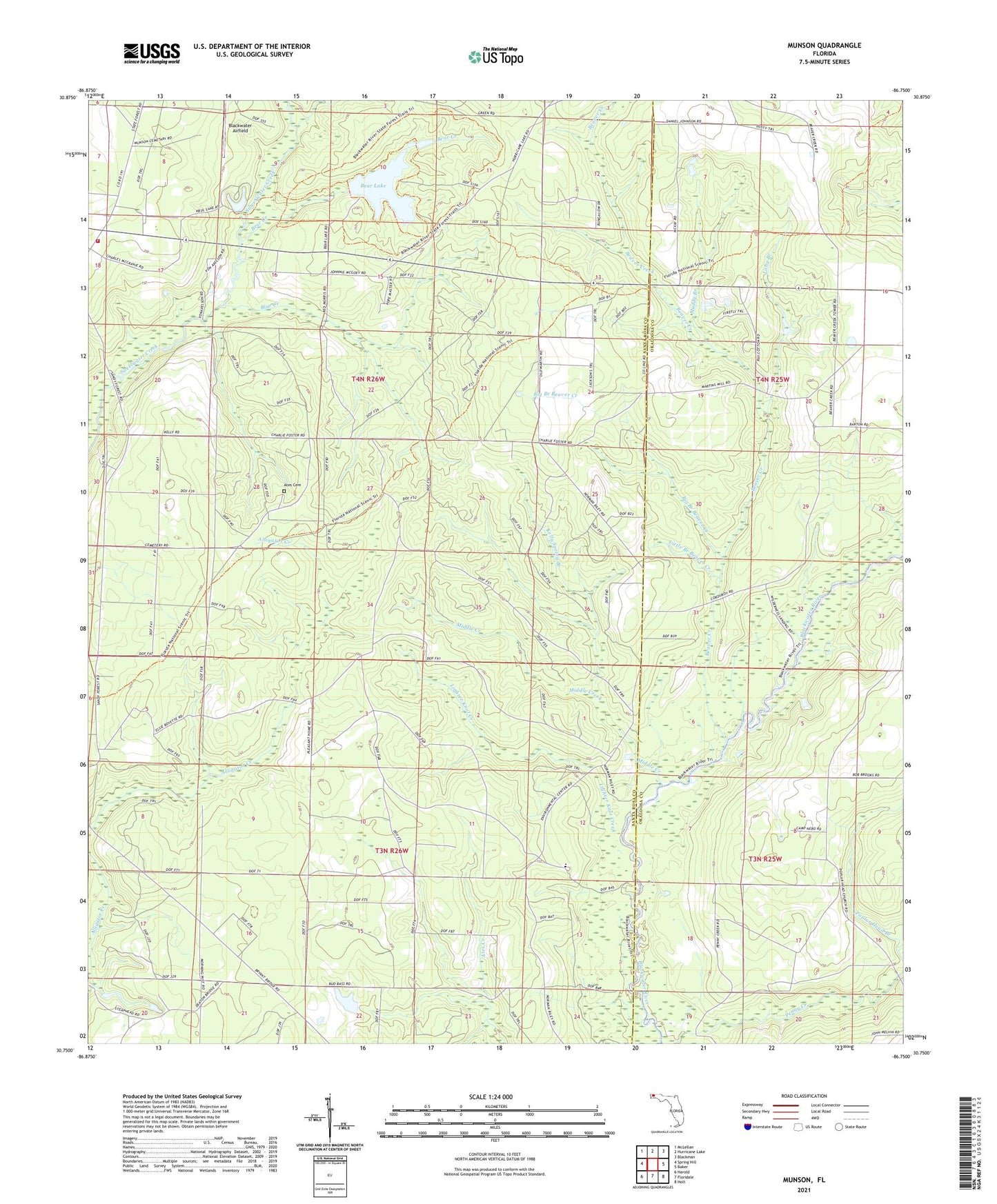
2024 topographic map quadrangle Munson in the state of Florida. Scale: 1:24000. Based on the newly updated USGS 7.5' US Topo map series, this map is in the following counties: Santa Rosa, Okaloosa. The map contains contour data, water features, and other items you are used to seeing on USGS maps, but also has updated roads and other features. This is the next generation of topographic maps. Printed on high-quality waterproof paper with UV fade-resistant inks.
Quads adjacent to this one:
West: Spring Hill
Northwest: McLellan
North: Hurricane Lake
Northeast: Blackman
East: Baker
Southeast: Holt
South: Floridale
Southwest: Harold
This map covers the same area as the classic USGS quad with code o30086g7.
Contains the following named places: Ates Cemetery, Bear Creek, Bear Lake, Beaver Creek, Beaver Creek Church, Big Branch Beaver Creek, Blackwater Wildlife Management Area, Blue Creek, Good Hope Church, Kelly Spring Branch, Lake Munson, Lighter Knot Creek, Little Branch Beaver Creek, Long Branch, Martins Mill Pond, Middle Creek, Muddy Branch, Munson, Munson Recreation Area, Munson Volunteer Fire Department District 19 Station 1, New Bethany Church, Poplar Head Branch