
MyTopo
High Springs SW Florida US Topo Map
Couldn't load pickup availability
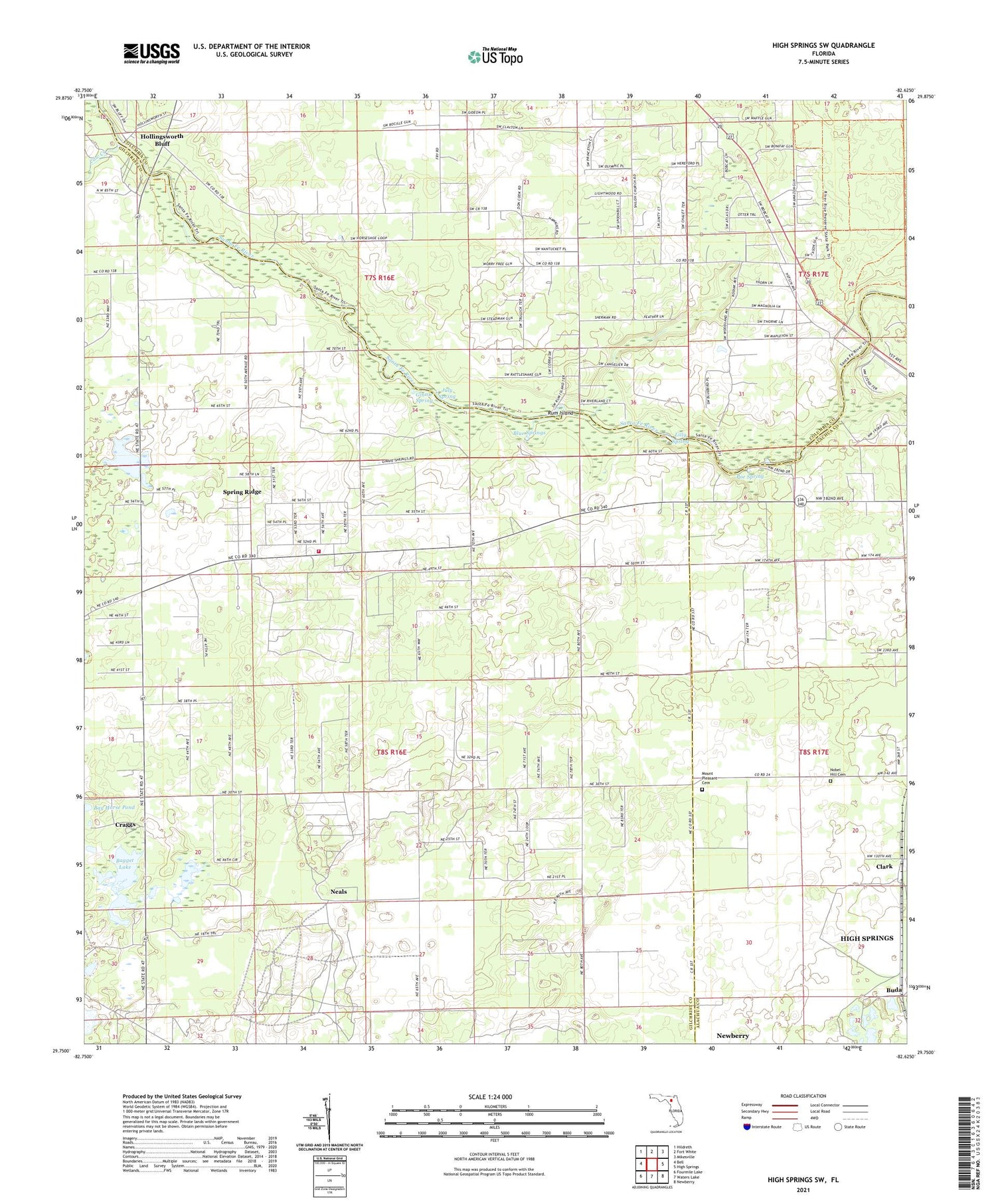
2024 topographic map quadrangle High Springs SW in the state of Florida. Scale: 1:24000. Based on the newly updated USGS 7.5' US Topo map series, this map is in the following counties: Gilchrist, Columbia, Alachua. The map contains contour data, water features, and other items you are used to seeing on USGS maps, but also has updated roads and other features. This is the next generation of topographic maps. Printed on high-quality waterproof paper with UV fade-resistant inks.
Quads adjacent to this one:
West: Bell
Northwest: Hildreth
North: Fort White
Northeast: Mikesville
East: High Springs
Southeast: Newberry
South: Waters Lake
Southwest: Fourmile Lake
This map covers the same area as the classic USGS quad with code o29082g6.
Contains the following named places: Bagget Lake, Blue Springs, Buda, Central Florida Electric Cooperative Neals Substation, Clark, Cornerstone Baptist Church, Cow Creek, Craggs, Fort White Branch Library, Gilchrist County Fire and Rescue Station 3, Ginnie Spring, Hollingsworth Bluff, July Spring, Lilly Spring, Mount Pleasant Baptist Church, Mount Pleasant Cemetery, Neals, Nobel Hill Cemetery, Poe Spring, Rum Island, Spring Ridge Census Designated Place, ZIP Code: 32643


