
MyTopo
West Pass Florida US Topo Map
Couldn't load pickup availability
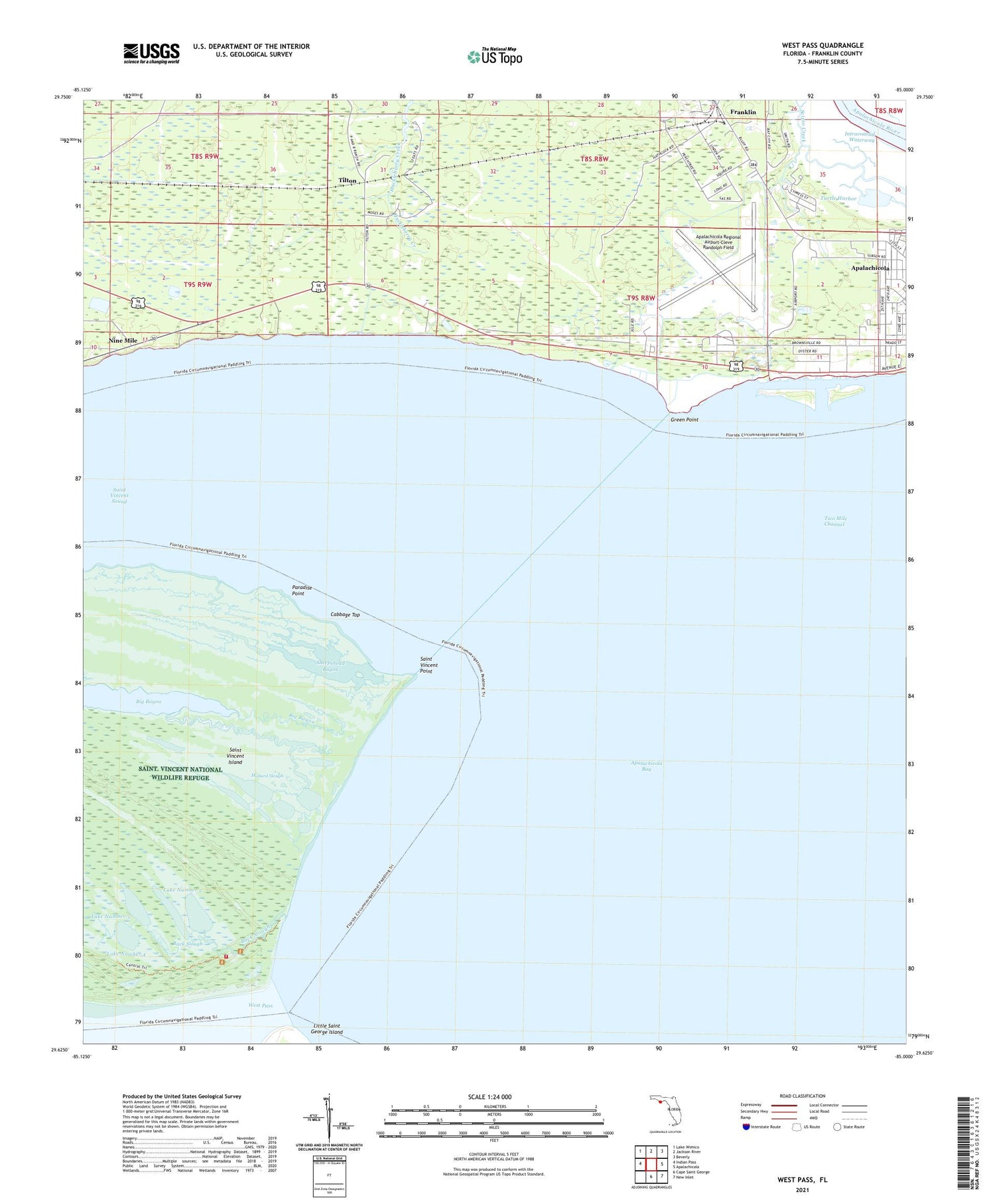
2025 topographic map quadrangle West Pass in the state of Florida. Scale: 1:24000. Based on the newly updated USGS 7.5' US Topo map series, this map is in the following counties: Franklin. The map contains contour data, water features, and other items you are used to seeing on USGS maps, but also has updated roads and other features. This is the next generation of topographic maps. Printed on high-quality waterproof paper with UV fade-resistant inks.
Quads adjacent to this one:
West: Indian Pass
Northwest: Lake Wimico
North: Jackson River
Northeast: Beverly
East: Apalachicola
Southeast: New Inlet
South: Cape Saint George
This map covers the same area as the classic USGS quad with code o29085f1.
Contains the following named places: Apalachicola Army Air Field, Apalachicola Regional Airport-Cleve Randolph Field, Back Slough, Cabbage Top, Eagles Nest Boat Landing, Franklin, Green Point, Lake Number 1, Lake Number 2, Lake Number 3, Lake Number 4, Mallard Slough, Nine Mile, Paradise Point, Saint Vincent Point, Saint Vincent Sound, Saint Vincents National Wildlife Refuge Fire Department, Sand Island, Sheepshead Bayou, Tilton, Turtle Harbor, Two Mile, Two Mile Channel, West Pass, ZIP Code: 32320


