MyTopo
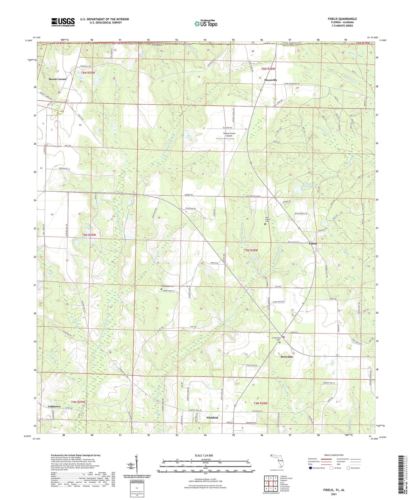
Fidelis Florida US Topo Map
Couldn't load pickup availability
2024 topographic map quadrangle Fidelis in the state of Florida. Scale: 1:24000. Based on the newly updated USGS 7.5' US Topo map series, this map is in the following counties: Santa Rosa, Escambia. The map contains contour data, water features, and other items you are used to seeing on USGS maps, but also has updated roads and other features. This is the next generation of topographic maps. Printed on high-quality waterproof paper with UV fade-resistant inks.
Quads adjacent to this one:
West: Jay
Northwest: Pollard
North: Brewton South
Northeast: Roberts
East: McLellan
Southeast: Spring Hill
South: Allentown
Southwest: Chumuckla
This map covers the same area as the classic USGS quad with code o30087h1.
Contains the following named places: Berrydale, Berrydale Census Designated Place, Berrydale Division, Berrydale Fire Department Station 14, Bishop Branch, Clear Branch, Cobb Branch, Cobb Creek, Cobbtown, Cobbtown Census Designated Place, Copeland Cemetery, Crossroads Cemetery, Crossroads Church, Dixonville, Dixonville Census Designated Place, Dixonville Church, Dry Branch, East Fork Juniper Creek, Ellis Pond, Fidelis, Fidelis Census Designated Place, Fidelis Church, Fidelis School, Golden Harvest Flying Service Inc, Golden Memorial Church, James Thomas Pond, Malloy Branch, Mount Carmel, Mount Carmel Census Designated Place, Picnic Lake, Pine Grove Church, Thomas Farms Airport, Travelers Rest Church, West Fork Juniper Creek, Whitfield, Whitfield Census Designated Place, Whitfield Church