MyTopo
Kings Ferry Florida US Topo Map
Couldn't load pickup availability
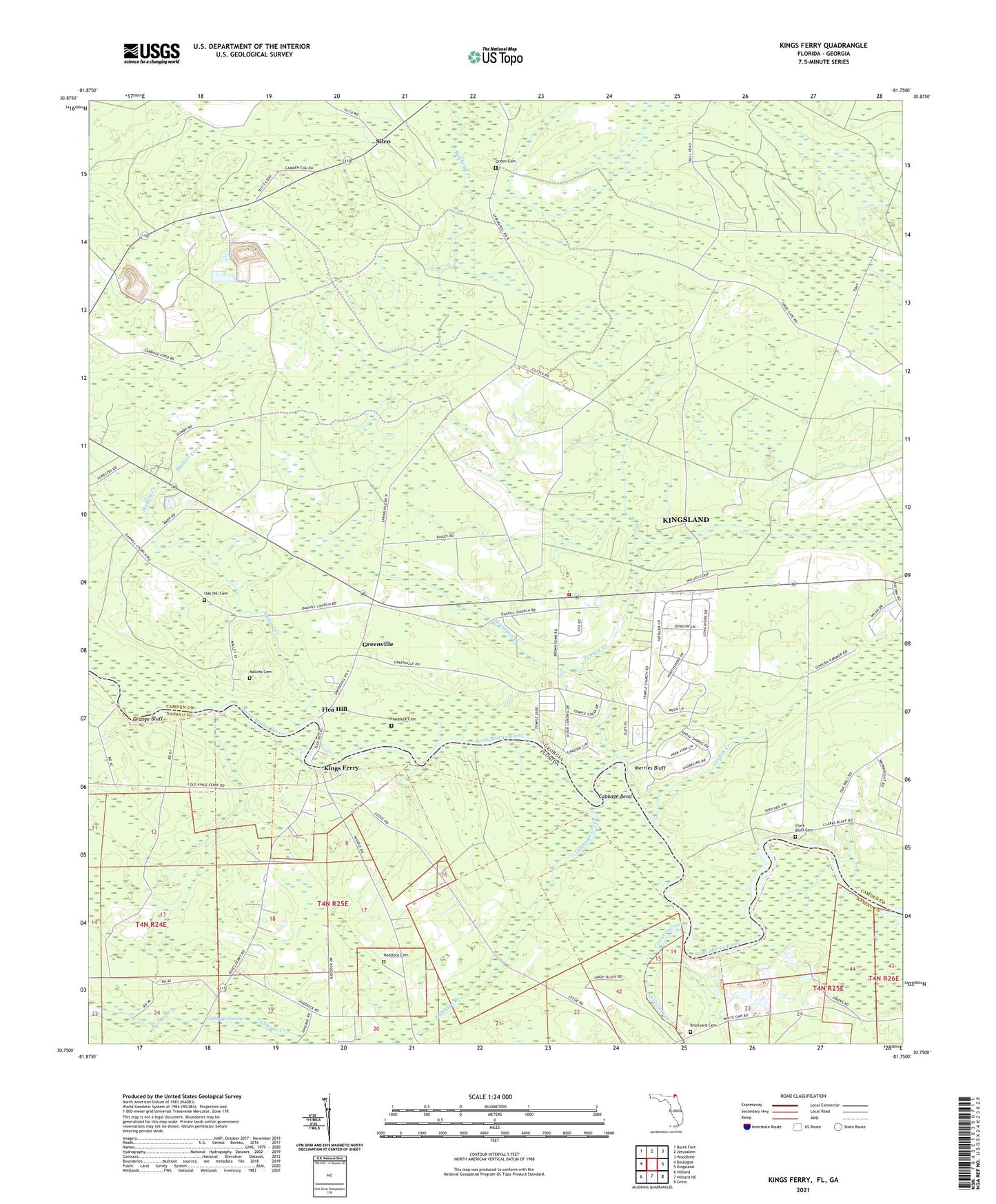
2024 topographic map quadrangle Kings Ferry in the states of Georgia, Florida. Scale: 1:24000. Based on the newly updated USGS 7.5' US Topo map series, this map is in the following counties: Nassau, Camden. The map contains contour data, water features, and other items you are used to seeing on USGS maps, but also has updated roads and other features. This is the next generation of topographic maps. Printed on high-quality waterproof paper with UV fade-resistant inks.
Quads adjacent to this one:
West: Boulogne
Northwest: Burnt Fort
North: Jerusalem
Northeast: Woodbine
East: Kingsland
Southeast: Gross
South: Hilliard NE
Southwest: Hilliard
Contains the following named places: Allens Mill, Blood Landing, Brickyard Cemetery, Brickyard Landing, Cabbage Bend, Cabbage Creek, Camden County Fire - Rescue Station 15, Catfish Creek, City of Kingsland, Clark Bluff Cemetery, Clarks Bluff, Cossiers Creek, Flea Hill, Germantown, Germantown School, Green Cemetery, Greenville, Haddock Cemetery, Horsepen Creek, Kings Ferry, Kingsland Division, Mallets Cemetery, Mallets Creek, Mallets Landing, Merrles Bluff, Mount Olive Church, Mount Zion Church, Oak Hill Cemetery, Oak Hill Church, Orange Bluff, Ruhamah Church, Silco, Spring Hill Church, Temple Church, Temple Creek, Zion Sisters Baptist Church