MyTopo
Lake Nellie Florida US Topo Map
Couldn't load pickup availability
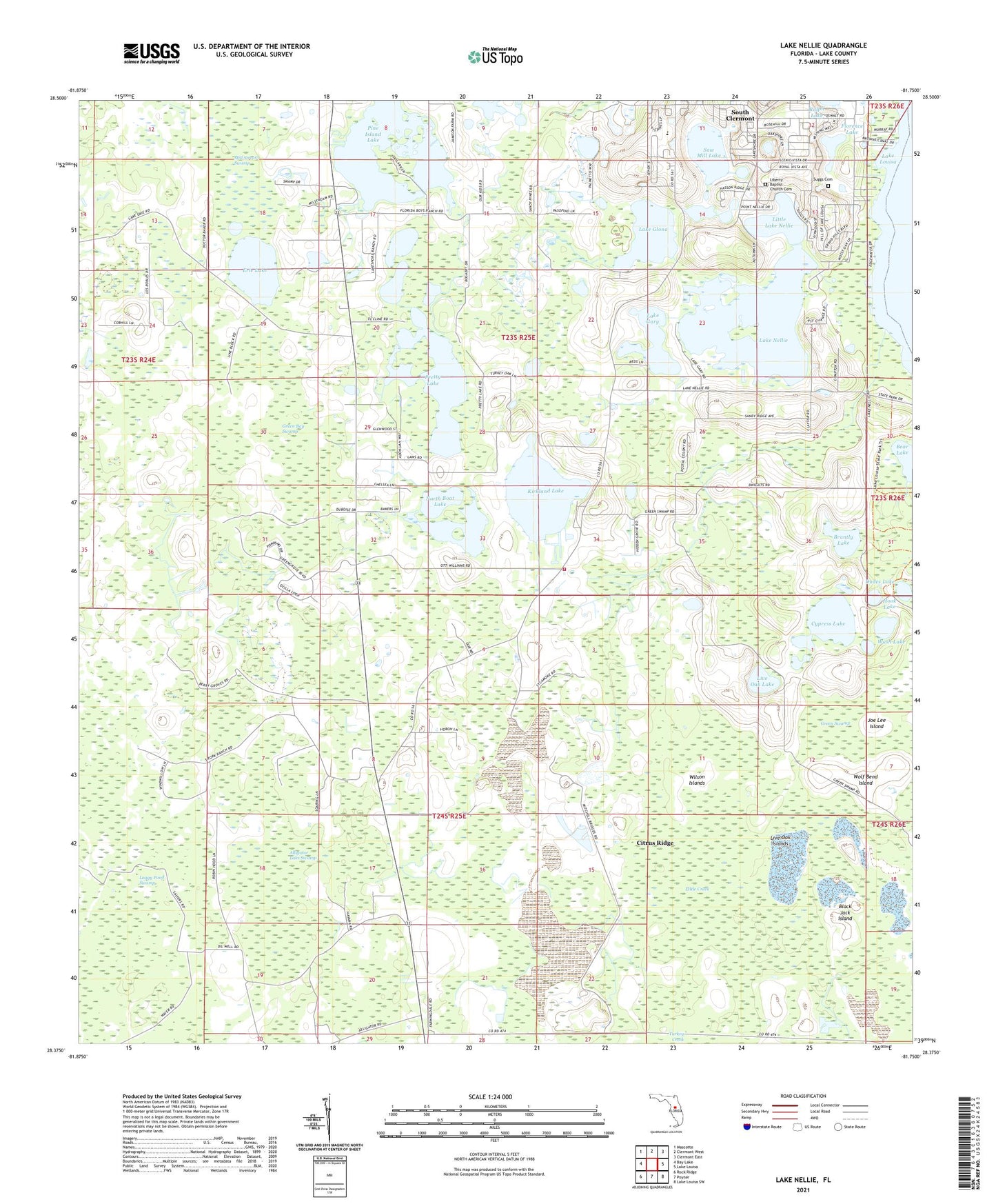
2024 topographic map quadrangle Lake Nellie in the state of Florida. Scale: 1:24000. Based on the newly updated USGS 7.5' US Topo map series, this map is in the following counties: Lake. The map contains contour data, water features, and other items you are used to seeing on USGS maps, but also has updated roads and other features. This is the next generation of topographic maps. Printed on high-quality waterproof paper with UV fade-resistant inks.
Quads adjacent to this one:
West: Bay Lake
Northwest: Mascotte
North: Clermont West
Northeast: Clermont East
East: Lake Louisa
Southeast: Lake Louisa SW
South: Poyner
Southwest: Rock Ridge
This map covers the same area as the classic USGS quad with code o28081d7.
Contains the following named places: Alligator Lake Swamp, Bear Lake, Black Jack Island, Brantly Lake, Cypress Lake, Dudes Lake, Erie Lake, Eva Lookout Tower, Florence Lake, Green Bay Swamp, Hook Lake, Joe Lee Island, Kirkland Lake, Lake County Fire Rescue Station 110, Lake Gary, Lake Glona, Lake Louisa State Park, Lake Nellie, Little Creek, Little Lake Nellie, Live Oak Islands, Live Oak Lake, North and South Boat Lake, North Boat Lake, Pine Island Lake, Pretty Lake, Saw Mill Lake, Seminole Lake Gliderport, South Boat Lake, South Clermont, True Life Church, Wash Lake, WGTO-AM (Pine Hills), Wilson Islands, Wolf Bend Island, WQTM - AM (Pine Hills), ZIP Code: 34714