MyTopo
Lulu Florida US Topo Map
Couldn't load pickup availability
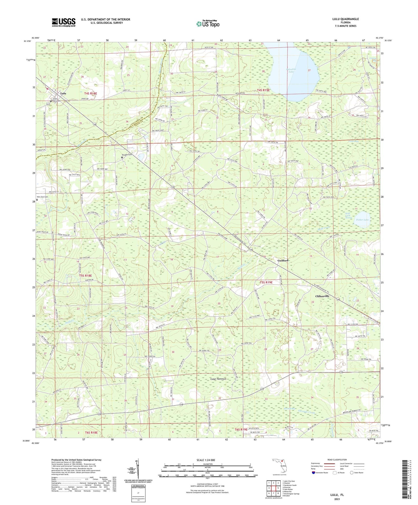
2024 topographic map quadrangle Lulu in the state of Florida. Scale: 1:24000. Based on the newly updated USGS 7.5' US Topo map series, this map is in the following counties: Union, Columbia. The map contains contour data, water features, and other items you are used to seeing on USGS maps, but also has updated roads and other features. This is the next generation of topographic maps. Printed on high-quality waterproof paper with UV fade-resistant inks.
Quads adjacent to this one:
West: Ellisville
Northwest: Lake City East
North: Olustee
Northeast: Sanderson South
East: Lake Butler
Southeast: Brooker
South: Worthington Springs
Southwest: Mikesville
This map covers the same area as the classic USGS quad with code o30082a4.
Contains the following named places: Cedar Hammock, Center Bay, Cliftonville, Douglas Cemetery, Fisher Lake, Fivemile Bay, Gillen Allen Cemetery, Guilford, Lake Butler Division, Lulu, Lulu Volunteer Fire Department Station 47, Midway Church, New Zion Cemetery, Oak Grove Church, Palestine Lake, Shaws Still, Swift Creek Swamp, Union Lookout Tower, ZIP Code: 32054