MyTopo
Mikesville Florida US Topo Map
Couldn't load pickup availability
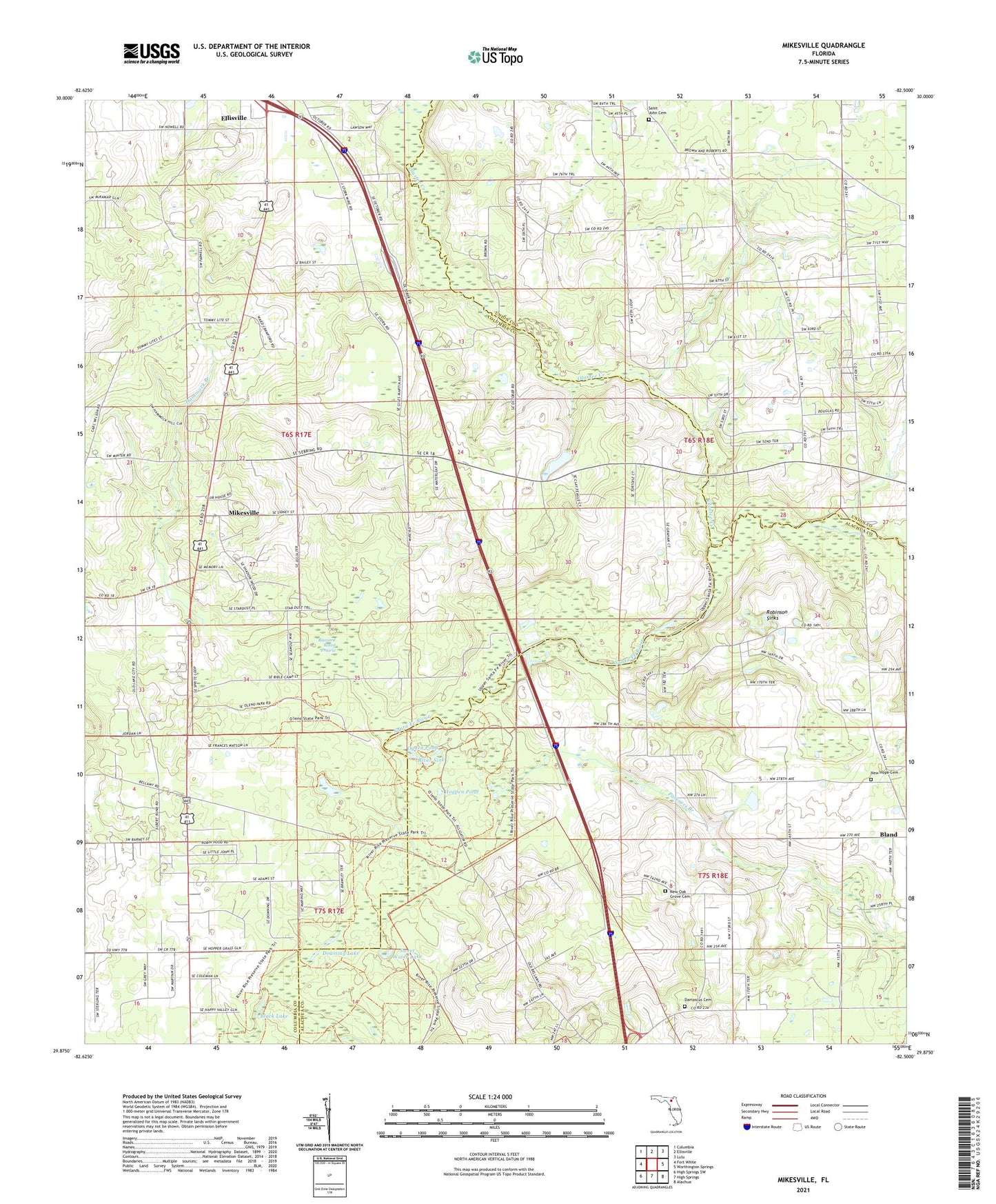
2024 topographic map quadrangle Mikesville in the state of Florida. Scale: 1:24000. Based on the newly updated USGS 7.5' US Topo map series, this map is in the following counties: Columbia, Alachua, Union. The map contains contour data, water features, and other items you are used to seeing on USGS maps, but also has updated roads and other features. This is the next generation of topographic maps. Printed on high-quality waterproof paper with UV fade-resistant inks.
Quads adjacent to this one:
West: Fort White
Northwest: Columbia
North: Ellisville
Northeast: Lulu
East: Worthington Springs
Southeast: Alachua
South: High Springs
Southwest: High Springs SW
This map covers the same area as the classic USGS quad with code o29082h5.
Contains the following named places: Black Lake, Buzzard Roost Prairie, Clay Electric Cooperative Bland Substation, Damascus Cemetery, Damascus Church, Downing Lake, Francis R Sanchez Grant, Full Gospel of Jesus Christ, Greater New Hope Baptist Church, Greater New Hope Missionary Baptist Church, Hammock Branch, Hogpen Pond, Hopewell Church of God by Faith, Mikesville, Mikesville Church, Natural Bridge, New Hope Cemetery, New Oak Grove Baptist Church, New Oak Grove Cemetery, Ogden Pond, O'Leno State Park, Olustee Creek, Pareners Branch, Philippi Church, River Sink, Robinson Sinks, Saint John Cemetery, Saint John Missionary Baptist Church, San Francisco Potano, Sarah Community Park, Sweet Water Lake, Vinzant Landing