MyTopo
Newberry SW Florida US Topo Map
Couldn't load pickup availability
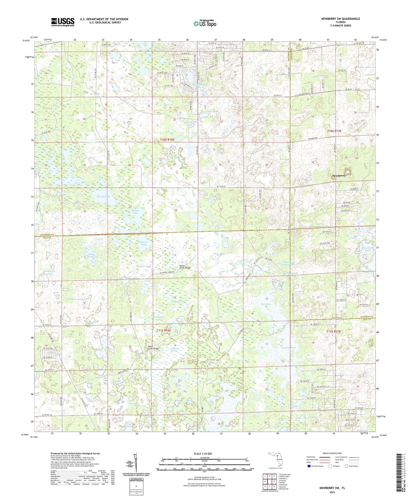
2024 topographic map quadrangle Newberry SW in the state of Florida. Scale: 1:24000. Based on the newly updated USGS 7.5' US Topo map series, this map is in the following counties: Levy, Gilchrist, Alachua. The map contains contour data, water features, and other items you are used to seeing on USGS maps, but also has updated roads and other features. This is the next generation of topographic maps. Printed on high-quality waterproof paper with UV fade-resistant inks.
Quads adjacent to this one:
West: Trenton
Northwest: Fourmile Lake
North: Waters Lake
Northeast: Newberry
East: Archer
Southeast: Bronson NE
South: Bronson
Southwest: Chiefland
This map covers the same area as the classic USGS quad with code o29082e6.
Contains the following named places: Asbell Creek Bridge, Billups Pond, Boat Pond, Bowen Lake, Crabgrass Pond, Doorshutter Lake, Duck Pond, Ebenezer Church, Fox Lake, Jones Pond, McCain Lake, McGowen Pond, Meeting Pond, Mineral Feeder Pond, Newton, Porter Smith Bridge, Sawgrass Springs, Shirley Lake, Station Pond, Tom Pond, Union Church, Waccasassa Lake, Waccasassa River, Watermelon Pond, Waters Pond, Winquipin Lake