MyTopo
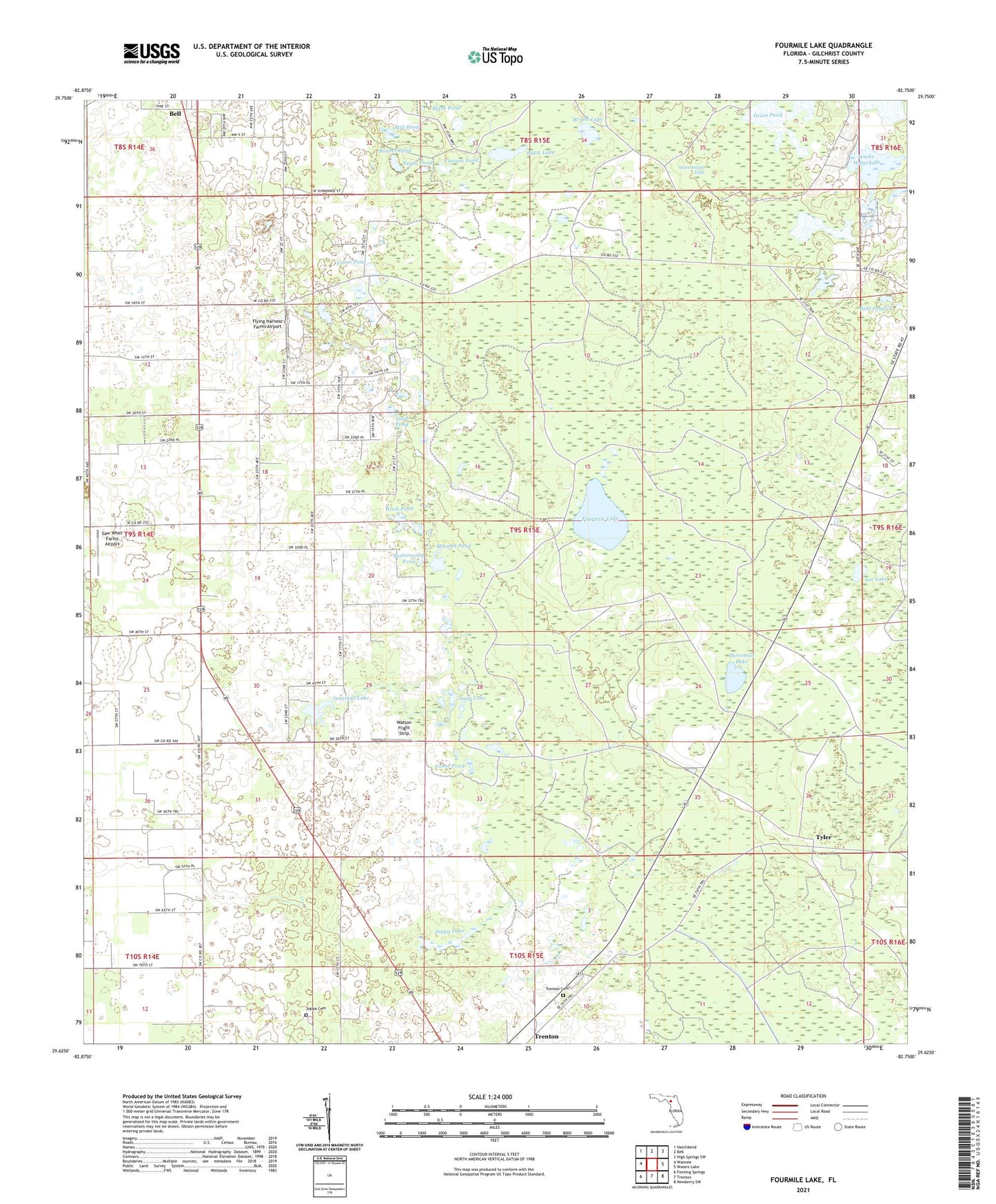
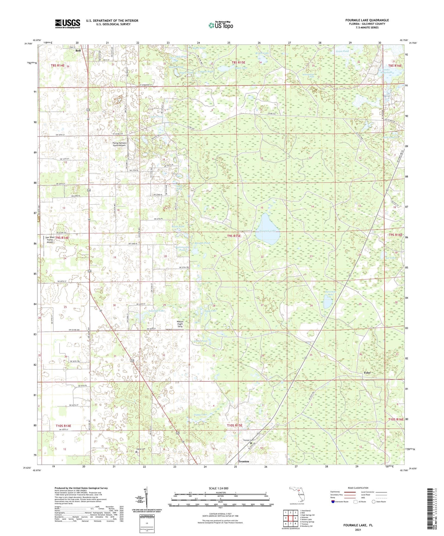
Fourmile Lake Florida US Topo Map
Couldn't load pickup availability
2024 topographic map quadrangle Fourmile Lake in the state of Florida. Scale: 1:24000. Based on the newly updated USGS 7.5' US Topo map series, this map is in the following counties: Gilchrist. The map contains contour data, water features, and other items you are used to seeing on USGS maps, but also has updated roads and other features. This is the next generation of topographic maps. Printed on high-quality waterproof paper with UV fade-resistant inks.
Quads adjacent to this one:
West: Wannee
Northwest: Hatchbend
North: Bell
Northeast: High Springs SW
East: Waters Lake
Southeast: Newberry SW
South: Trenton
Southwest: Fanning Springs
This map covers the same area as the classic USGS quad with code o29082f7.
Contains the following named places: Bird Pond, Black Lake, Bonnet Pond, Bright Lake, Buttonwood Pond, Cannon Pond, Flying Harness Farms Airport, Fourmile Lake, Gator Pond, Gilchrist County, Gilchrist County Emergency Medical Services Medic 2, Gilchrist County Lookout Tower, Goose Pond, Grass Pond, Jennings Lake, Jennings Lake Church, Joppa Cemetery, Joppa Lake, Lee Lake, Mill Pond, Morgan Pond, Mutual, Negro Pond, Pleasant Hill Church, Sapp Lake, Saw Whet Farms Airport, Threemile Lake, Trenton Cemetery, Trenton Division, Tyler, Waccasassa Flats, Wash Pond, Watson Flight Strip, Weeks Lake, Weeks Waterhole, Yard Pond, ZIP Code: 32693