MyTopo
Bronson NE Florida US Topo Map
Couldn't load pickup availability
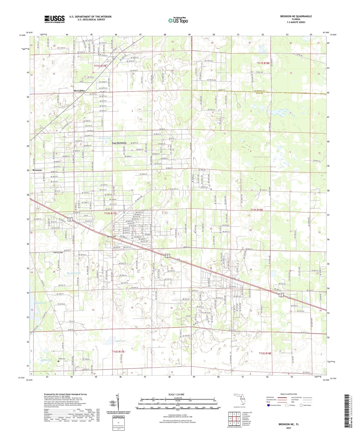
2024 topographic map quadrangle Bronson NE in the state of Florida. Scale: 1:24000. Based on the newly updated USGS 7.5' US Topo map series, this map is in the following counties: Levy, Alachua. The map contains contour data, water features, and other items you are used to seeing on USGS maps, but also has updated roads and other features. This is the next generation of topographic maps. Printed on high-quality waterproof paper with UV fade-resistant inks.
Quads adjacent to this one:
West: Bronson
Northwest: Newberry SW
North: Archer
Northeast: Arredondo
East: Williston
Southeast: Morriston
South: Bronson SE
Southwest: Bronson SW
This map covers the same area as the classic USGS quad with code o29082d5.
Contains the following named places: Adam, Bailey Mine, Bronson Church of God, Cherry Sink, East Bronson Census Designated Place, German Pond, Iglesia Evagelica el Tabor, Iglesia Pentecostal Redimidos por Cristo, Iglesia Pentecostal Templo de la Alabanza, Marshall Pond, Merediths, Mount Olive African Methodist Elpiscopal Church, Sand Pond, Sawgrass Lake, Sinclair Mine, Smith Cemetery, Spring Hill, WFEZ-FM (Williston), Williston-Bronson Division, ZIP Code: 32621