MyTopo
Waters Lake Florida US Topo Map
Couldn't load pickup availability
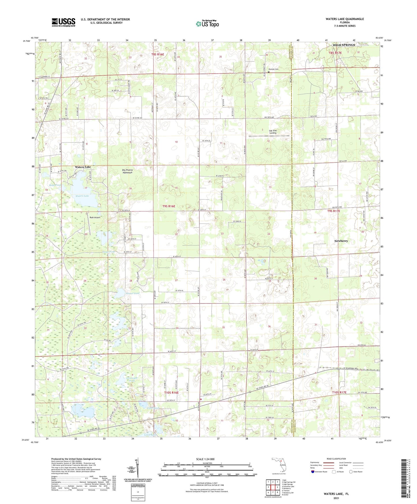
2024 topographic map quadrangle Waters Lake in the state of Florida. Scale: 1:24000. Based on the newly updated USGS 7.5' US Topo map series, this map is in the following counties: Gilchrist, Alachua. The map contains contour data, water features, and other items you are used to seeing on USGS maps, but also has updated roads and other features. This is the next generation of topographic maps. Printed on high-quality waterproof paper with UV fade-resistant inks.
Quads adjacent to this one:
West: Fourmile Lake
Northwest: Bell
North: High Springs SW
Northeast: High Springs
East: Newberry
Southeast: Archer
South: Newberry SW
Southwest: Trenton
This map covers the same area as the classic USGS quad with code o29082f6.
Contains the following named places: Bogg Pond, Camp Pond, Center Hill Church, Christmas Lake, Clear Pond, Corinth Church, Dinner Pond, Dry Prairie Hammock, Fivemile Pond, Gilchrist County Fire and Rescue Station 4, Iris Railroad Station, Jeb Knight Pond, Knighting Lake, Leech Pond, Mona Railroad Station, Oak Tree Landing, Osceola Cemetery, Rush Airport, Thames, Thames Junction, Union Church, Waters Lake