MyTopo
Dorcas Florida US Topo Map
Couldn't load pickup availability
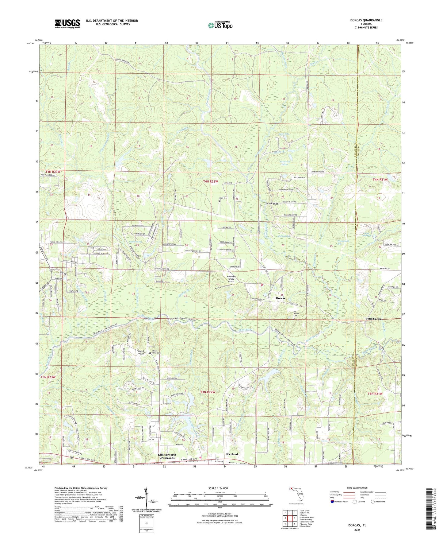
2024 topographic map quadrangle Dorcas in the state of Florida. Scale: 1:24000. Based on the newly updated USGS 7.5' US Topo map series, this map is in the following counties: Okaloosa, Walton. The map contains contour data, water features, and other items you are used to seeing on USGS maps, but also has updated roads and other features. This is the next generation of topographic maps. Printed on high-quality waterproof paper with UV fade-resistant inks.
Quads adjacent to this one:
West: Crestview North
Northwest: Oak Grove
North: Laurel Hill
Northeast: Paxton
East: New Harmony
Southeast: Mossy Head
South: Spencer Flats
Southwest: Crestview South
This map covers the same area as the classic USGS quad with code o30086g4.
Contains the following named places: Beech Branch, Bends Creek, Bogy Branch, Bridge Branch, Clear Creek, Copeland Bay, Deerland, Dorcas, Dorcas Fire District Station 41, Dorcas Fire District Station 42, East Branch Mare Creek, Faircloth Lakes, Five Oaks Estate Airport, Fort Kirkland Branch, Gourd Bay, Hannah Branch, Hart Cemetery, Horsehead Creek, Indian Branch, Jack Branch, Juniper Creek, Killingsworth Crossroads, Laird Mill Creek, Lake Ella, Long Creek, Long Creek Bay, McCloud Bay, Mount Olive Cemetery, Old Dorcas Cemetery, Painter Branch, Pennywinkle Bay, Pine Log Creek, Pond Creek, Poverty Creek, Reedy Branch, Rum Still Branch, Spring Branch, Steves Wash Branch, Triple B Airpark, Ward Mill Creek, Welcome Church, West Branch Mare Creek, Yellow Bluff, ZIP Code: 32539