MyTopo
Pine Lakes Florida US Topo Map
Couldn't load pickup availability
Also explore the Pine Lakes Forest Service Topo of this same quad for updated USFS data
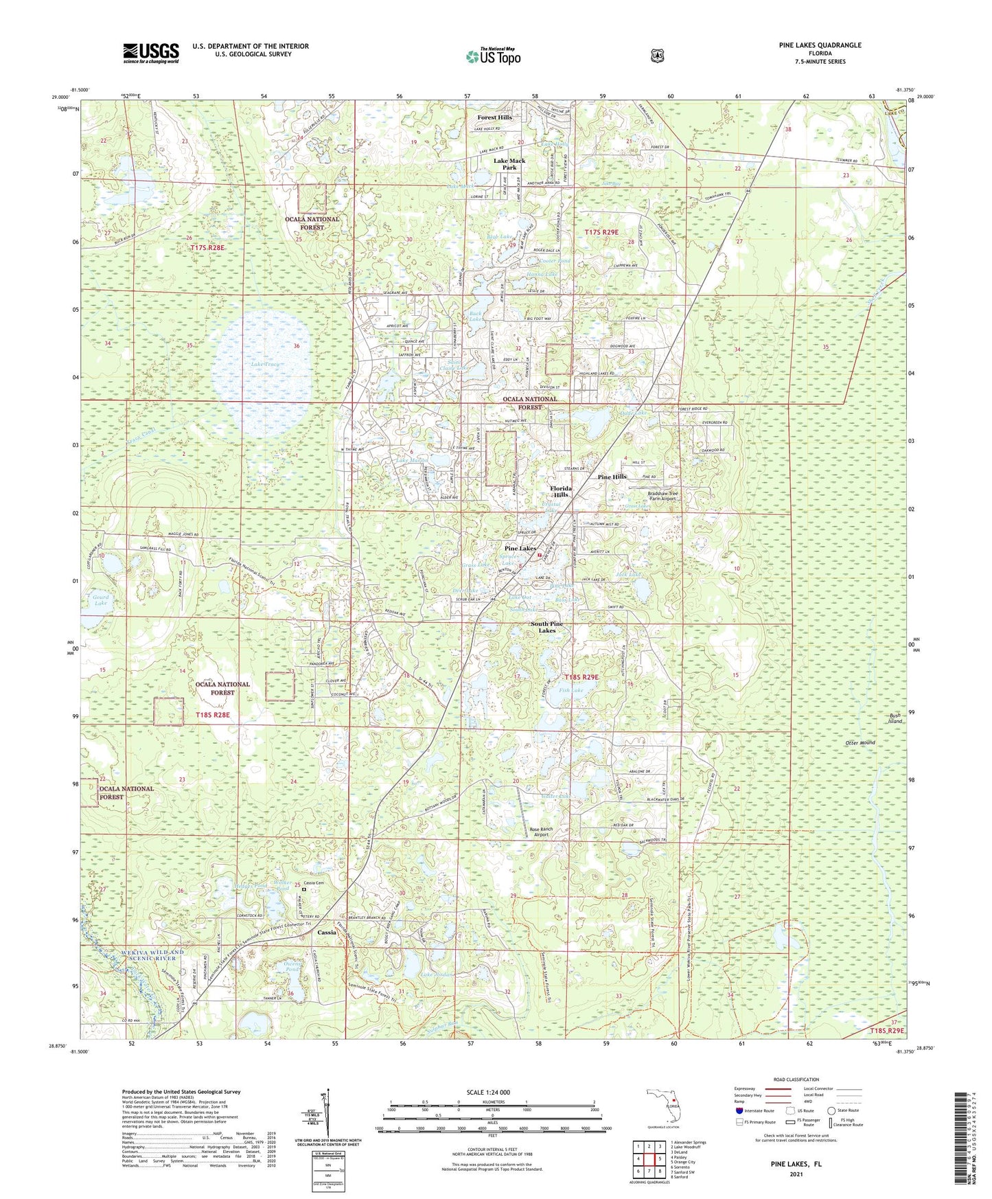
2024 topographic map quadrangle Pine Lakes in the state of Florida. Scale: 1:24000. Based on the newly updated USGS 7.5' US Topo map series, this map is in the following counties: Lake, Volusia. The map contains contour data, water features, and other items you are used to seeing on USGS maps, but also has updated roads and other features. This is the next generation of topographic maps. Printed on high-quality waterproof paper with UV fade-resistant inks.
Quads adjacent to this one:
West: Paisley
Northwest: Alexander Springs
North: Lake Woodruff
Northeast: DeLand
East: Orange City
Southeast: Sanford
South: Sanford SW
Southwest: Sorrento
This map covers the same area as the classic USGS quad with code o28081h4.
Contains the following named places: Bass Lake, Bear Lake, Benton Lake, Bradshaw Tree Farm Airport, Buck Lake, Bush Island, Cassia, Cassia Cemetery, Cooter Pond, Crystal Lake, Dade Lake, Deer Lake, Drigger Islands, First Baptist Church of Pine Lakes, Fish Lake, Florida Hills, Gaiter Lake, Gourd Lake, Grass Lake, Hanna Lake, Hedges Pond, Jack Lake, Jake Bay, Lake County Fire Rescue Station 15, Lake Dot, Lake Holly, Lake Jordan, Lake Lappin, Lake Mack, Lake Mack Park, Lake Marion, Lake Tracy, Otter Mound, Owens Pond, Pine Hills, Pine Lake, Pine Lakes, Pine Lakes Census Designated Place, Pine Lakes Farm Airport, Rose Ranch Airport, Royal Trails Airport, Saint Claire Lake, South Lake, South Pine Lakes, Spruce Lake, Walker Pond, WWLV-FM (Daytona Beach), ZIP Code: 32736