MyTopo
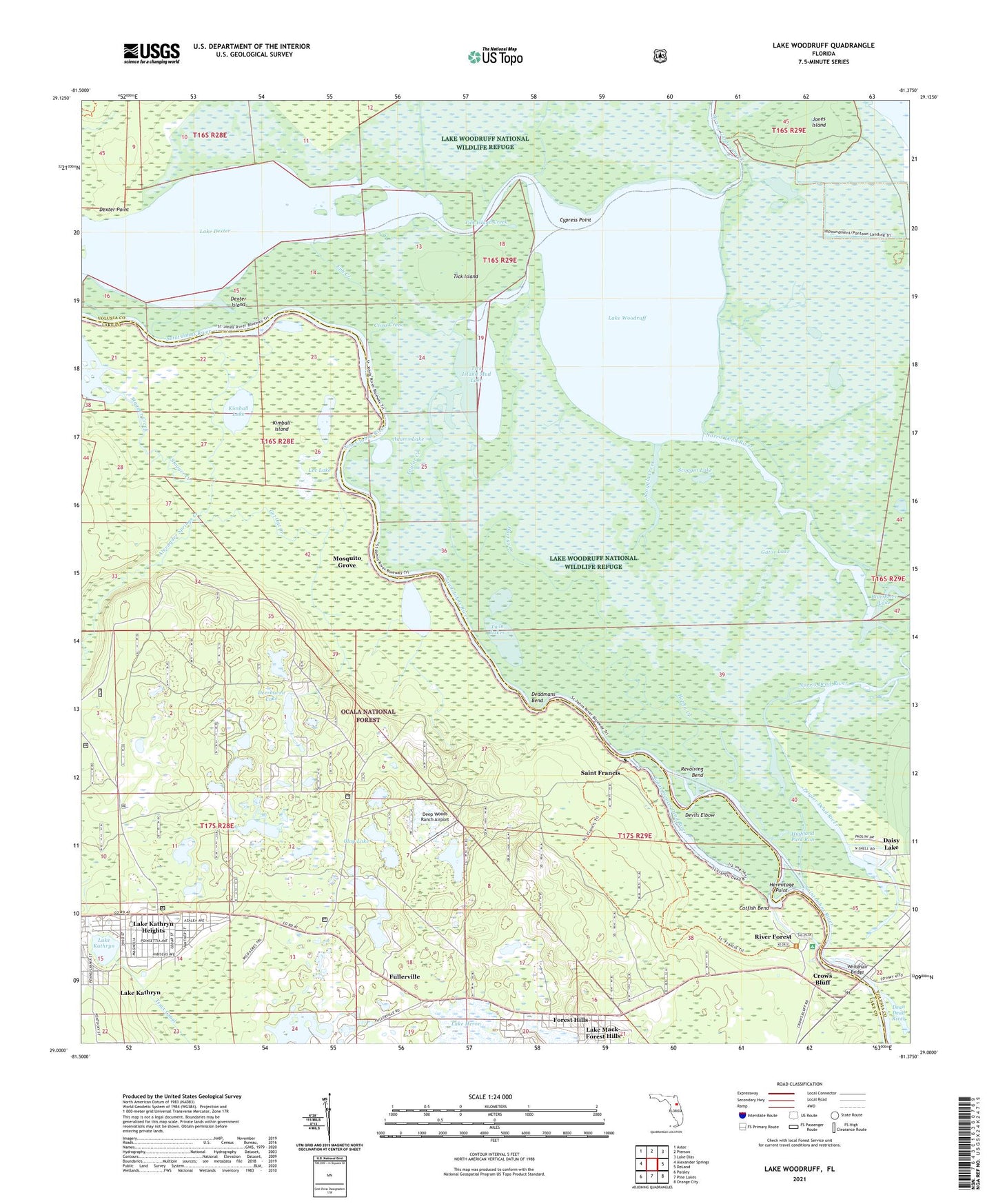
Lake Woodruff Florida US Topo Map
Couldn't load pickup availability
Also explore the Lake Woodruff Forest Service Topo of this same quad for updated USFS data
2024 topographic map quadrangle Lake Woodruff in the state of Florida. Scale: 1:24000. Based on the newly updated USGS 7.5' US Topo map series, this map is in the following counties: Volusia, Lake. The map contains contour data, water features, and other items you are used to seeing on USGS maps, but also has updated roads and other features. This is the next generation of topographic maps. Printed on high-quality waterproof paper with UV fade-resistant inks.
Quads adjacent to this one:
West: Alexander Springs
Northwest: Astor
North: Pierson
Northeast: Lake Dias
East: DeLand
Southeast: Orange City
South: Pine Lakes
Southwest: Paisley
This map covers the same area as the classic USGS quad with code o29081a4.
Contains the following named places: Adams Lake, Alexander Springs Creek, Alexander Springs Wilderness, Antonio Huertas Grant, Bennett Landing, Blue Peter Lake, Catfish Bend, Central Baptist Church Youth Camp, Clay Lake, Cowpen Pond, Cross Creek, Crows Bluff, Cypress Branch, Cypress Point, Daisy Lake, Deadmans Bend, Deep Woods Ranch Airport, Deerhaven Campgrounds, Deerhaven Lake, Devils Elbow, Dexter Island, Dexter Point, Domingo Fernandez Grant, Eph Creek, Forest Hills, Forest Lake, Fullerville, Gator Lake, Get Out Creek, Harrys Creek, Hermitage Point, Hickory Landing, Highland Park Run, Honey Creek, Horseshoe Mud Lake, Jones Island, Kimball Island, Kimball Lake, Lake Dexter, Lake Heron, Lake Kathryn, Lake Kathryn Census Designated Place, Lake Kathryn Heights, Lake Mack-Forest Hills Census Designated Place, Lake Woodruff, Lake Woodruff National Wildlife Refuge, Lake Woodruff Wilderness, Lake Woodruff Wilderness Refuge, Lee Lake, Mosquito Grove, Norris Dead River, North Shell Fish Camp Marina, Pier 44 Marina, Revolving Bend, River Forest, River Forest Recreaton Site, Saint Francis, Saint Francis Dead River, Scoggin Creek, Scoggin Lake, Shell Landing, Spring Garden Creek, Stagger Creek, Taylor Creek, Tick Island, Tick Island Creek, Tick Island Mud Lake, Twin Lakes, Whitehair Bridge, Zeigler Dead River