MyTopo
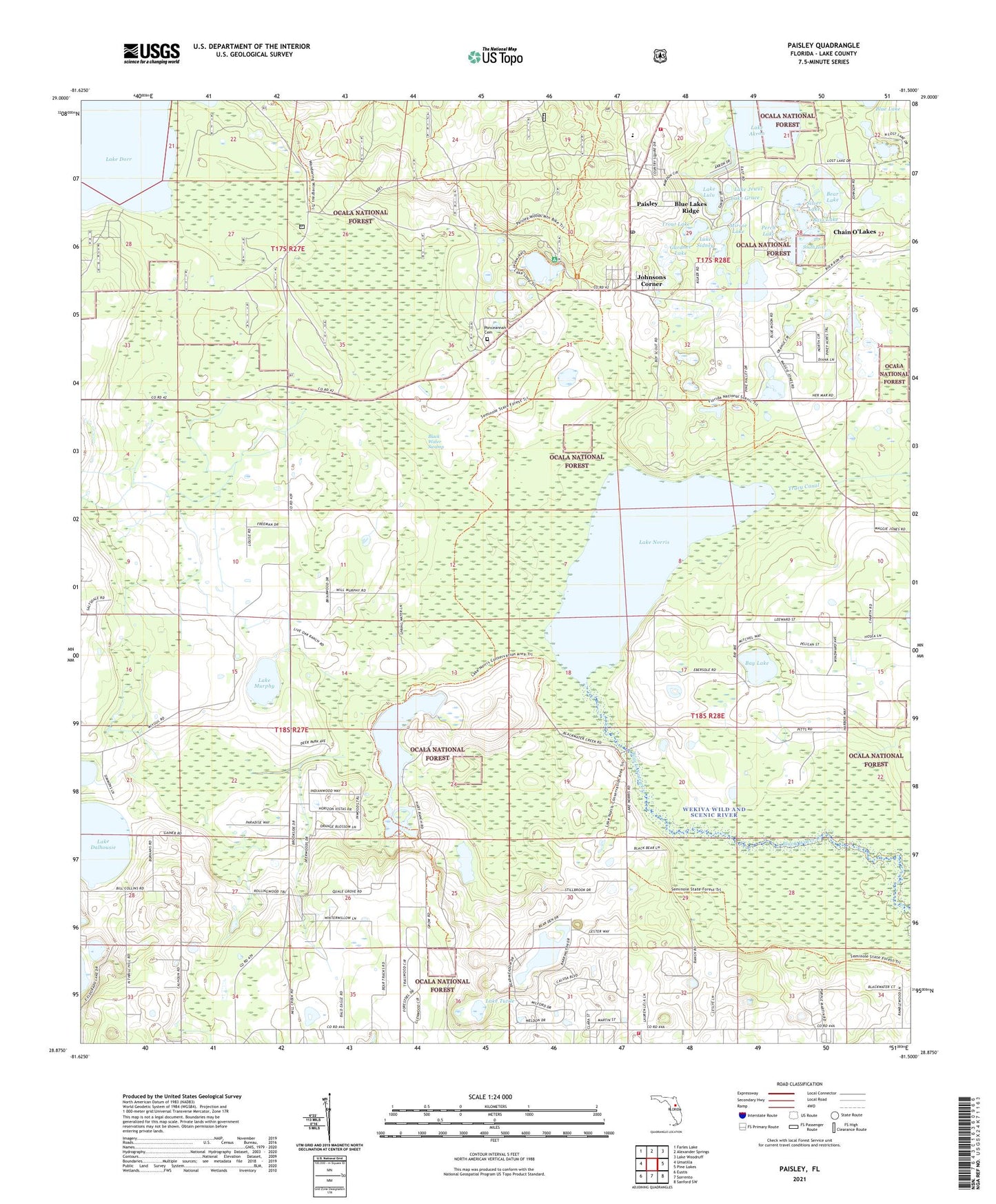
Paisley Florida US Topo Map
Couldn't load pickup availability
Also explore the Paisley Forest Service Topo of this same quad for updated USFS data
2024 topographic map quadrangle Paisley in the state of Florida. Scale: 1:24000. Based on the newly updated USGS 7.5' US Topo map series, this map is in the following counties: Lake. The map contains contour data, water features, and other items you are used to seeing on USGS maps, but also has updated roads and other features. This is the next generation of topographic maps. Printed on high-quality waterproof paper with UV fade-resistant inks.
Quads adjacent to this one:
West: Umatilla
Northwest: Farles Lake
North: Alexander Springs
Northeast: Lake Woodruff
East: Pine Lakes
Southeast: Sanford SW
South: Sorrento
Southwest: Eustis
This map covers the same area as the classic USGS quad with code o28081h5.
Contains the following named places: Bass Lake, Bay Lake, Bear Lake, Black Water Swamp, Blue Lakes Ridge, Camp La-No-Che, Central Florida Bible Camp, Chain O'Lakes, Clearwater Recreation Area, Country Squire Mobile Home Village, Deering Bay Yacht and Country Club, First Baptist Church of Paisley, Gardner Lake, Johnsons Corner, Lake - Sumter Emergency Medical Services Station 111, Lake Akron, Lake Clearwater, Lake County Fire Rescue Station 13, Lake County Fire Rescue Station 21, Lake County Public Library System Paisley Branch Library, Lake Dalhousie, Lake Grace, Lake Jewel, Lake Lulu, Lake Murphy, Lake Norris, Lake Sidney, Lake Tuttle, Mirror Lake, Paisley, Paisley Census Designated Place, Paisley Lookout Tower, Paisley Post Office, Paisley United Methodist Church, Perch Lake, Ponceannah Cemetery, Silver Lake, South Lake, Trout Lake, Umatilla Division