MyTopo
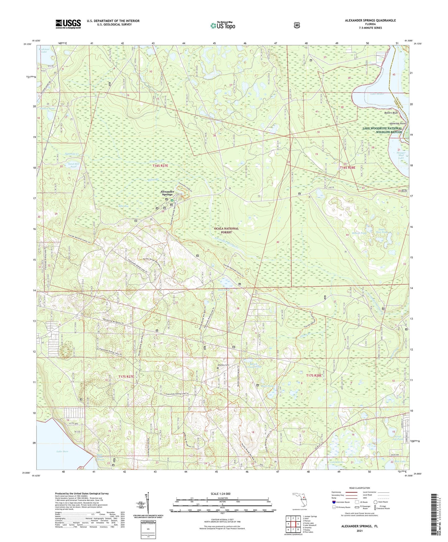
Alexander Springs Florida US Topo Map
Couldn't load pickup availability
Also explore the Alexander Springs Forest Service Topo of this same quad for updated USFS data
2024 topographic map quadrangle Alexander Springs in the state of Florida. Scale: 1:24000. Based on the newly updated USGS 7.5' US Topo map series, this map is in the following counties: Lake, Volusia. The map contains contour data, water features, and other items you are used to seeing on USGS maps, but also has updated roads and other features. This is the next generation of topographic maps. Printed on high-quality waterproof paper with UV fade-resistant inks.
Quads adjacent to this one:
West: Farles Lake
Northwest: Juniper Springs
North: Astor
Northeast: Pierson
East: Lake Woodruff
Southeast: Pine Lakes
South: Paisley
Southwest: Umatilla
This map covers the same area as the classic USGS quad with code o29081a5.
Contains the following named places: Alco Dock, Alexander Springs, Alexander Springs Recreation Area, Astor Landing Marina, Billies Bay, Billies Bay Wilderness, Billies Branch, Blue Lake, Bobcat Pond, Bowers Bluff, Bunch Ground Pond, Dillard Pond, Duck Pond, Eagle Nest Pond, F J Advice Grant, Flatwoods Trail, Francis Marin Grant, Glenn Branch, Idlewilde Point, Lake Dorr, Lakeview Park, Moses E Levy Grant, Mud Pond, Ninemile Creek, Powells Campground Mobile Home Park, Sand Hill Pond, Scrub Jay Pond, Sellers Lake Boat Ramp, Shockley Cemetery, Stagger Mud Lake, Tracy Canal, ZIP Code: 32767