MyTopo
Point Washington Florida US Topo Map
Couldn't load pickup availability
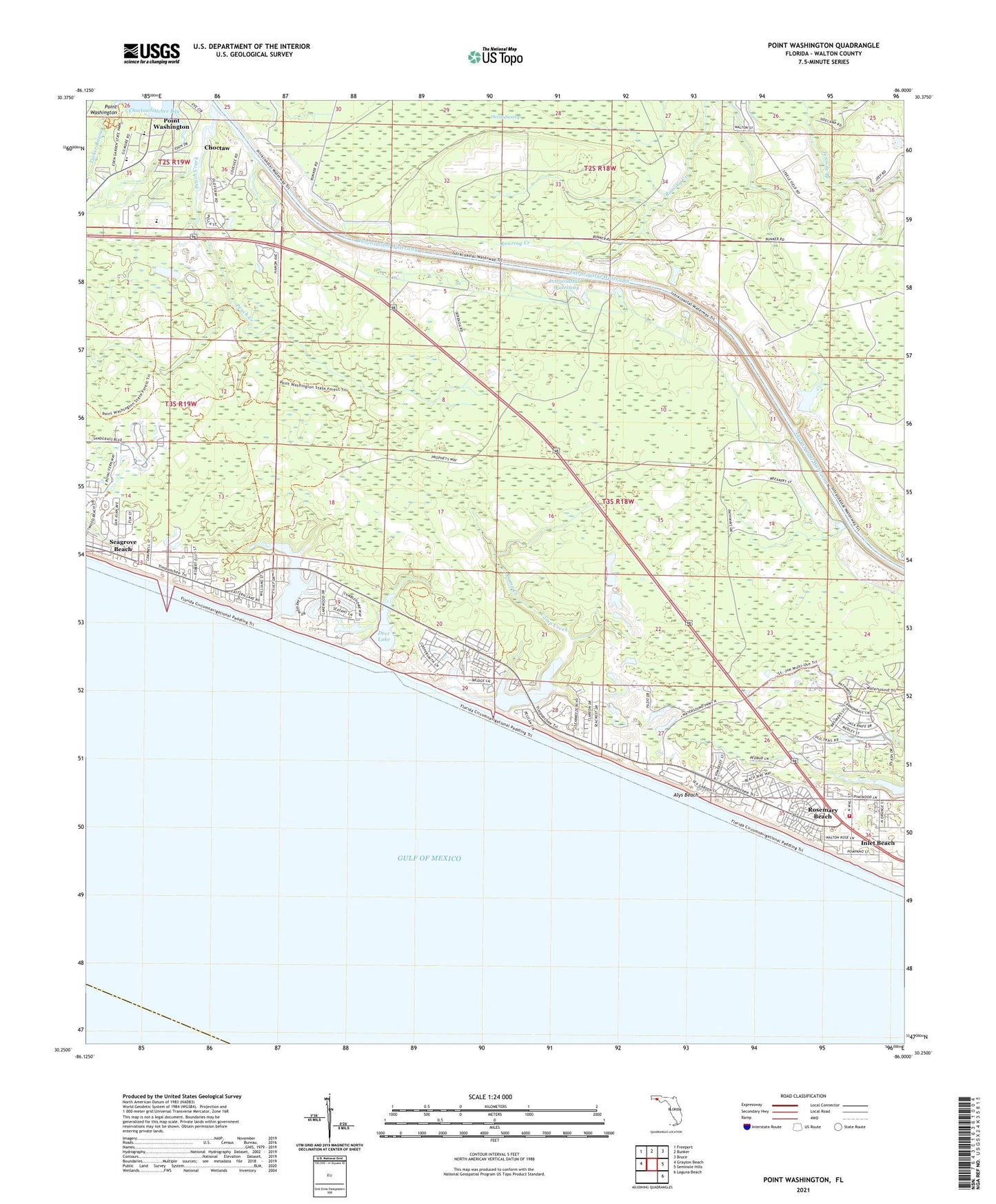
2025 topographic map quadrangle Point Washington in the state of Florida. Scale: 1:24000. Based on the newly updated USGS 7.5' US Topo map series, this map is in the following counties: Walton. The map contains contour data, water features, and other items you are used to seeing on USGS maps, but also has updated roads and other features. This is the next generation of topographic maps. Printed on high-quality waterproof paper with UV fade-resistant inks.
Quads adjacent to this one:
West: Grayton Beach
Northwest: Freeport
North: Bunker
Northeast: Bruce
East: Seminole Hills
Southeast: Laguna Beach
This map covers the same area as the classic USGS quad with code o30086c1.
Contains the following named places: Alys Beach, Bay Elementary School, Camp Creek, Camp Creek Lake, Choctaw, Deer Lake, Deer Lake State Park, Devils Swamp, Eastern Lake, Inlet Beach, Ninemile Branch, Peach Creek, Point Washington, Point Washington Methodist Church, Red Fish Lake, Rosemary Beach, Seacrest, Seacrest Beach, South Walton Fire District Station 1, ZIP Code: 32461