MyTopo
Seminole Hills Florida US Topo Map
Couldn't load pickup availability
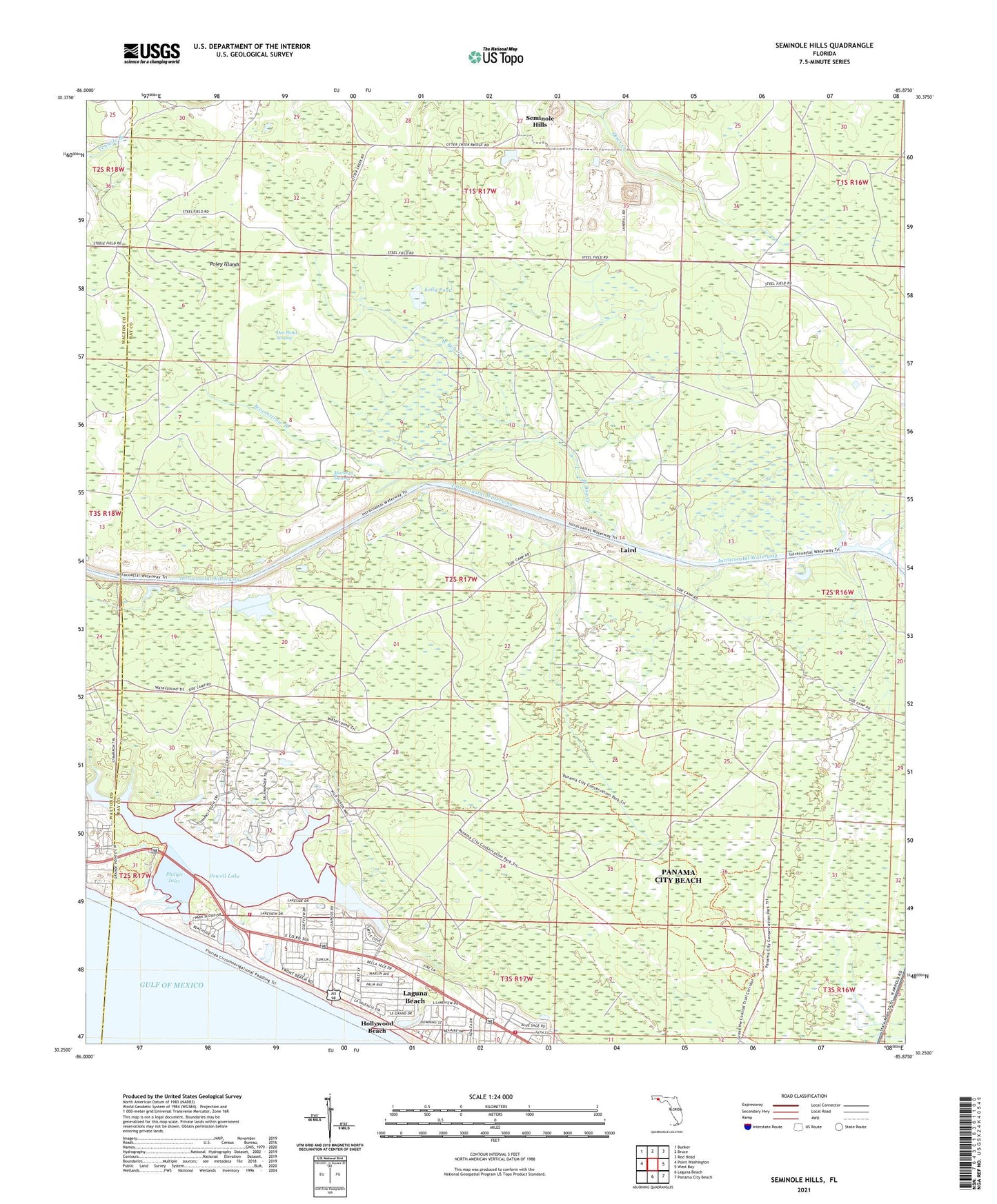
2025 topographic map quadrangle Seminole Hills in the state of Florida. Scale: 1:24000. Based on the newly updated USGS 7.5' US Topo map series, this map is in the following counties: Bay, Walton. The map contains contour data, water features, and other items you are used to seeing on USGS maps, but also has updated roads and other features. This is the next generation of topographic maps. Printed on high-quality waterproof paper with UV fade-resistant inks.
Quads adjacent to this one:
West: Point Washington
Northwest: Bunker
North: Bruce
Northeast: Red Head
East: West Bay
Southeast: Panama City Beach
South: Laguna Beach
This map covers the same area as the classic USGS quad with code o30085c8.
Contains the following named places: Broomstraw Branch, County Line Landing, Doe Head Swamp, Hollywood Beach, Kelly Pond, Laguna Beach Census Designated Place, Laird, Marshall Swamp, Otter Creek, Philips Inlet, Point Washington Wildlife Management Area, Poley Islands, Powell Lake, Seminole Hills, Sunnyside, Tiller Branch, West Bay Creek, West End Volunteer Fire Department Station 1, West End Volunteer Fire Department Station 2, WFSG-TV (Panama City), ZIP Code: 32413