MyTopo
Freeport Florida US Topo Map
Couldn't load pickup availability
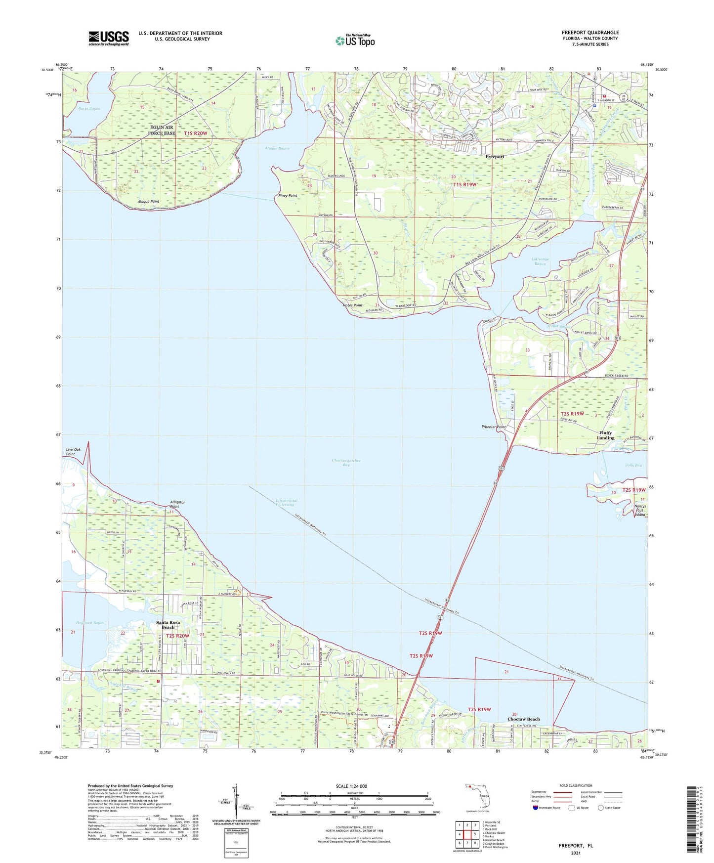
2024 topographic map quadrangle Freeport in the state of Florida. Scale: 1:24000. Based on the newly updated USGS 7.5' US Topo map series, this map is in the following counties: Walton. The map contains contour data, water features, and other items you are used to seeing on USGS maps, but also has updated roads and other features. This is the next generation of topographic maps. Printed on high-quality waterproof paper with UV fade-resistant inks.
Quads adjacent to this one:
West: Choctaw Beach
Northwest: Niceville SE
North: Portland
Northeast: Rock Hill
East: Bunker
Southeast: Point Washington
South: Grayton Beach
Southwest: Miramar Beach
This map covers the same area as the classic USGS quad with code o30086d2.
Contains the following named places: Alaqua Bayou, Alaqua Creek, Alaqua Point, Alligator Point, Basin Bayou, Basin Bayou State Recreation Area, Bay View, Bear Creek, Bowman Bayou, Choctaw Bay Estates, Churchill Bayou, Fluffy Landing, Fourmile Creek, Freeport, Freeport Fire Department, Freeport Plaza, Goodwin Creek, Jolly Bay, La Grange Point, Lafayette Creek, LaGrange Bayou, Lion Park, Littles Bayou, Live Oak Point, Mallet Bayou, McQuage Bayou, Motes Point, Nancys Cutoff, Piney Point, Ramsey Branch, Santa Rosa Beach, South Walton Fire District Headquarters, Walton County Fire Rescue Station 12, Walton County Sheriff's Office Freeport Substation, West Bayou, Wheeler Point