MyTopo
Port Boca Grande Florida US Topo Map
Couldn't load pickup availability
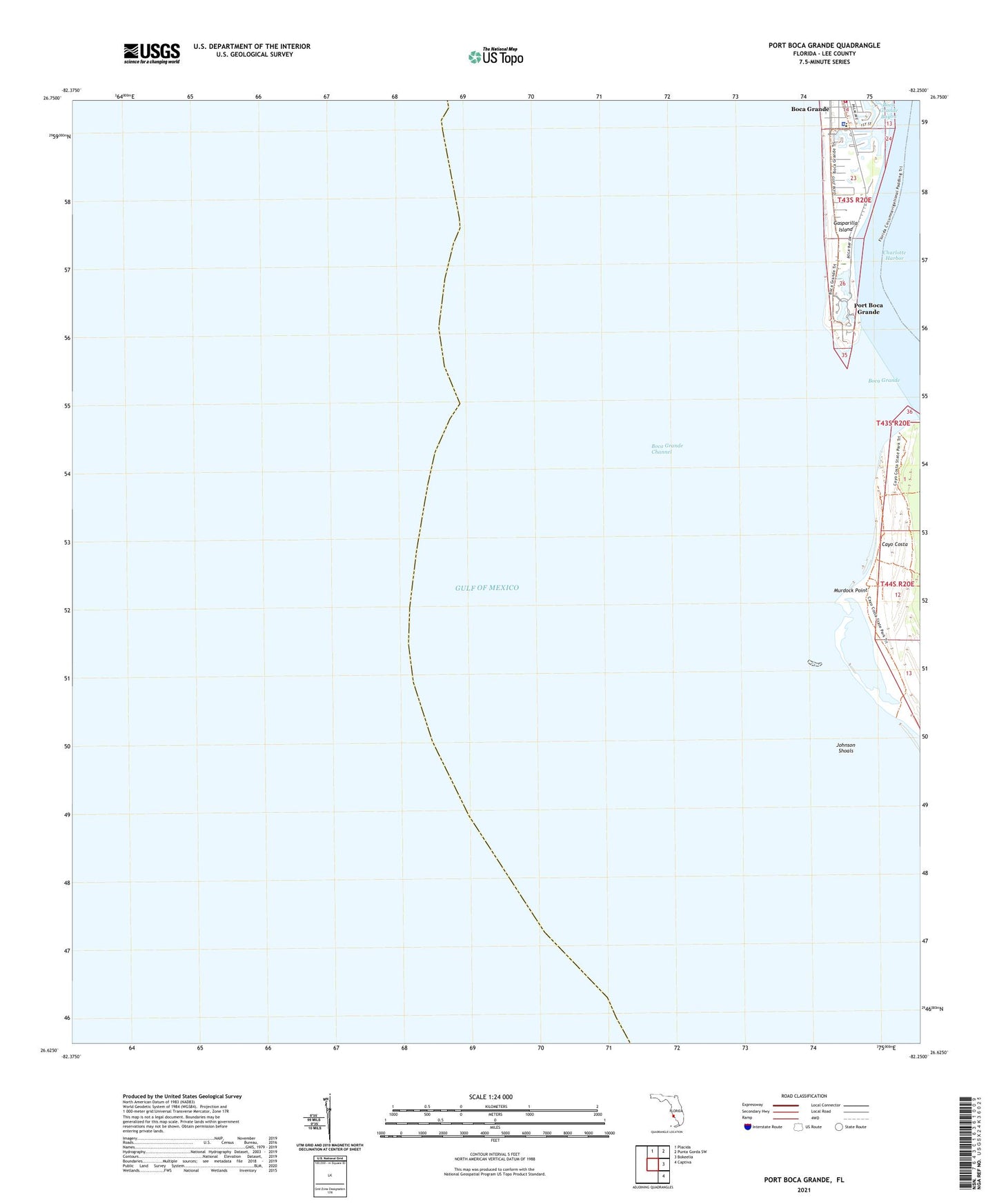
2025 topographic map quadrangle Port Boca Grande in the state of Florida. Scale: 1:24000. Based on the newly updated USGS 7.5' US Topo map series, this map is in the following counties: Lee. The map contains contour data, water features, and other items you are used to seeing on USGS maps, but also has updated roads and other features. This is the next generation of topographic maps. Printed on high-quality waterproof paper with UV fade-resistant inks.
Quads adjacent to this one:
North: Placida
Northeast: Punta Gorda SW
East: Bokeelia
Southeast: Captiva
This map covers the same area as the classic USGS quad with code o26082f3.
Contains the following named places: Boca Grande, Boca Grande Channel, Boca Grande Division, Boca Grande Fire Department, Boca Grande Helistop, Boca Grande Light, Gasparilla Island State Park, Johnson Shoals, LaCosta Test Pile South Light, Lee County Emergency Medical Services, Lee County Sheriff's Office Boca Grande, Murdock Point, Port Boca Grande, Port Boca Grande Light