MyTopo
Indiantown SE Florida US Topo Map
Couldn't load pickup availability
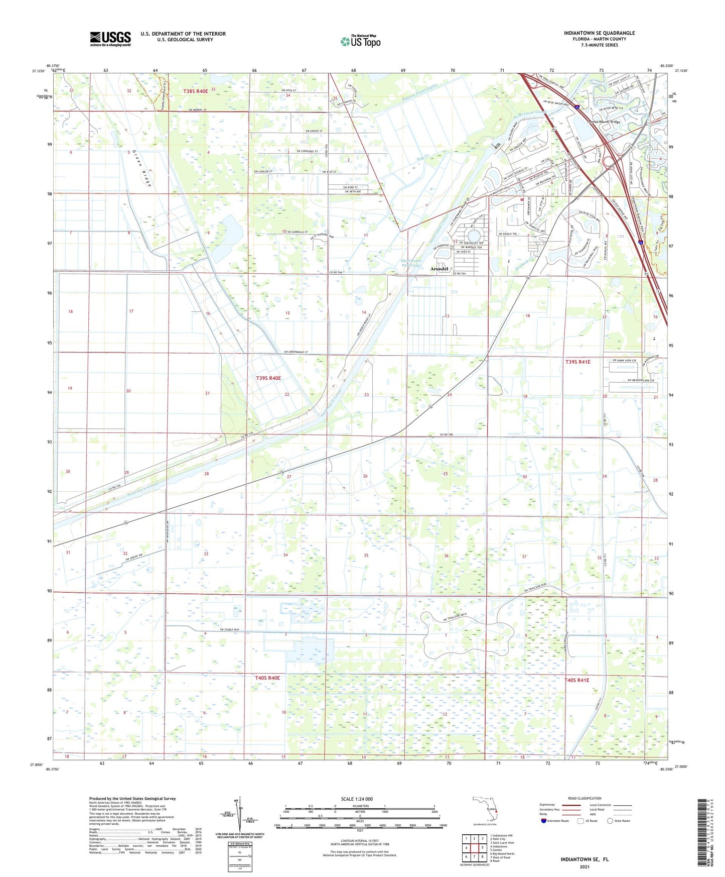
2024 topographic map quadrangle Indiantown SE in the state of Florida. Scale: 1:24000. Based on the newly updated USGS 7.5' US Topo map series, this map is in the following counties: Martin. The map contains contour data, water features, and other items you are used to seeing on USGS maps, but also has updated roads and other features. This is the next generation of topographic maps. Printed on high-quality waterproof paper with UV fade-resistant inks.
Quads adjacent to this one:
West: Indiantown
Northwest: Indiantown NW
North: Palm City
Northeast: Saint Lucie Inlet
East: Gomez
Southeast: Rood
South: West of Rood
Southwest: Big Mound North
This map covers the same area as the classic USGS quad with code o27080a3.
Contains the following named places: Ackel Mobile Home Estates, Arundel, Calvary Baptist Church, Christian Victory Center, Hanson Grant Outlet, Hog Creek, Martin County Fire Rescue Station 22, Queens Park, Roebuck Creek, Saint Lucie Lock and Dam, South Fork High School, Stuart Yacht Marina, The Vines Golf and Country Club, Thomas Mauvel Bridge, Towering Pines Mobile Home Park, Tropical Farms Baptist Church, Tropical Park, Tropical Plantation Airport, ZIP Code: 34997