
MyTopo
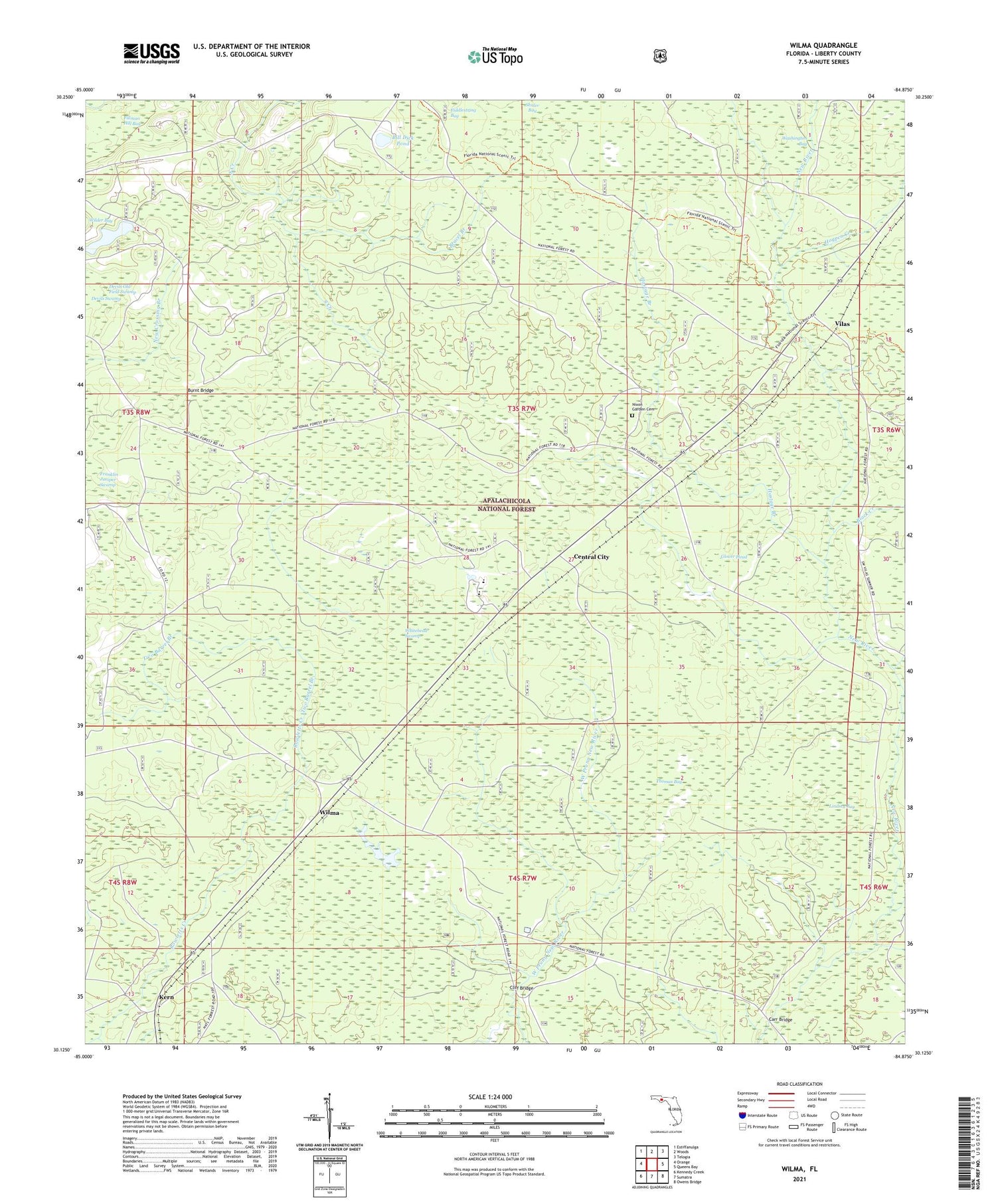
Wilma Florida US Topo Map
Couldn't load pickup availability
Also explore the Wilma Forest Service Topo of this same quad for updated USFS data
2024 topographic map quadrangle Wilma in the state of Florida. Scale: 1:24000. Based on the newly updated USGS 7.5' US Topo map series, this map is in the following counties: Liberty. The map contains contour data, water features, and other items you are used to seeing on USGS maps, but also has updated roads and other features. This is the next generation of topographic maps. Printed on high-quality waterproof paper with UV fade-resistant inks.
Quads adjacent to this one:
West: Orange
Northwest: Estiffanulga
North: Woods
Northeast: Telogia
East: Queens Bay
Southeast: Owens Bridge
South: Sumatra
Southwest: Kennedy Creek
This map covers the same area as the classic USGS quad with code o30084b8.
Contains the following named places: Bay Creek, Bill Dick Pond, Black Creek, Bracel Branch, Brushy Crossing, Burnt Bridge, Carr Bridge, Central City, Cliff Bridge, Devils Old Field Swamp, Fillman Hill Bay, Franklin Pond, Glover Head, Hogpen Creek, Hostage Branch, Jensen Place, Kern, Liberty County, Lindsey Bay, Nixon Garden Cemetery, Ranger Station, Rock Pond, Thomas Bay, Two Barrel Branch, Vilas, Whitehead Swamp, Wilma, Wilma Fire Tower, Wilma Work Center


