MyTopo
Upper Matecumbe Key Florida US Topo Map
Couldn't load pickup availability
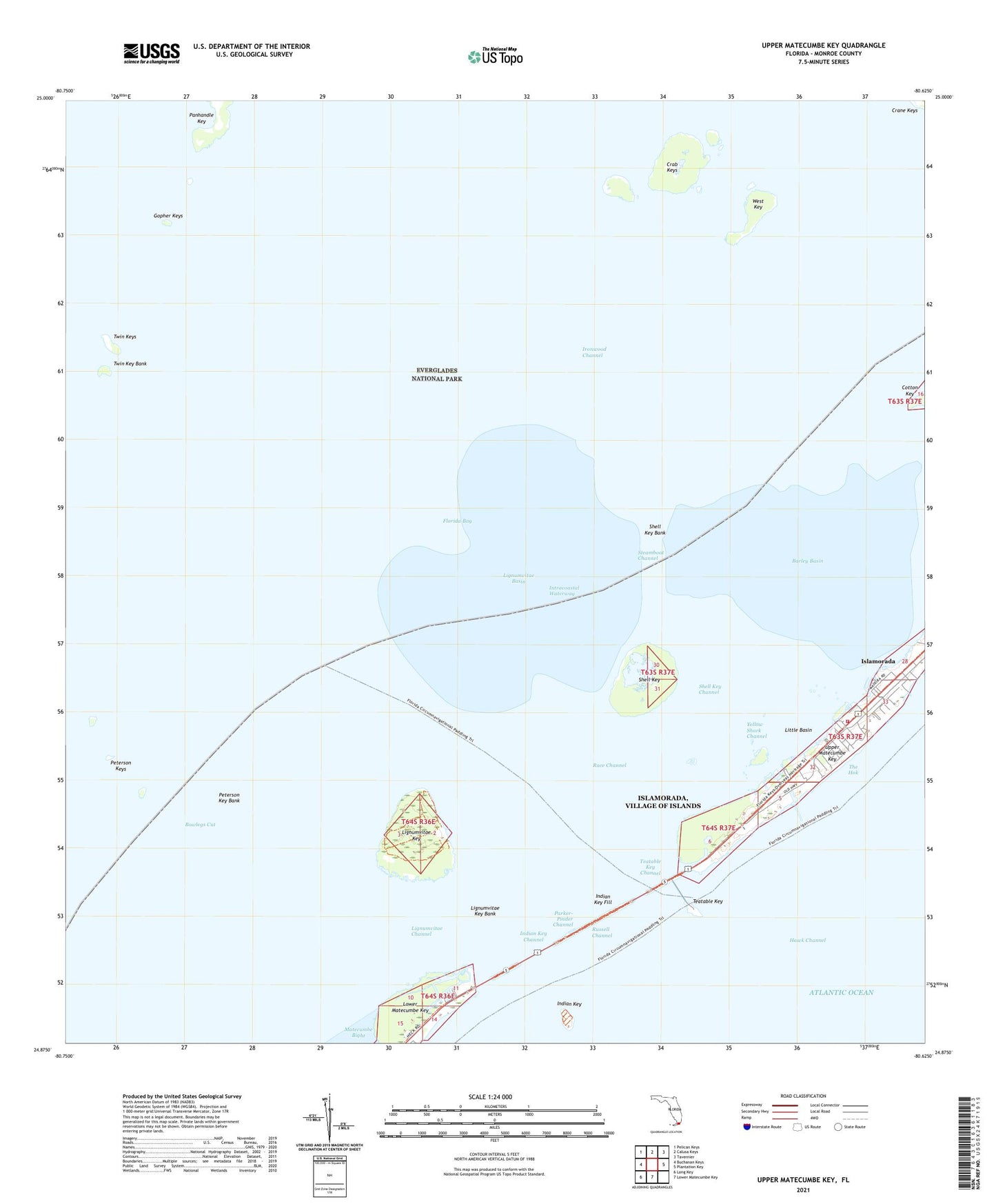
2024 topographic map quadrangle Upper Matecumbe Key in the state of Florida. Scale: 1:24000. Based on the newly updated USGS 7.5' US Topo map series, this map is in the following counties: Monroe. The map contains contour data, water features, and other items you are used to seeing on USGS maps, but also has updated roads and other features. This is the next generation of topographic maps. Printed on high-quality waterproof paper with UV fade-resistant inks.
Quads adjacent to this one:
West: Buchanan Keys
Northwest: Pelican Keys
North: Calusa Keys
Northeast: Tavernier
East: Plantation Key
South: Lower Matecumbe Key
Southwest: Long Key
This map covers the same area as the classic USGS quad with code o24080h6.
Contains the following named places: Barley Basin, Bowlegs Cut, Crab Keys, First Baptist Church, Gopher Keys, Indian Key, Indian Key Channel, Indian Key Fill, Indian Key Historic State Park, Ironwood Channel, Islamorada, Islamorada Fire Rescue Department Station 20, Lignumvitae Basin, Lignumvitae Channel, Lignumvitae Key, Lignumvitae Key Aquatic Preserve, Lignumvitae Key Bank, Lignumvitae Key Botanical State Park, Little Basin, Matecumbe, Panhandle Key, Parker-Pinder Channel, Peterson Key Bank, Peterson Keys, Race Channel, Russell Channel, Saint James the Fisherman Episcopal Church, Shell Key, Shell Key Bank, Shell Key Channel, Steamboat Channel, Teatable Key, Teatable Key Channel, Teatable Key Relief Channel, The Hok, Twin Keys, Upper Matecumbe Key, Village Mobile Park, West Key, Yellow Shark Channel, ZIP Code: 33036