
MyTopo
Wetappo Creek Florida US Topo Map
Couldn't load pickup availability
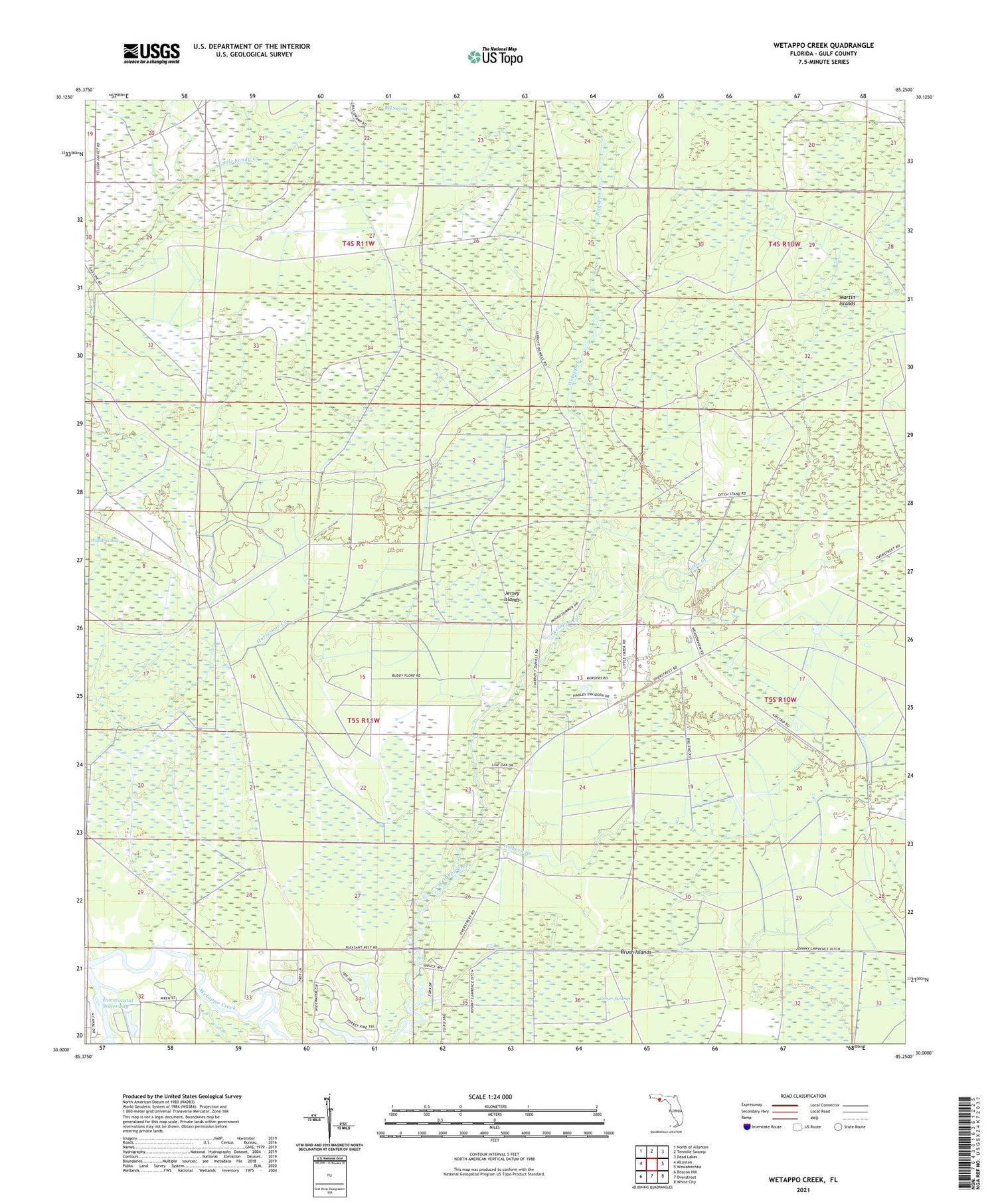
2024 topographic map quadrangle Wetappo Creek in the state of Florida. Scale: 1:24000. Based on the newly updated USGS 7.5' US Topo map series, this map is in the following counties: Gulf. The map contains contour data, water features, and other items you are used to seeing on USGS maps, but also has updated roads and other features. This is the next generation of topographic maps. Printed on high-quality waterproof paper with UV fade-resistant inks.
Quads adjacent to this one:
West: Allanton
Northwest: North of Allanton
North: Tenmile Swamp
Northeast: Dead Lakes
East: Wewahitchka
Southeast: White City
South: Overstreet
Southwest: Beacon Hill
This map covers the same area as the classic USGS quad with code o30085a3.
Contains the following named places: Britt Branch, Brush Islands, Early, Fico Farms Airport, Jersey Islands, Little Creek, Majette, Martin Islands, Sandy Branch, WEBZ-FM (Mexico Beach), Wetappo Side Camp, Wewahitchka Division, Wilburn Branch


