MyTopo
Alma NE Georgia US Topo Map
Couldn't load pickup availability
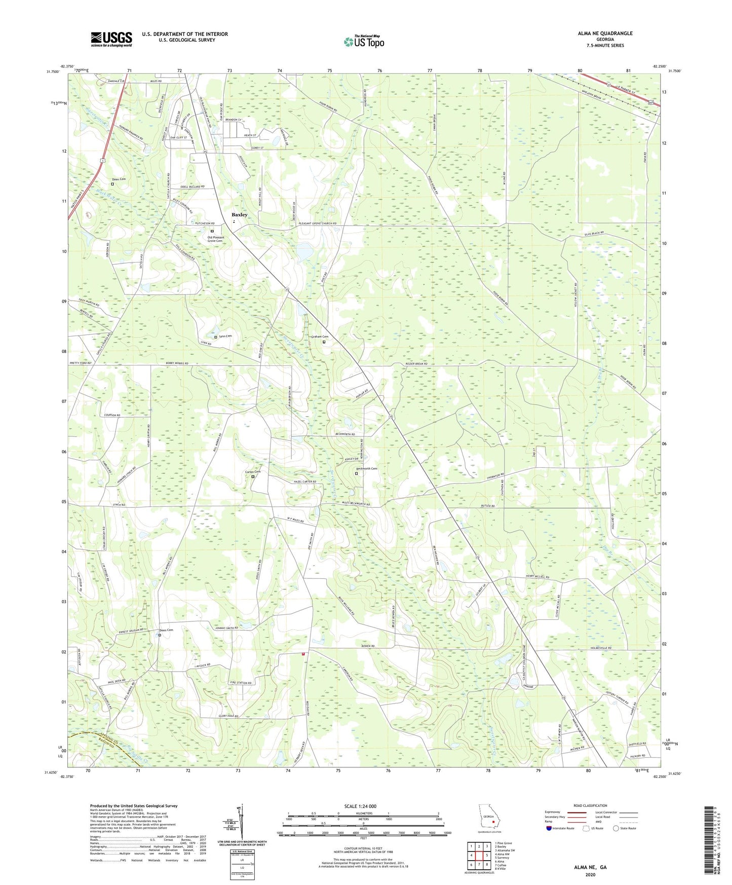
2024 topographic map quadrangle Alma NE in the state of Georgia. Scale: 1:24000. Based on the newly updated USGS 7.5' US Topo map series, this map is in the following counties: Appling, Bacon. The map contains contour data, water features, and other items you are used to seeing on USGS maps, but also has updated roads and other features. This is the next generation of topographic maps. Printed on high-quality waterproof paper with UV fade-resistant inks.
Quads adjacent to this one:
West: Alma NW
Northwest: Pine Grove
North: Baxley
Northeast: Altamaha SW
East: Surrency
South: Coffee
Southwest: Alma
This map covers the same area as the classic USGS quad with code o31082f3.
Contains the following named places: Appling County, Beckworth Cemetery, Black Water Creek, Carter Cemetery, Cook Chapel, Deen Cemetery, Graham Cemetery, Holmesville, Hopewell School, Hopewell United Methodist Church, Lynn Cemetery, Mount Vernon Baptist Church, Odum Childrens Home, Old Pleasant Grove Cemetery, Pine Forest, Pine View Baptist Church, Pleasant Grove Missionary Baptist Church, Red Oak Baptist Church, Red Oak Volunteer Fire Department, Revival Worship Center, Satilla Missionary Baptist Church