MyTopo
Altamaha SW Georgia US Topo Map
Couldn't load pickup availability
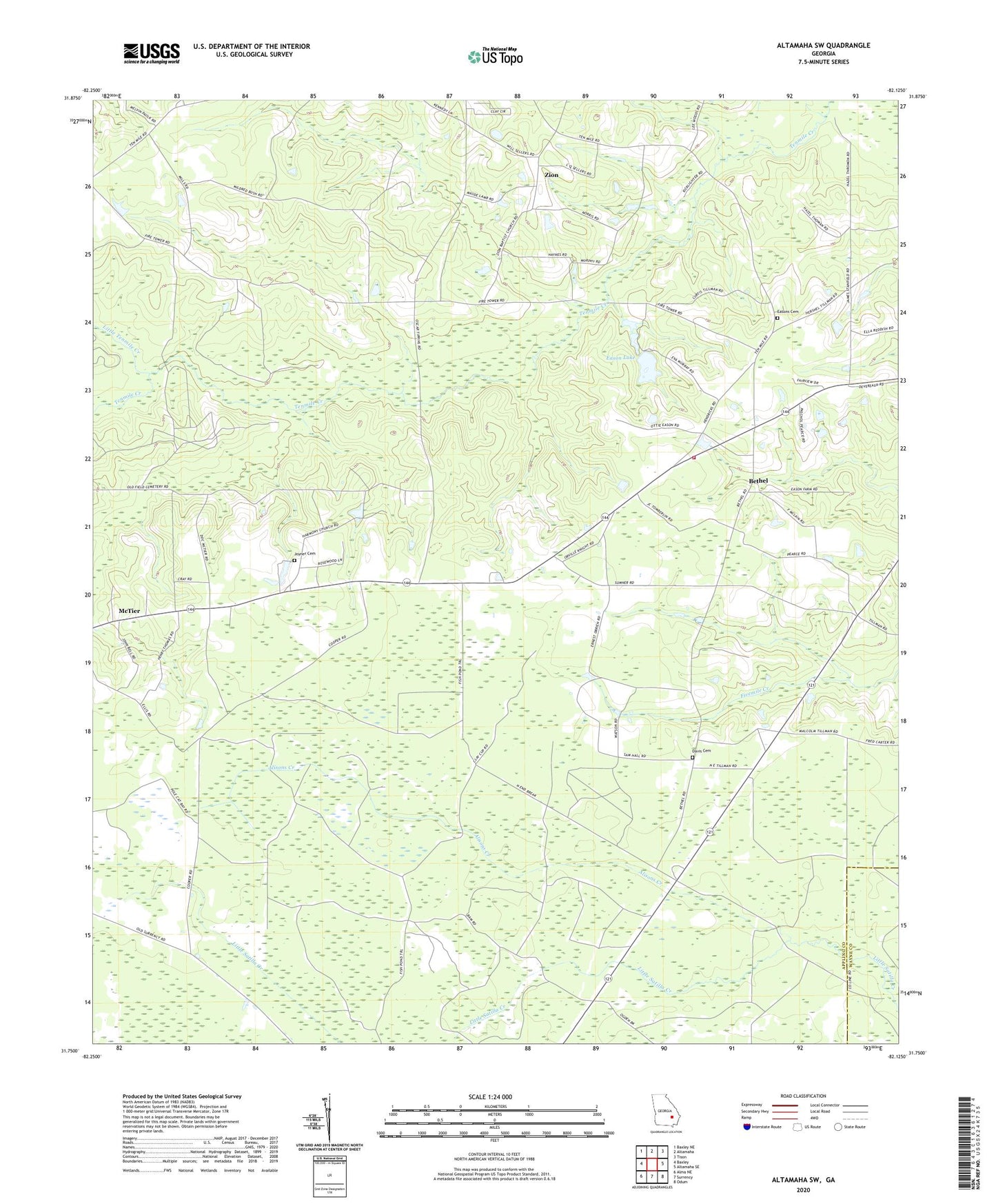
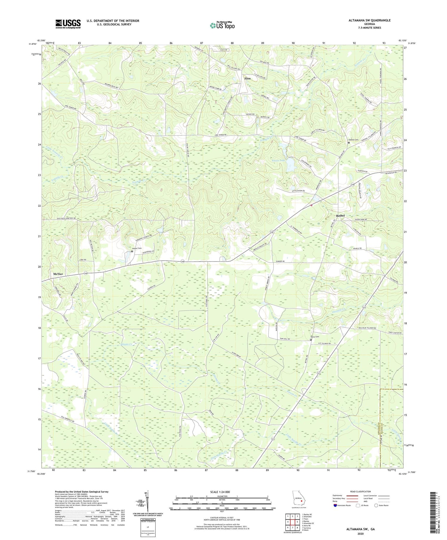
2024 topographic map quadrangle Altamaha SW in the state of Georgia. Scale: 1:24000. Based on the newly updated USGS 7.5' US Topo map series, this map is in the following counties: Appling, Wayne. The map contains contour data, water features, and other items you are used to seeing on USGS maps, but also has updated roads and other features. This is the next generation of topographic maps. Printed on high-quality waterproof paper with UV fade-resistant inks.
Quads adjacent to this one:
West: Baxley
Northwest: Baxley NE
North: Altamaha
Northeast: Tison
East: Altamaha SE
Southeast: Odum
South: Surrency
Southwest: Alma NE
This map covers the same area as the classic USGS quad with code o31082g2.
Contains the following named places: Alisons Creek, Appling County Fire Department Highway 144 Station, Bethel, Bethel United Methodist Church, Davis Cemetery, Eason Lake, Eason Lake Dam, Easons Cemetery, Harmony Missionary Baptist Church, Joyner Cemetery, Little Tenmile Creek, McTier, McTier Church, Oak Grove Church of God, Oak Grove Freewill Baptist Church, Rachel Baptist Church, Tenmile Lookout Tower, Zion, Zion Missionary Baptist Church, ZIP Code: 31563