MyTopo
Alma NW Georgia US Topo Map
Couldn't load pickup availability
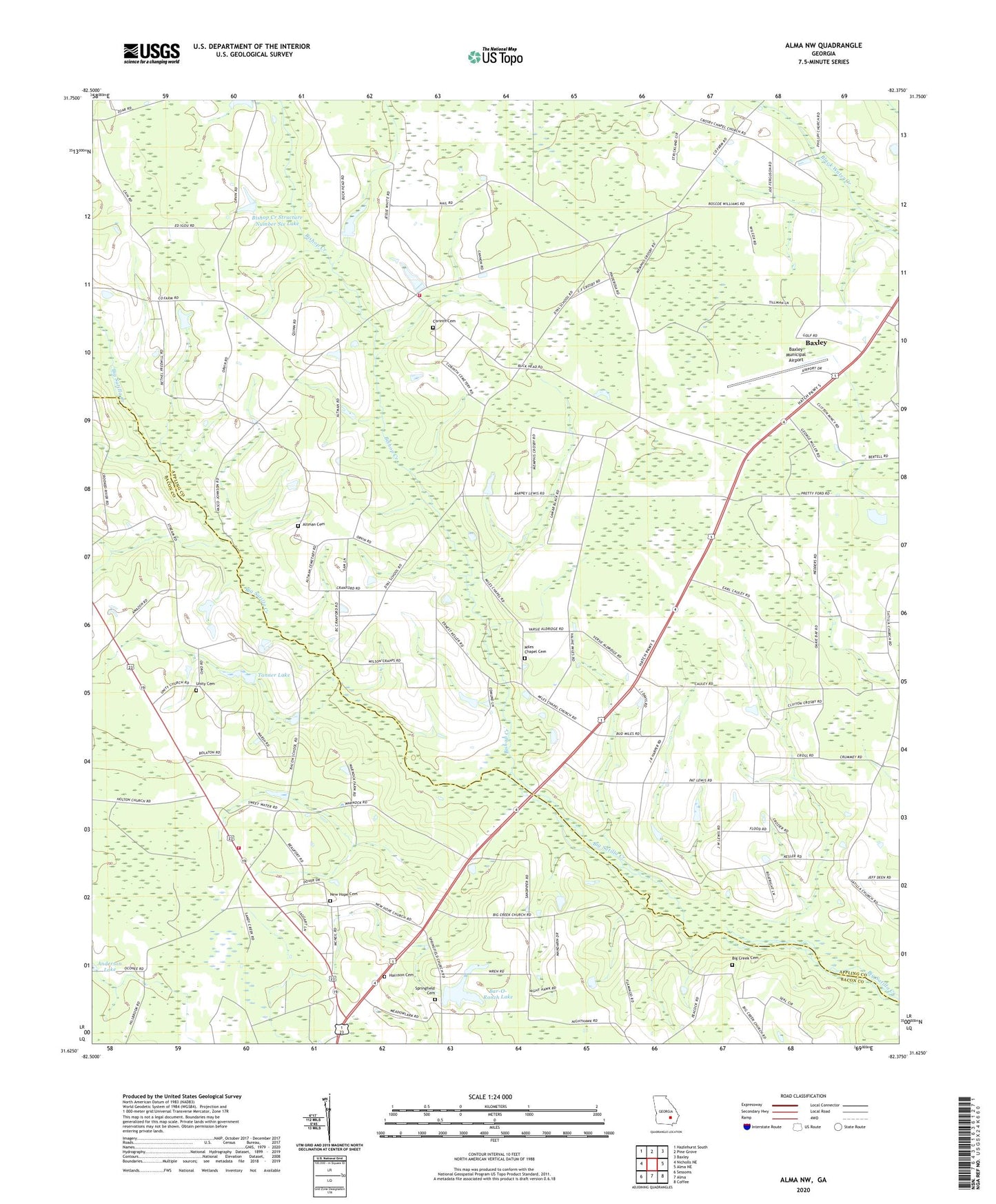
2024 topographic map quadrangle Alma NW in the state of Georgia. Scale: 1:24000. Based on the newly updated USGS 7.5' US Topo map series, this map is in the following counties: Appling, Bacon. The map contains contour data, water features, and other items you are used to seeing on USGS maps, but also has updated roads and other features. This is the next generation of topographic maps. Printed on high-quality waterproof paper with UV fade-resistant inks.
Quads adjacent to this one:
West: Nicholls NE
Northwest: Hazlehurst South
North: Pine Grove
Northeast: Baxley
East: Alma NE
Southeast: Coffee
South: Alma
Southwest: Sessoms
This map covers the same area as the classic USGS quad with code o31082f4.
Contains the following named places: Altman Cemetery, Appling Country Club, Appling County Fire Department County Farm Station, Bar-O-Ranch Lake, Bar-O-Ranch Lake Dam, Baxley Municipal Airport, Bethel Free Will Baptist Church, Big Creek Cemetery, Big Creek Church, Big Satilla Creek Division, Bishop Creek, Bishop Creek Structure Number Six Dam, Bishop Creek Structure Number Six Lake, Corinth Cemetery, Corinth United Methodist Church, Crosby Chapel United Methodist Church, Dyal Elementary School, Harrison Cemetery, Midway Methodist Episcopal Church South, Miles Chapel Cemetery, Miles Chapel Missionary Baptist Church, Mount Olive Baptist Church, New Hope Cemetery, New Hope Church, Sand Hill Creek Freewill Baptist Church, Springfield Cemetery, Springfield Methodist Church, Tanner Lake, Tanner Lake Dam, Unity Cemetery, Unity Church, Warnock Volunteer Fire Station