MyTopo
Pennington Georgia US Topo Map
Couldn't load pickup availability
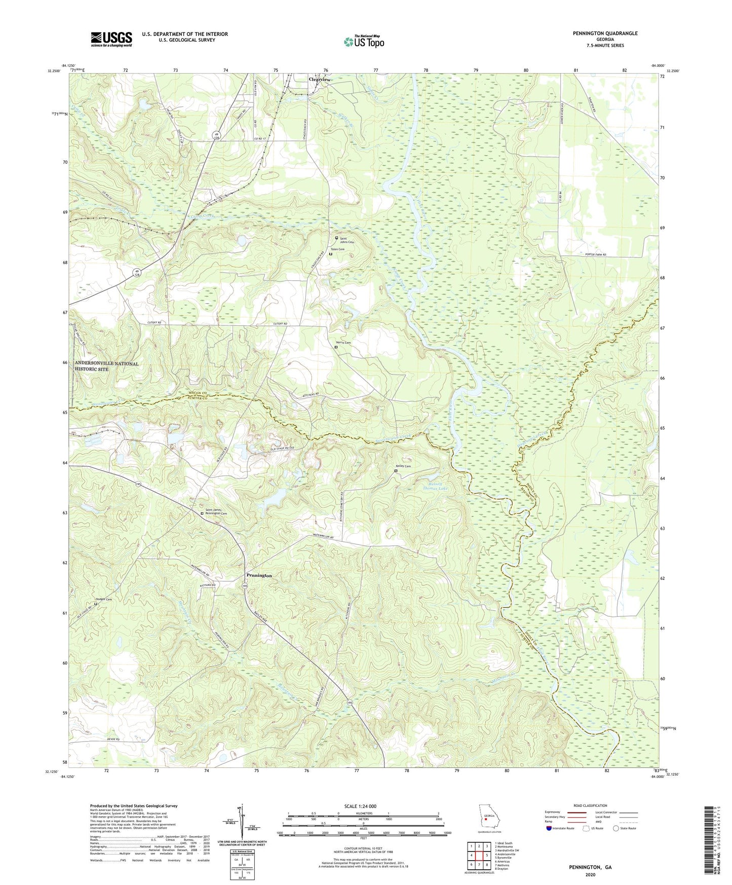
2024 topographic map quadrangle Pennington in the state of Georgia. Scale: 1:24000. Based on the newly updated USGS 7.5' US Topo map series, this map is in the following counties: Macon, Sumter, Dooly. The map contains contour data, water features, and other items you are used to seeing on USGS maps, but also has updated roads and other features. This is the next generation of topographic maps. Printed on high-quality waterproof paper with UV fade-resistant inks.
Quads adjacent to this one:
West: Andersonville
Northwest: Ideal South
North: Montezuma
Northeast: Marshallville SW
East: Byromville
Southeast: Drayton
South: Methvins
Southwest: Americus
This map covers the same area as the classic USGS quad with code o32084b1.
Contains the following named places: Boggy Branch, Camp Creek, Chamblis Mill, Clearview, Goose Creek, Hodges Cemetery, Hogcrawl Creek, Kelley Cemetery, Mount Springs Church, Mountain Creek, Mountain Creek Church, Norris Cemetery, Pennington, Pennyton School, Prison Branch, Russell Thomas Lake, Russell Thomas Lake Dam, Saint James - Pennington Cemetery, Saint Johns Cemetery, Saint Johns Church, Sweetwater Creek, Tolen Cemetery, Triple Creek, Walker Branch, Zion Temple