MyTopo
Penia Georgia US Topo Map
Couldn't load pickup availability
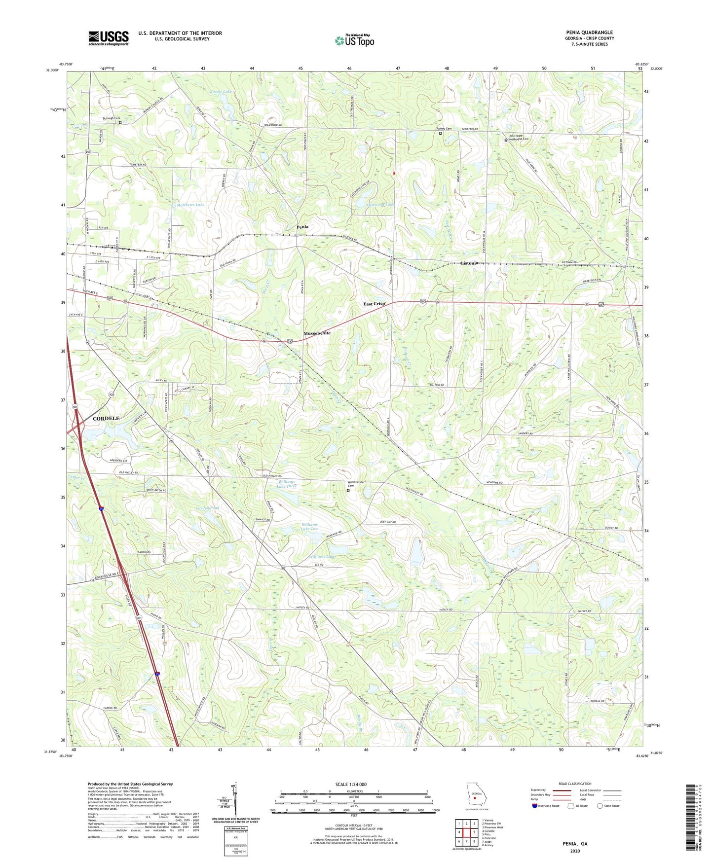
2024 topographic map quadrangle Penia in the state of Georgia. Scale: 1:24000. Based on the newly updated USGS 7.5' US Topo map series, this map is in the following counties: Crisp. The map contains contour data, water features, and other items you are used to seeing on USGS maps, but also has updated roads and other features. This is the next generation of topographic maps. Printed on high-quality waterproof paper with UV fade-resistant inks.
Quads adjacent to this one:
West: Cordele
Northwest: Vienna
North: Pineview SW
Northeast: Pineview West
East: Pitts
Southeast: Amboy
South: Arabi
Southwest: Pateville
This map covers the same area as the classic USGS quad with code o31083h6.
Contains the following named places: Benefield Lake Dam, Carden Pond, Carden Pond Dam, Crane Lake, Crane Lake Dam, Crisp County Fire Department Station 02, Dorough Cemetery, East Crisp, Eastwood Lake, Eastwood Lake Dam, Emmous Church, Listonia, Matthews Lake, Matthews Lake Dam, McKenzie, Midway Church, Midway School, Morningside Church, Mount Carmel Church, Mount Carmel School, Musselwhite, Musselwhite Cemetery, New Hope Church, Oak Grove Church, Penia, Penia Church, Pleasant Grove Church, Providence School, Rainey Cemetery, Redoak Creek, Wells Lake Dam, Wilford Community Church, Williams Lake, Williams Lake Dam One, Williams Lake Dam Three, Williams Lake Dam Two, Williams Lake Three, Williams Lake Two, Williford, Williford School, Zion Hope Church, Zion Hope Methodist Cemetery