MyTopo
Pateville Georgia US Topo Map
Couldn't load pickup availability
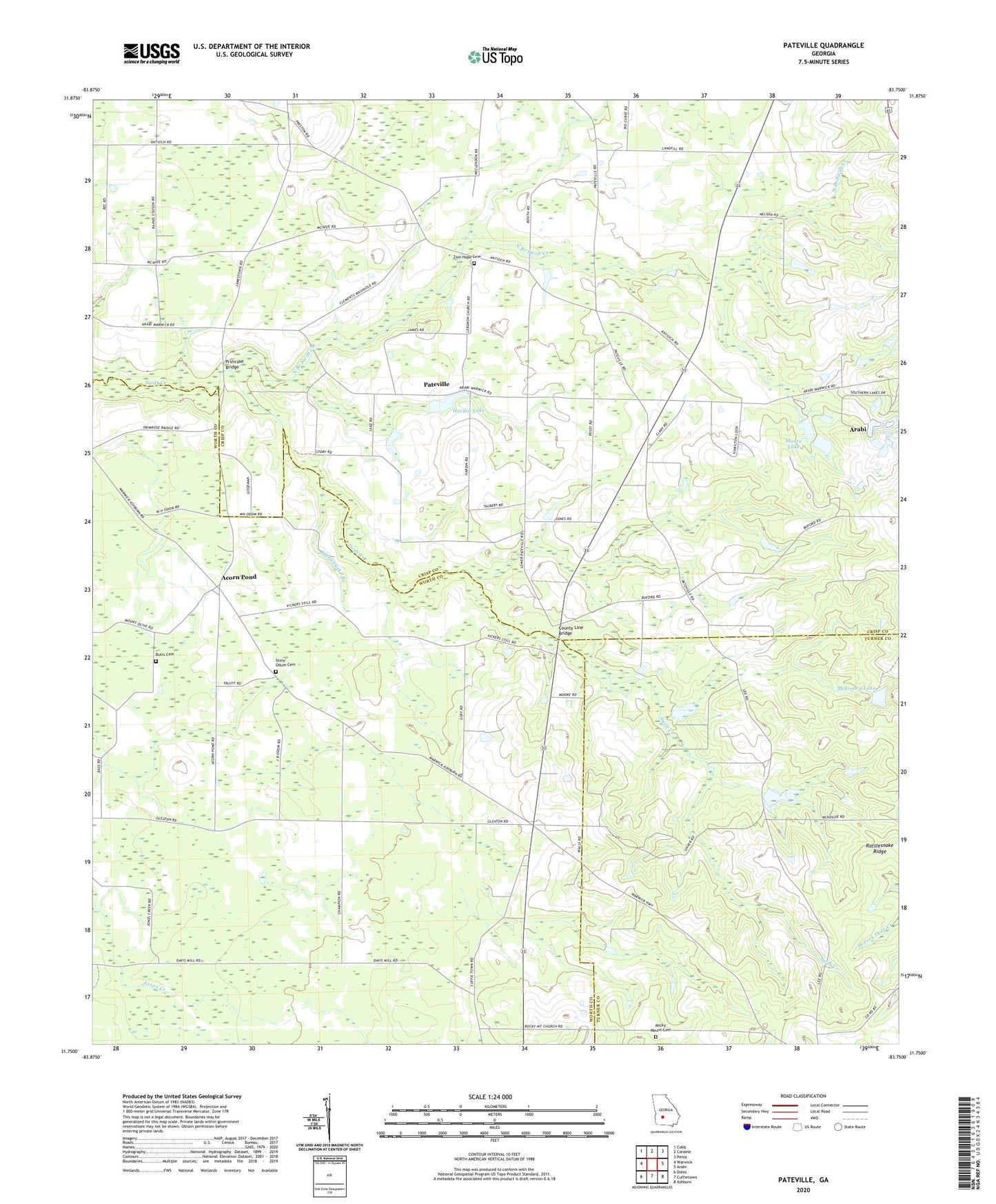
2024 topographic map quadrangle Pateville in the state of Georgia. Scale: 1:24000. Based on the newly updated USGS 7.5' US Topo map series, this map is in the following counties: Crisp, Worth, Turner. The map contains contour data, water features, and other items you are used to seeing on USGS maps, but also has updated roads and other features. This is the next generation of topographic maps. Printed on high-quality waterproof paper with UV fade-resistant inks.
Quads adjacent to this one:
West: Warwick
Northwest: Cobb
North: Cordele
Northeast: Penia
East: Arabi
Southeast: Ashburn
South: Cuffietown
Southwest: Doles
This map covers the same area as the classic USGS quad with code o31083g7.
Contains the following named places: Acorn Pond, Acorn Pond Missionary Baptist Church, Antioch Missionary Baptist Church, Bridges, Bridges School, Bryant Store, Butts Cemetery, Cabb Chapel, County Line Bridge, Davis Chapel, Hardin, Hardin Lake, Hardin Lake Dam, Hopewell School, Houston Youth Camp, Lebanon Church, Mckinney Lake, Mckinney Lake Dam, Moore Lake, Moore Lake Dam, Mount Olive Church, Mount Olive School, New Hope School, North Branch Swift Creek, Pateville, Pateville Community Center, Primrose Bridge, Primrose Church, Rattlesnake Branch, Rocky Mount Cemetery, Rocky Mount Church, Saint James Church, Saint James School, Story-Odum Cemetery, Vickers School, White Store, Zion Hope Cemetery, ZIP Code: 31796