MyTopo
Baxley NE Georgia US Topo Map
Couldn't load pickup availability
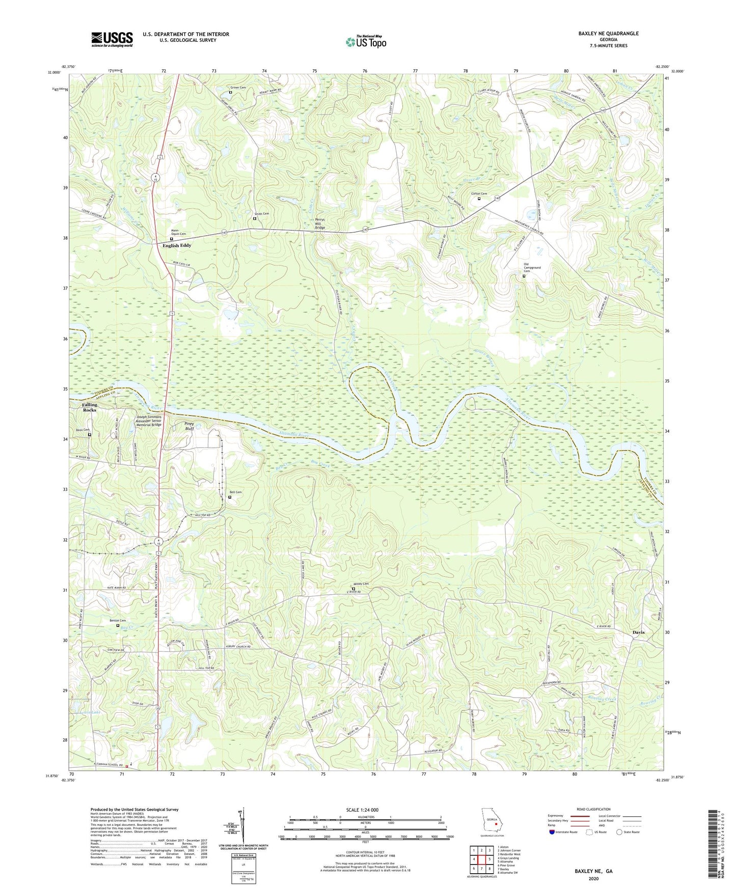
2024 topographic map quadrangle Baxley NE in the state of Georgia. Scale: 1:24000. Based on the newly updated USGS 7.5' US Topo map series, this map is in the following counties: Toombs, Appling. The map contains contour data, water features, and other items you are used to seeing on USGS maps, but also has updated roads and other features. This is the next generation of topographic maps. Printed on high-quality waterproof paper with UV fade-resistant inks.
Quads adjacent to this one:
West: Grays Landing
Northwest: Alston
North: Johnson Corner
Northeast: Reidsville West
East: Altamaha
Southeast: Altamaha SW
South: Baxley
Southwest: Pine Grove
This map covers the same area as the classic USGS quad with code o31082h3.
Contains the following named places: Altamaha Elementary School, Altamaha River Division, Appling County Fire Department Altamaha Station, Asbury United Methodist Church, Bay Creek, Bell Cemetery, Benton Cemetery, Calvary Missionary Baptist Church, Church of God and Christ, Clifton Cemetery, Cobb Creek, Corbetts Chapel, Davis, Deen Cemetery, Deens Landing, English Eddy, English Eddy Church, Falling Rocks, Georgia Power Plant Hatch, Grace Branch, Griner Cemetery, Hatch Nuclear Power Plant, Inman Creek, Joseph Simmons Alexander Senior Memorial Bridge, Lewis Lake, Lewis Lake Dam, Mann - Oquin Cemetery, Marvey Church, Marvin Yancey School, Meltons Chapel United Methodist Church, Mizpah Baptist Church, Moody Cemetery, Oak Grove Church, Old Campground Cemetery, Perrys Mill Bridge, Piney Bluff, Piney Bluff Ferry, Providence Church, Riverside Missionary Baptist Church, Rocky Creek Church, Sharpes Landing, Smith Cemetery, Taylor Chapel, Williams Creek