MyTopo
Grays Landing Georgia US Topo Map
Couldn't load pickup availability
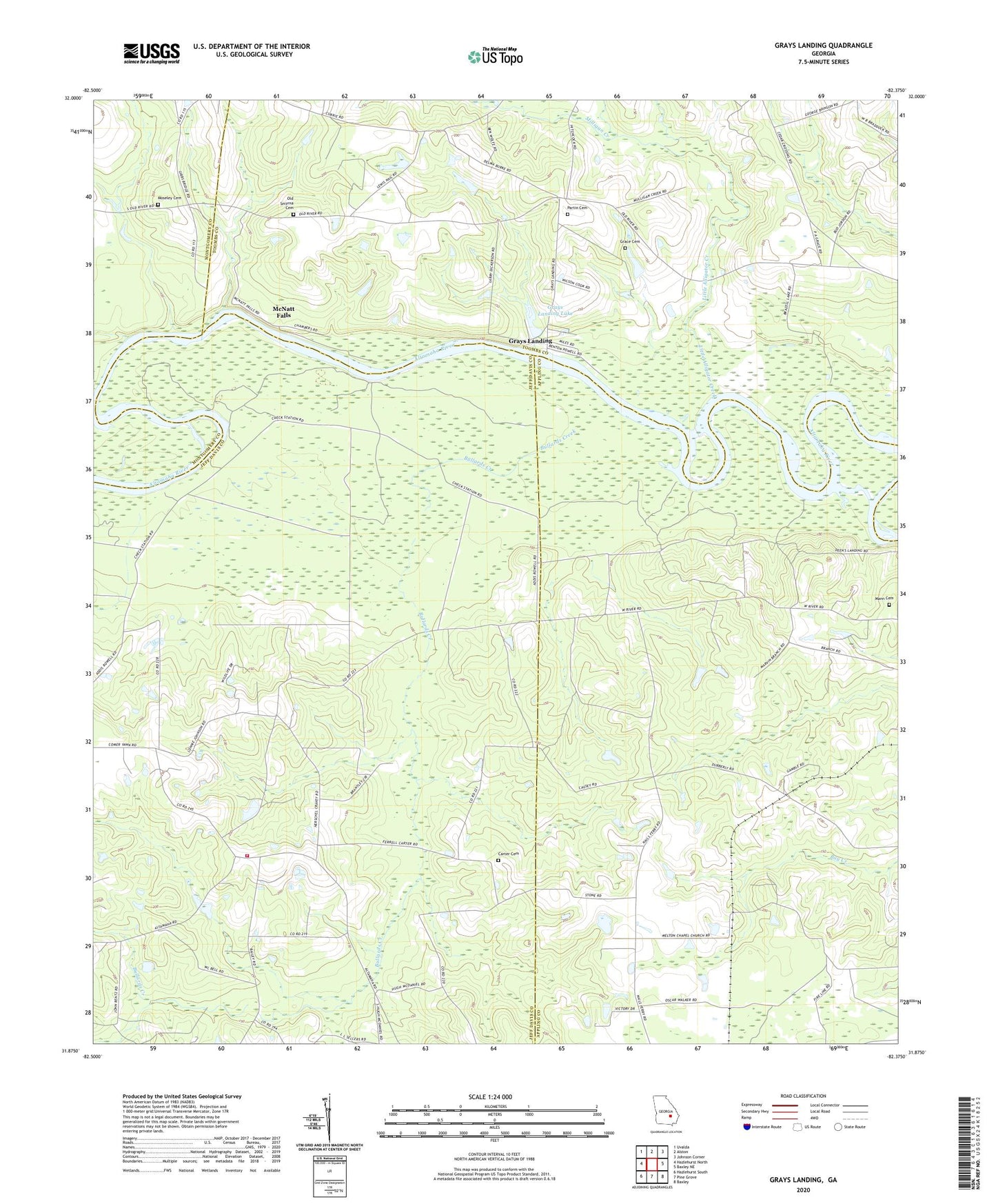
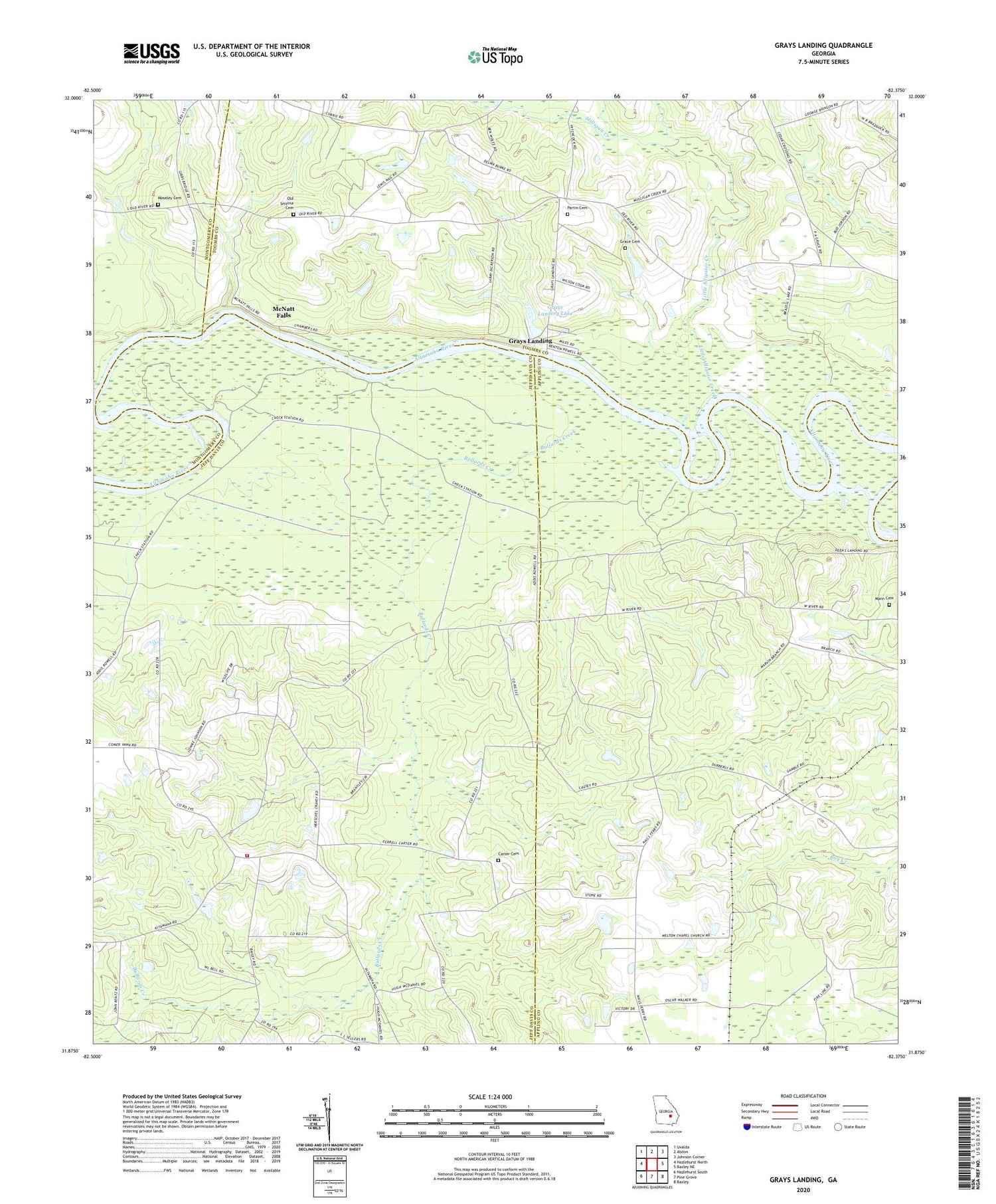
2024 topographic map quadrangle Grays Landing in the state of Georgia. Scale: 1:24000. Based on the newly updated USGS 7.5' US Topo map series, this map is in the following counties: Jeff Davis, Appling, Toombs, Montgomery. The map contains contour data, water features, and other items you are used to seeing on USGS maps, but also has updated roads and other features. This is the next generation of topographic maps. Printed on high-quality waterproof paper with UV fade-resistant inks.
Quads adjacent to this one:
West: Hazlehurst North
Northwest: Uvalda
North: Alston
Northeast: Johnson Corner
East: Baxley NE
Southeast: Baxley
South: Pine Grove
Southwest: Hazlehurst South
This map covers the same area as the classic USGS quad with code o31082h4.
Contains the following named places: Altamaha Church, Bullard Creek Wildlife Management Area, Bullards Creek, Bullards Creek Lookout Tower, Carter Cemetery, Grace Cemetery, Grays Landing, Grays Landing Dam, Grays Landing Lake, Half Moon Landing, Halls Ferry Landing, Jeff Davis County Fire Department Station 3 Altamaha, Little Alligator Creek, Mann Cemetery, Manns Ferry, McNatt Falls, Milligan Creek, Moseley Cemetery, Oak Ridge Church, Old Smyrna Cemetery, Partin Cemetery, Red Bluff Landing, Smyrna Church, Union Grove School