MyTopo
Beaverdale Georgia US Topo Map
Couldn't load pickup availability
Also explore the Beaverdale Forest Service Topo of this same quad for updated USFS data
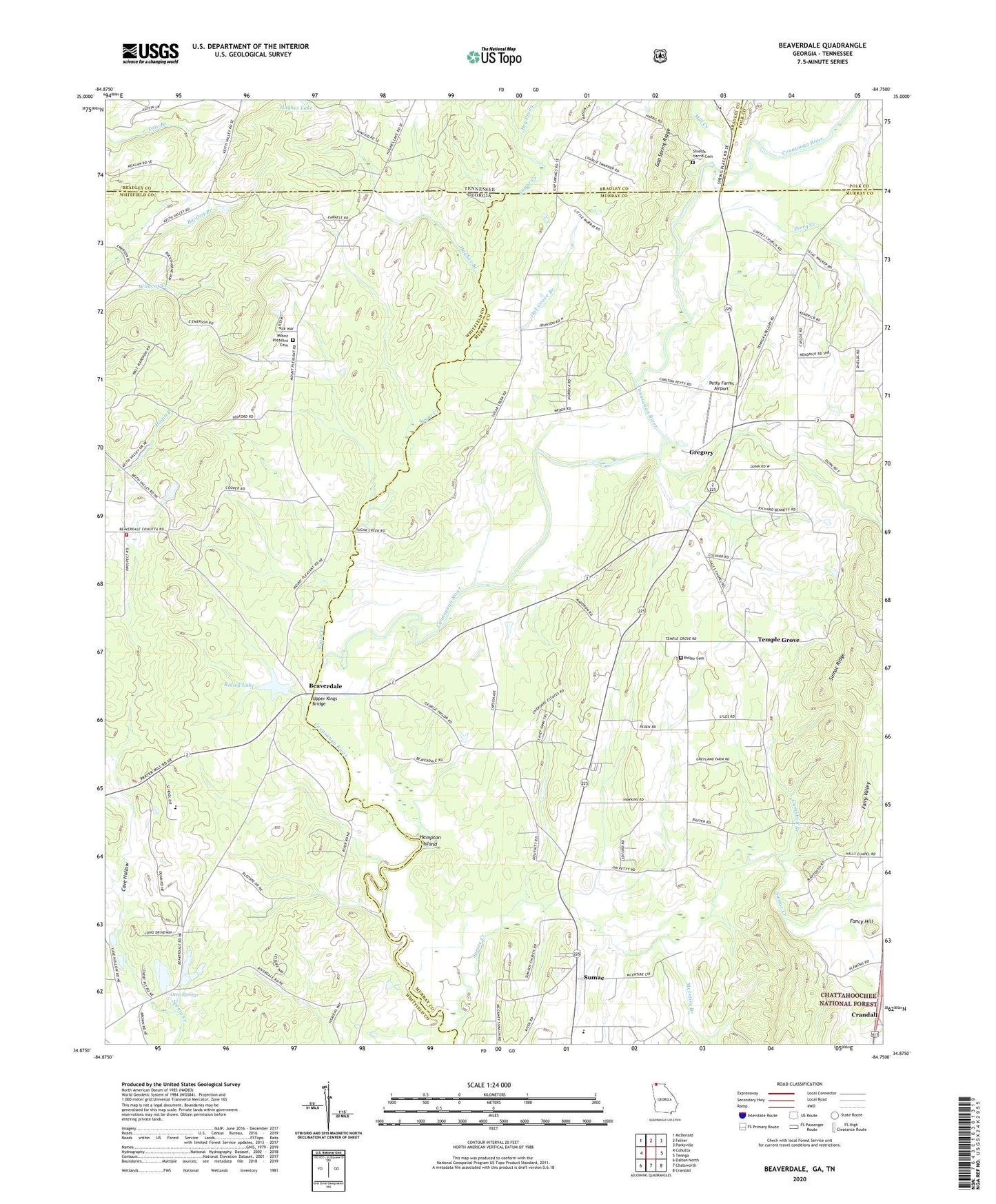
2024 topographic map quadrangle Beaverdale in the states of Georgia, Tennessee. Scale: 1:24000. Based on the newly updated USGS 7.5' US Topo map series, this map is in the following counties: Murray, Whitfield, Bradley, Polk. The map contains contour data, water features, and other items you are used to seeing on USGS maps, but also has updated roads and other features. This is the next generation of topographic maps. Printed on high-quality waterproof paper with UV fade-resistant inks.
Quads adjacent to this one:
West: Cohutta
Northwest: McDonald
North: Felker
Northeast: Parksville
East: Tennga
Southeast: Crandall
South: Chatsworth
Southwest: Dalton North
Contains the following named places: Beaverdale, Beaverdale Elementary School, Beaverdale School, Blue Bird Field, Calvary Church, Campbell Branch, Cave Hollow, Colvard School, Conasauga Church, Dalton Childrens Home, Deep Spring School, Deep Springs, Deep Springs Church, Dry Prong, Dunn Store, Fancy Hill, Fraziers Chapel, Gap Spring Ridge, Gregory, Gregorys Mill, Halls Chapel School, Hampton Island, Holiness Church, Hughes Branch, Hughes Lake, Liberty Bell Church, McIntire Branch, Mill Creek, Mount Pleasant Cemetery, Mount Pleasant Church, Mount Pleasant School, Murray County Fire Department Station 4, North Mount Pleasant Church, Northwest Elementary School, Oak Grove Branch, Oak Grove Church, Oak Grove School, Perry Creek, Petty Farms Airport, Prospect Church, Ridley Cemetery, Ridley Lake, Ridley Lake Dam, Ruralvale, Shields - Harris Cemetery, Sugar Creek, Sumac, Sumac Creek, Sumach-cumberland Church, Temple Grove, Upper Kings Bridge, Whitfield County Fire Department Station 10, Worthy Lake, Worthy Lake Dam