
MyTopo
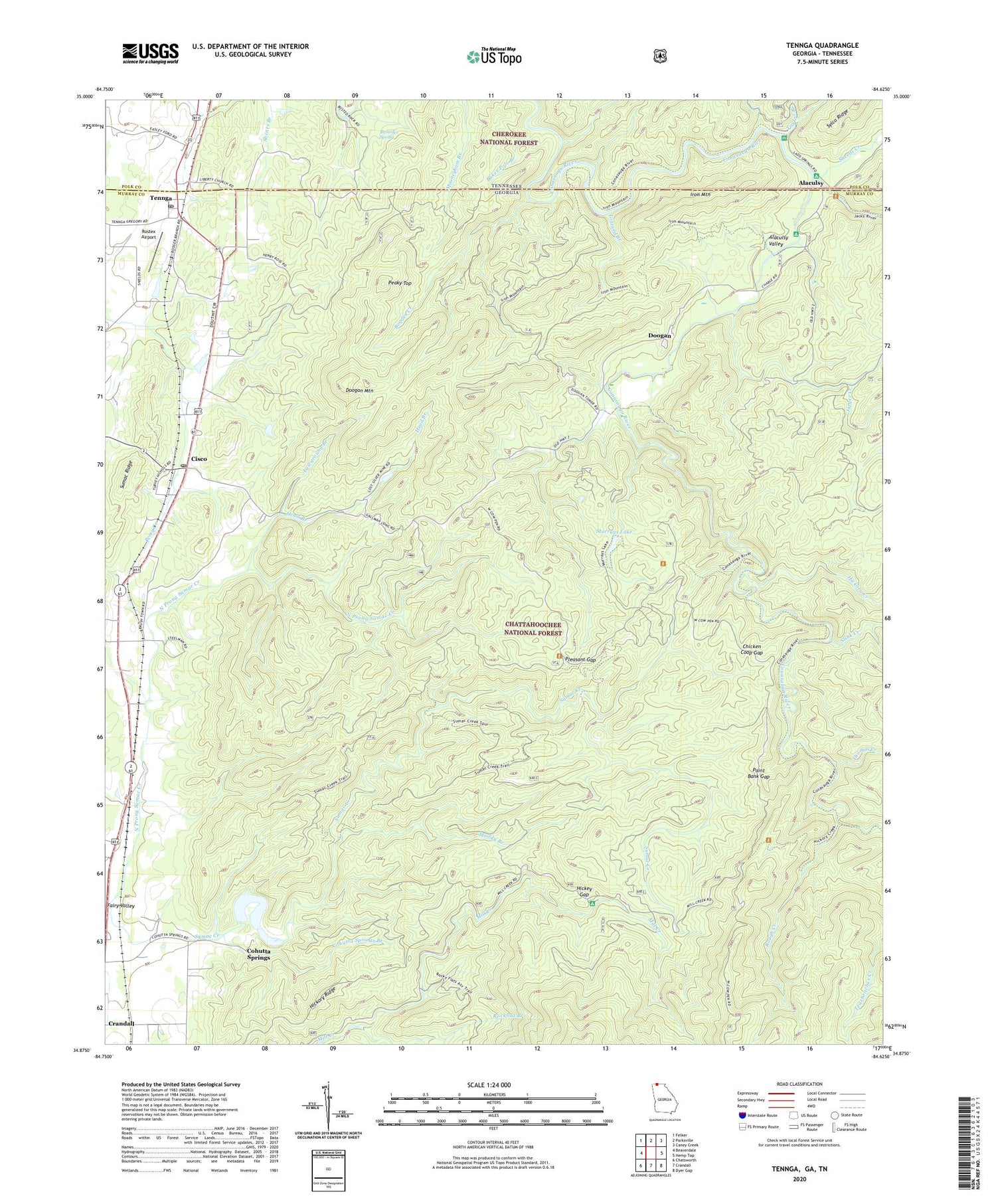
Tennga Georgia US Topo Map
Couldn't load pickup availability
Also explore the Tennga Forest Service Topo of this same quad for updated USFS data
2024 topographic map quadrangle Tennga in the states of Georgia, Tennessee. Scale: 1:24000. Based on the newly updated USGS 7.5' US Topo map series, this map is in the following counties: Murray, Polk. The map contains contour data, water features, and other items you are used to seeing on USGS maps, but also has updated roads and other features. This is the next generation of topographic maps. Printed on high-quality waterproof paper with UV fade-resistant inks.
Quads adjacent to this one:
West: Beaverdale
Northwest: Felker
North: Parksville
Northeast: Caney Creek
East: Hemp Top
Southeast: Dyer Gap
South: Crandall
Southwest: Chatsworth
Contains the following named places: Alaculsa, Alaculsy, Alaculsy Valley, Baker Pole Branch, Bogden Creek, Browder Spring, Chicken Coop Gap, Cisco, Cisco Baptist Church, Cisco Division, Cisco Post Office, Cloer Trail, Coffey Lake, Cohutta Springs, Cohutta Springs Branch, Conasauga River Trail, Doogan, Doogan Mountain, Fairy, Fairy Valley, Fairy Valley Church, Gizzard Branch, Graham Branch, Gryder Camp, Gryder Camp Trail, Halfway Branch, Head Branch, Hickey Gap, Hickory Creek, Hickory Ridge, Hopewell Church, Iron Mountain, Jacks River, Jigger Creek, Lawground Branch, Liberty Church, Mount Sumac Church, Muddy Branch, Murrays Lake, North Cohutta, North Prong Sumac Creek, Paint Bank Gap, Peaky Top, Pleasant Gap, Rockflat Branch, Rostex Airport, Rough Creek, Sheeds Creek, Stink Creek, Sumac Ridge, Summerour Church, Taylor Branch, Tennga, Tennga Post Office, Thomas Creek, ZIP Codes: 30708, 30711, 30751


