MyTopo
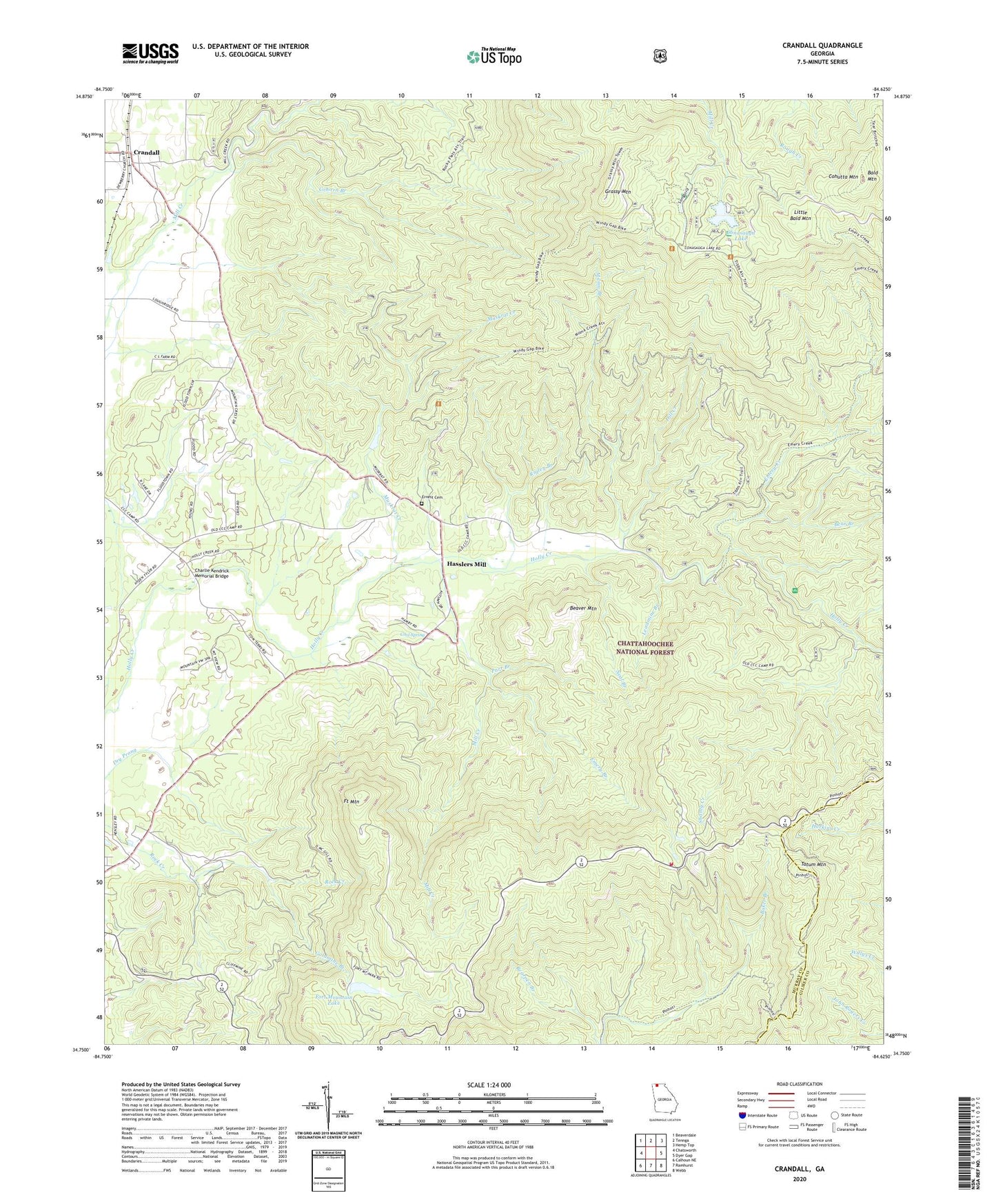
Crandall Georgia US Topo Map
Couldn't load pickup availability
Also explore the Crandall Forest Service Topo of this same quad for updated USFS data
2024 topographic map quadrangle Crandall in the state of Georgia. Scale: 1:24000. Based on the newly updated USGS 7.5' US Topo map series, this map is in the following counties: Murray, Gilmer. The map contains contour data, water features, and other items you are used to seeing on USGS maps, but also has updated roads and other features. This is the next generation of topographic maps. Printed on high-quality waterproof paper with UV fade-resistant inks.
Quads adjacent to this one:
West: Chatsworth
Northwest: Beaverdale
North: Tennga
Northeast: Hemp Top
East: Dyer Gap
Southeast: Webb
South: Ramhurst
Southwest: Calhoun NE
This map covers the same area as the classic USGS quad with code o34084g6.
Contains the following named places: Bald Mountain, Bear Branch, Beaver Mountain, Charlie Kendrick Memorial Bridge, Cohorn Branch, Cohutta Mine, Cohutta Mountain, Cohutta Overlook, Cohutta Work Center, Conasauga Lake, Conasauga Lake Dam, Cool Spring, Cool Spring Church, Cool Spring School, Crandall, Crandall-Eton Division, Dill Creek, Emery Branch, Emery Creek, Ernest Cemetery, Eton Chapel, Fort Mountain, Fort Mountain Lake, Fort Mountain Mine, Fort Mountain State Park, Full Gospel Church, Goldmine Branch, Grassy Mountain, Grassy Mountain Lookout, Grassy Mountain Tower Trail, Hasslers Mill, Lake Conasauga Campground, Leadmine Branch, Little Bald Mountain, McDaniel Lake, McDaniel Lake Dam, Mill Creek, Milma Branch, Murray County, Murray County Fire Department Station 6, Muskrat Creek, Neal Branch, Parr Branch, Rigley Branch, Shanty Creek, Songbird Trail, Southern Mine, Tatum Mountain, WCLP-TV (Chatsworth), WQMT-FM (Chatsworth)