MyTopo
Cravens Island Georgia US Topo Map
Couldn't load pickup availability
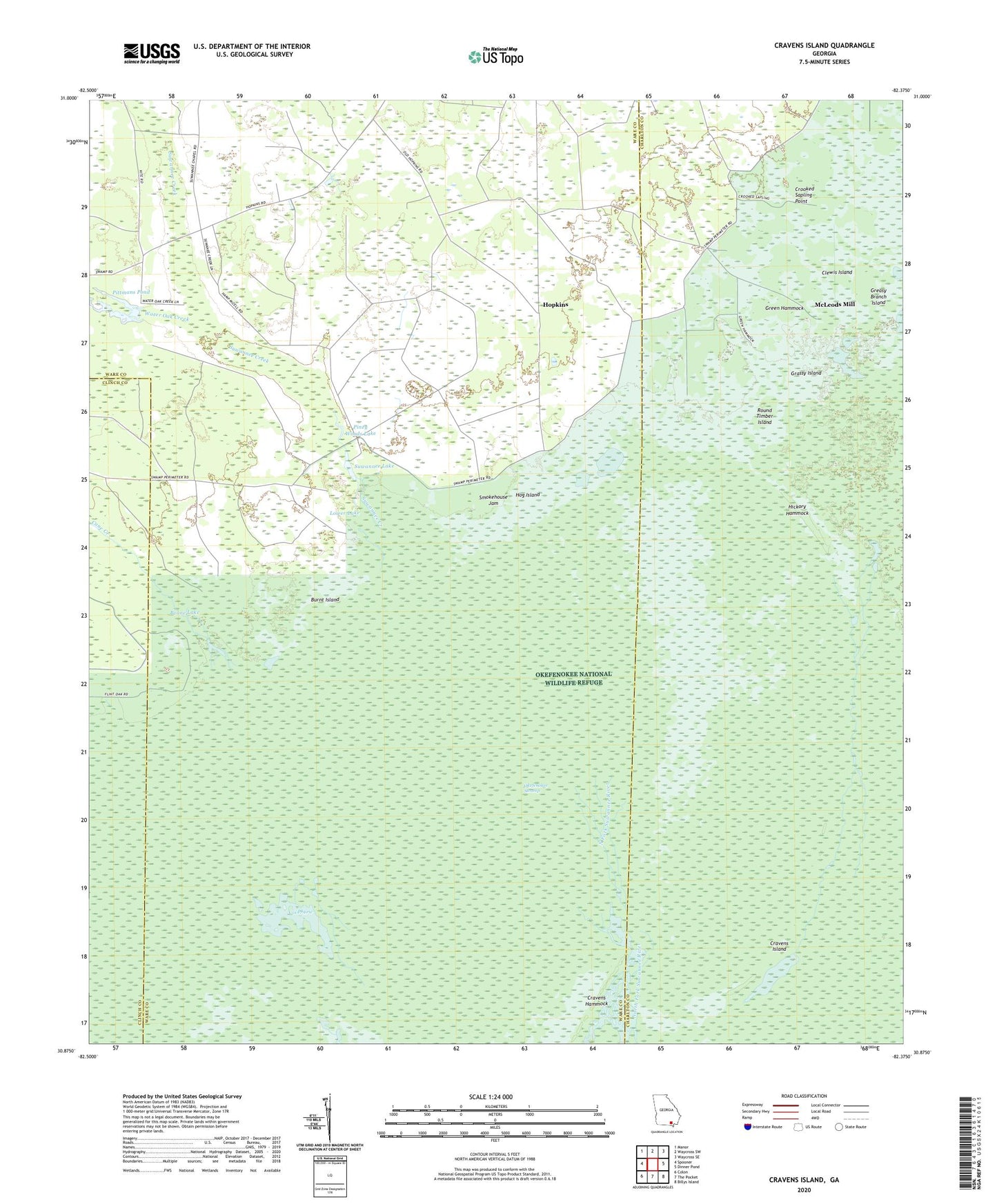
2024 topographic map quadrangle Cravens Island in the state of Georgia. Scale: 1:24000. Based on the newly updated USGS 7.5' US Topo map series, this map is in the following counties: Ware, Charlton, Clinch. The map contains contour data, water features, and other items you are used to seeing on USGS maps, but also has updated roads and other features. This is the next generation of topographic maps. Printed on high-quality waterproof paper with UV fade-resistant inks.
Quads adjacent to this one:
West: Spooner
Northwest: Manor
North: Waycross SW
Northeast: Waycross SE
East: Dinner Pond
Southeast: Billys Island
South: The Pocket
Southwest: Colon
This map covers the same area as the classic USGS quad with code o30082h4.
Contains the following named places: Boone Lake, Burnt Island, Cane Creek, Clewis Island, Cox Prairie, Cravens Island, Crooked Sapling Point, Grassy Island, Greasy Branch, Greasy Branch Island, Green Hammock, Hickory Hammock, Hog Island, Hopkins, Lower Lake, McLeods Mill, Piney Woods Lake, Pittmans Pond, Round Timber Island, Smokehouse Jam, Suwannee Creek, Suwannee Lake, Turkey Branch, Water Oak Creek