MyTopo
Milan Georgia US Topo Map
Couldn't load pickup availability
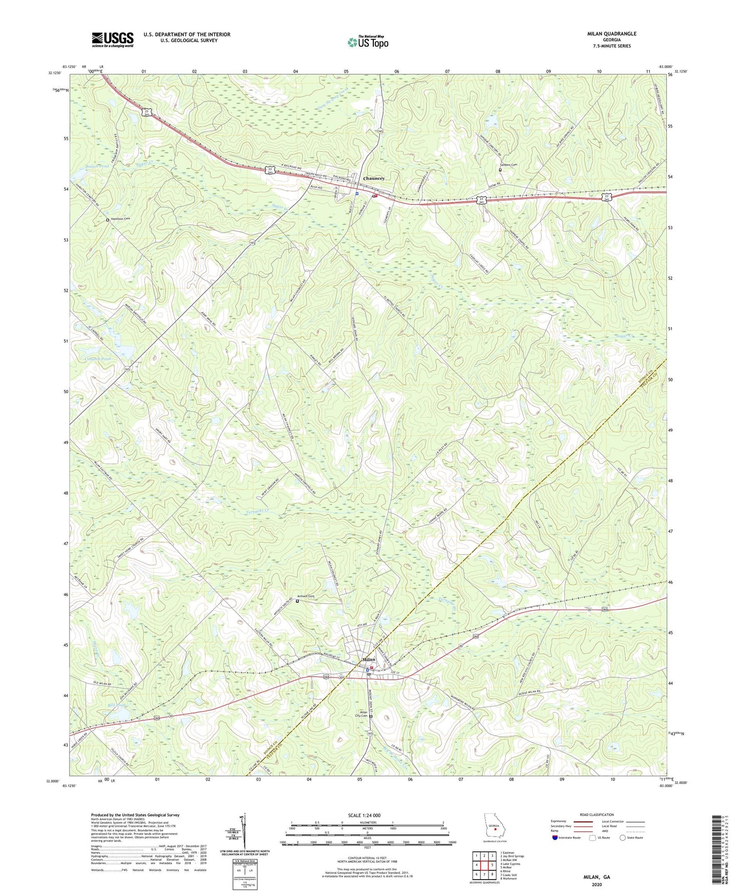
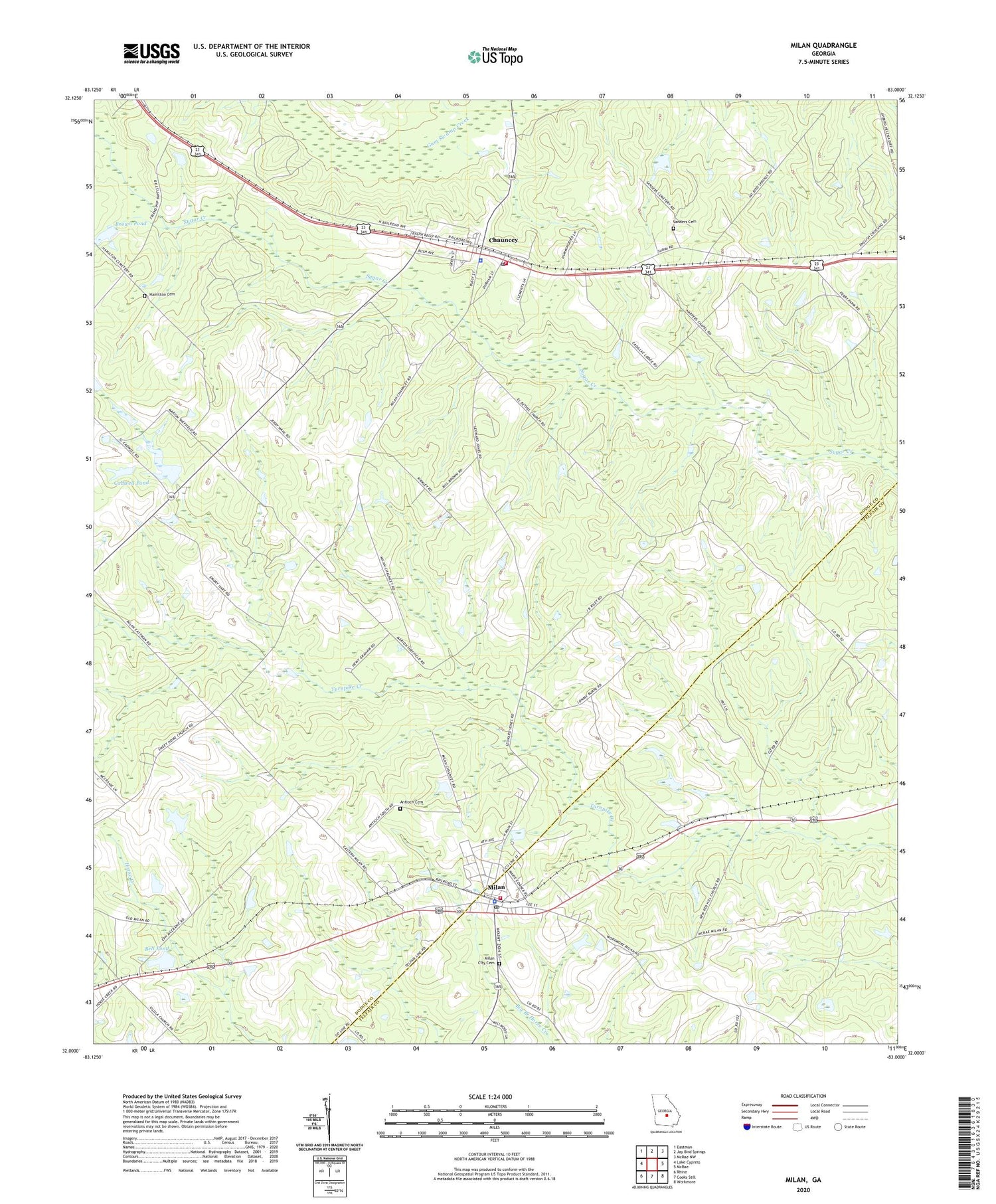
2024 topographic map quadrangle Milan in the state of Georgia. Scale: 1:24000. Based on the newly updated USGS 7.5' US Topo map series, this map is in the following counties: Dodge, Telfair. The map contains contour data, water features, and other items you are used to seeing on USGS maps, but also has updated roads and other features. This is the next generation of topographic maps. Printed on high-quality waterproof paper with UV fade-resistant inks.
Quads adjacent to this one:
West: Lake Cypress
Northwest: Eastman
North: Jay Bird Springs
Northeast: McRae NW
East: McRae
Southeast: Workmore
South: Cooks Still
Southwest: Rhine
This map covers the same area as the classic USGS quad with code o32083a1.
Contains the following named places: Antioch Cemetery, Antioch Number Two Church, Bell Pond, Bell Pond Dam, Brown Pond, Brown Pond Dam, Cadwell Pond, Cadwell Pond Dam, Cadwell Pond North, Cadwell Pond North Dam, Chauncey, Chauncey Baptist Church, Chauncey Division, Chauncey Elementary School, Chauncey Fire Department, Chauncey Police Department, Chauncey Post Office, City of Chauncey, City of Milan, Cox, El Bethel Church, Hamilton Cemetery, Harpers Chapel, McCranie, Milan, Milan Baptist Church, Milan City Cemetery, Milan Elementary School, Milan Police Department, Milan Post Office, Milan Volunteer Fire Department, New Red Hill Church, Pilgrims Home Church, Popular Spring Church, Providence Church, Sand Grove Church, Sanders Cemetery, Sugar Creek Church, Sweet Home Church, Zion Hope Church