
MyTopo
Sessoms Georgia US Topo Map
Couldn't load pickup availability
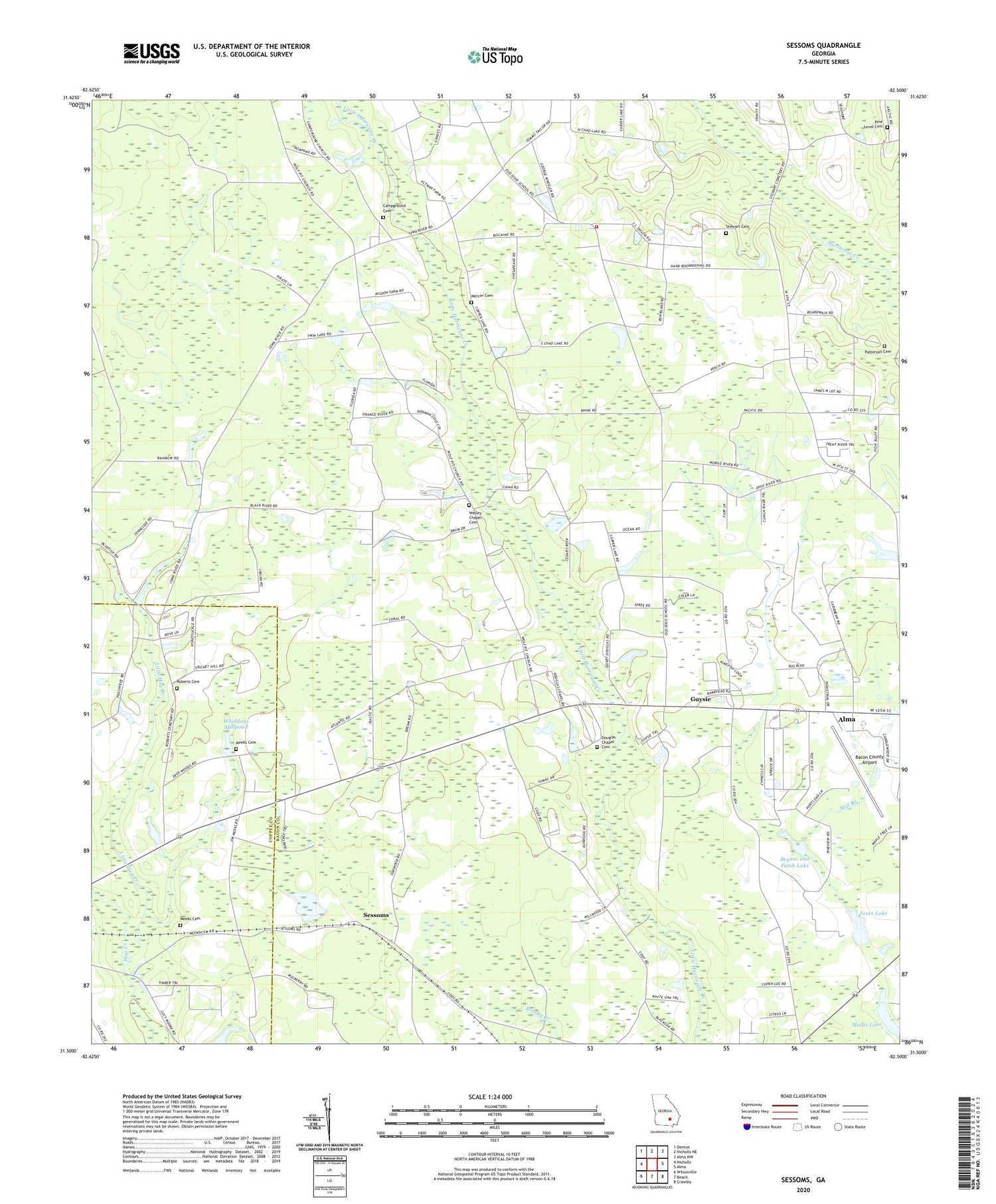
2024 topographic map quadrangle Sessoms in the state of Georgia. Scale: 1:24000. Based on the newly updated USGS 7.5' US Topo map series, this map is in the following counties: Bacon, Coffee. The map contains contour data, water features, and other items you are used to seeing on USGS maps, but also has updated roads and other features. This is the next generation of topographic maps. Printed on high-quality waterproof paper with UV fade-resistant inks.
Quads adjacent to this one:
West: Nicholls
Northwest: Denton
North: Nicholls NE
Northeast: Alma NW
East: Alma
Southeast: Crawley
South: Beach
Southwest: Wilsonville
This map covers the same area as the classic USGS quad with code o31082e5.
Contains the following named places: Alma Division, Bacon County Airport, Bryant and Futch Lake, Bryant and Futch Lake Dam, Campground Cemetery, Campground Church, Douglas Chapel, Douglas Chapel Cemetery, Elam Primitive Baptist Church, Guysie, Jones Lake, Jones Lake Dam, Little Hog Creek, Meeks Cemetery, Mercer Cemetery, Mount Pleasant Church, Mullis Lake, Patterson Cemetery, Pine Level Cemetery, Pine Level Church, Roberts Cemetery, Saint Raymonns Church, Sessoms, Stewart Cemetery, Taylor Town Volunteer Fire Station, Wesley Chapel, Wesley Chapel Cemetery, Whiddons Millpond Dam, WKXH-FM (Alma)


