MyTopo
Dinner Pond Georgia US Topo Map
Couldn't load pickup availability
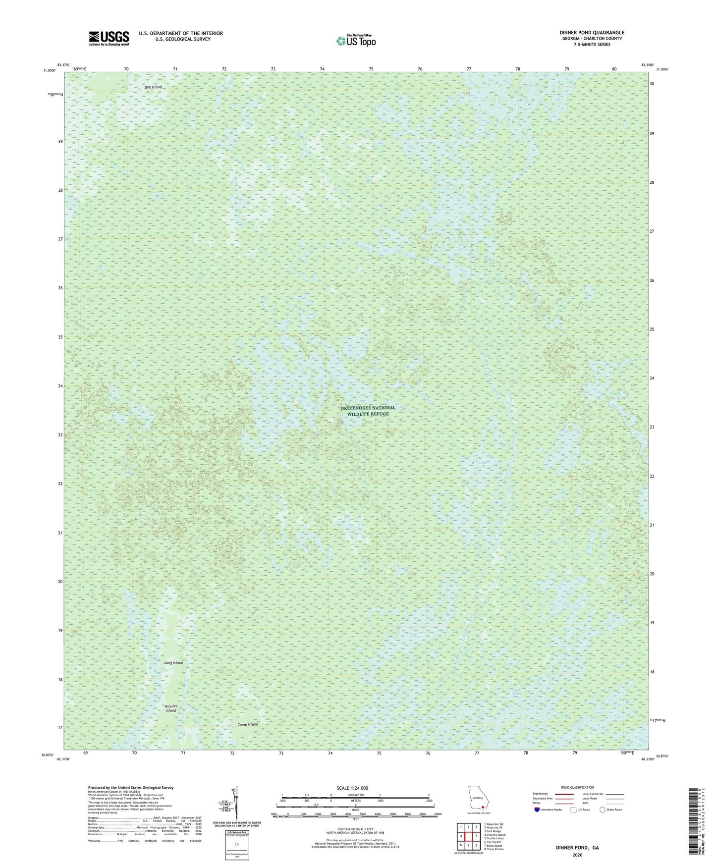
2024 topographic map quadrangle Dinner Pond in the state of Georgia. Scale: 1:24000. Based on the newly updated USGS 7.5' US Topo map series, this map is in the following counties: Charlton. The map contains contour data, water features, and other items you are used to seeing on USGS maps, but also has updated roads and other features. This is the next generation of topographic maps. Printed on high-quality waterproof paper with UV fade-resistant inks.
Quads adjacent to this one:
West: Cravens Island
Northwest: Waycross SW
North: Waycross SE
Northeast: Fort Mudge
East: Double Lakes
Southeast: Chase Prairie
South: Billys Island
Southwest: The Pocket
This map covers the same area as the classic USGS quad with code o30082h3.
Contains the following named places: Big Water Lake, Big Water Prairie, Bird Wing Run, Camp Island, Dinner Pond, Dog Island, Floyds Island Prairie, Long Island, Okefenokee Wilderness Canoe Trail