MyTopo
Doboy Sound Georgia US Topo Map
Couldn't load pickup availability
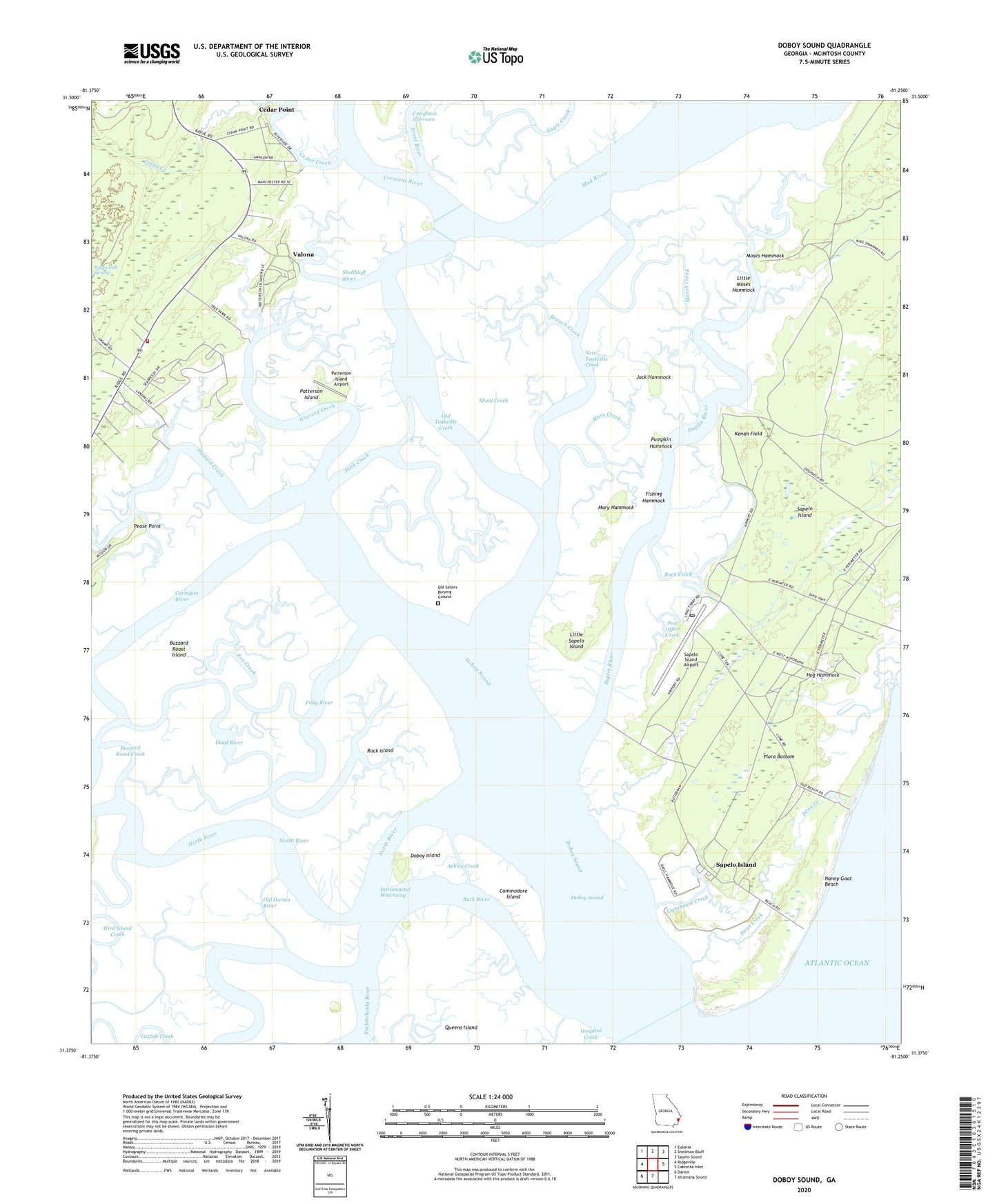
2024 topographic map quadrangle Doboy Sound in the state of Georgia. Scale: 1:24000. Based on the newly updated USGS 7.5' US Topo map series, this map is in the following counties: McIntosh. The map contains contour data, water features, and other items you are used to seeing on USGS maps, but also has updated roads and other features. This is the next generation of topographic maps. Printed on high-quality waterproof paper with UV fade-resistant inks.
Quads adjacent to this one:
West: Ridgeville
Northwest: Eulonia
North: Shellman Bluff
Northeast: Sapelo Sound
East: Cabretta Inlet
South: Altamaha Sound
Southwest: Darien
This map covers the same area as the classic USGS quad with code o31081d3.
Contains the following named places: Ashley Creek, Atwood Creek, Back River, Barn Creek, Branch Creek, Buzzard Roost Creek, Buzzard Roost Island, Carnigan River, Cedar Creek, Cedar Point, Commodore Island, Creighton Narrows, Crescent River, Darien Division, Dark Creek, Dead River, Dean Creek, Doboy, Doboy Island, Doboy Sound, Duplin River, Elm Grove Church, Fishing Hammock, Flora Bottom, Folly River, Fox Creek, Hog Hammock, Hudson Creek, Jack Hammock, Kenan Field, Lighthouse Creek, Little Moses Hammock, Little Sapelo Island, Lumber Landing, Marsh Creek, Marsh Landing, Mary Creek, Mary Hammock, McIntosh County Volunteer Fire Department Station 7, Moses Hammock, Nanny Goat Beach, New Teakettle Creek, North River, Old Darien River, Old Sailors Burying Ground, Old Teakettle Creek, Patterson Island, Patterson Island Airport, Pease Point, Post Office Creek, Pumpkin Hammock, Queens Island, Richard J Reynolds State Wildlife Refuge, Rock Island, Sapelo Island, Sapelo Island Airport, Sapelo Island National Estuarine Sanctuary, Sapelo Island School, Shellbluff River, Shoal Creek, University of Georgia Marine Institute, Valona