MyTopo
Eulonia Georgia US Topo Map
Couldn't load pickup availability
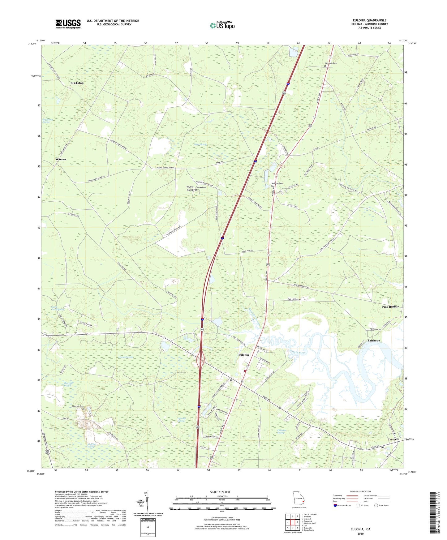
2024 topographic map quadrangle Eulonia in the state of Georgia. Scale: 1:24000. Based on the newly updated USGS 7.5' US Topo map series, this map is in the following counties: McIntosh. The map contains contour data, water features, and other items you are used to seeing on USGS maps, but also has updated roads and other features. This is the next generation of topographic maps. Printed on high-quality waterproof paper with UV fade-resistant inks.
Quads adjacent to this one:
West: Townsend
Northwest: East of Ludowici
North: Riceboro
Northeast: Seabrook
East: Shellman Bluff
Southeast: Doboy Sound
South: Ridgeville
Southwest: Cox
This map covers the same area as the classic USGS quad with code o31081e4.
Contains the following named places: Andrews Cemetery, Beasons Landing Strip, Bellville Church, Brickston, Buck Hill Swamp, Calvary Church, Cannon Bluff School, Chimney Villa, Church of God, Churchill Cemetery, Churchill Swamp, Cornerstone Christian School, Creddick Hill School, Crescent Census Designated Place, Crescent Post Office, Daniel Grove Church, Enterprise Church, Eulonia, Eulonia Census Designated Place, Eulonia School, Fairhope, Jackie Camp Swamp, McIntosh Cemetery, McIntosh County Fire Department Eulonia Station, McIntosh County Volunteer Fire Department Eulonia Station, Morgan Chapel, Oscar Swamp, Pine Harbor, Pine Hill Swamp, Prospect Church, R and M Water and Sewer Water Pollution Control Plant, Second Credit Hill Church, Shorter Chapel, South Newport Church, Townsend Division, Townsend Post Office, Warsaw, Welcome Church, Young Island Church, Youngs Cemetery, Youngs Island, Youngs Swamp, ZIP Code: 31331